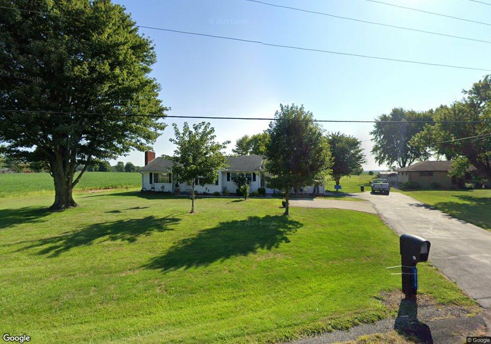
2279 State Route 19 Bucyrus, OH 44820
Estimated Value: $177,000 - $216,000
3
Beds
1
Bath
1,448
Sq Ft
$138/Sq Ft
Est. Value
About This Home
This home is located at 2279 State Route 19, Bucyrus, OH 44820 and is currently estimated at $200,107, approximately $138 per square foot. 2279 State Route 19 is a home located in Crawford County with nearby schools including Hannah Crawford Elementary School (PK-2), Hannah Crawford Elementary School (3 - 5), and William Crawford Intermediate School.
Ownership History
Date
Name
Owned For
Owner Type
Purchase Details
Closed on
Oct 27, 2022
Sold by
Dowell George O and Dowell Deborah A
Bought by
Dowell George O and Dowell Deborah A
Current Estimated Value
Purchase Details
Closed on
Jun 15, 2009
Sold by
Rosebrough Sharon and Estate Of Virginia M Hahn
Bought by
Dowell George O and Dowell Deborah A
Home Financials for this Owner
Home Financials are based on the most recent Mortgage that was taken out on this home.
Original Mortgage
$105,061
Interest Rate
4.92%
Mortgage Type
FHA
Create a Home Valuation Report for This Property
The Home Valuation Report is an in-depth analysis detailing your home's value as well as a comparison with similar homes in the area
Home Values in the Area
Average Home Value in this Area
Purchase History
| Date | Buyer | Sale Price | Title Company |
|---|---|---|---|
| Dowell George O | -- | -- | |
| Dowell George O | $107,000 | -- |
Source: Public Records
Mortgage History
| Date | Status | Borrower | Loan Amount |
|---|---|---|---|
| Previous Owner | Dowell George O | $105,061 |
Source: Public Records
Tax History Compared to Growth
Tax History
| Year | Tax Paid | Tax Assessment Tax Assessment Total Assessment is a certain percentage of the fair market value that is determined by local assessors to be the total taxable value of land and additions on the property. | Land | Improvement |
|---|---|---|---|---|
| 2024 | $1,428 | $51,540 | $9,440 | $42,100 |
| 2023 | $1,430 | $30,830 | $7,250 | $23,580 |
| 2022 | $916 | $30,830 | $7,250 | $23,580 |
| 2021 | $946 | $30,830 | $7,250 | $23,580 |
| 2020 | $641 | $24,500 | $7,250 | $17,250 |
| 2019 | $665 | $24,500 | $7,250 | $17,250 |
| 2018 | $665 | $24,500 | $7,250 | $17,250 |
| 2017 | $636 | $24,860 | $7,250 | $17,610 |
| 2016 | $638 | $24,860 | $7,250 | $17,610 |
| 2015 | $958 | $24,860 | $7,250 | $17,610 |
| 2014 | $978 | $24,860 | $7,250 | $17,610 |
| 2013 | $978 | $24,860 | $7,250 | $17,610 |
Source: Public Records
Map
Nearby Homes
- 2208 State Route 19
- 111 Kincora Dr
- 148 Kincora Dr
- 1465 Oakridge Dr
- 1267 N Dundee Trail
- 1320 E Southern Ave
- 948 S Highland Ave
- 318 Charlotte St
- 419 Short St
- 1220 E Warren St
- 924 E Warren St
- 346 Hopley Ave
- 1211 S Sandusky Ave
- 444 Woodlawn Ave
- 1021 S Sandusky Ave
- 583 Rogers St
- 708 S Sandusky Ave
- 550 S Walnut St
- 900 S Spring St
- 412 E Rensselaer St
- 2271 State Route 19
- 2270 State Route 19
- 2284 State Route 19
- 2261 State Route 19
- 2292 Ohio 19
- 2292 State Route 19
- 2254 State Route 19
- 2251 State Route 19
- 2251 Ohio 19
- 2305 State Route 19
- 2244 State Route 19
- 2244 State Route 19
- 2245 State Route 19
- 2235 State Route 19
- 2234 State Route 19
- 2247 State Route 19
- 3531 Crestline Rd
- 2327 Ohio 19
- 2327 State Route 19
- 2212 State Route 19