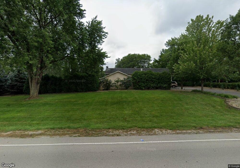
228 79th St Burr Ridge, IL 60527
Estimated Value: $664,000 - $796,000
--
Bed
1
Bath
2,017
Sq Ft
$356/Sq Ft
Est. Value
About This Home
This home is located at 228 79th St, Burr Ridge, IL 60527 and is currently estimated at $718,873, approximately $356 per square foot. 228 79th St is a home located in DuPage County with nearby schools including Gower West Elementary School, Gower Middle School, and Hinsdale South High School.
Ownership History
Date
Name
Owned For
Owner Type
Purchase Details
Closed on
Sep 7, 2017
Sold by
Hubacek Jeffrey J and The Jeffrey John Hubacek Livin
Bought by
Hubacek Jeffrey J
Current Estimated Value
Purchase Details
Closed on
Jun 18, 2004
Sold by
Hubacek Jeffrey J
Bought by
The Jeffrey John Hubacek Living Trust
Purchase Details
Closed on
May 2, 2003
Sold by
Hubacek Janet Lee
Bought by
Hubacek Jeffrey J
Home Financials for this Owner
Home Financials are based on the most recent Mortgage that was taken out on this home.
Original Mortgage
$325,000
Outstanding Balance
$143,410
Interest Rate
6%
Mortgage Type
Credit Line Revolving
Estimated Equity
$575,463
Purchase Details
Closed on
Dec 1, 1998
Sold by
Schaefer Dennis W and Schaefer Diana
Bought by
Hubacek Jeffrey J and Hubacek Janet L
Create a Home Valuation Report for This Property
The Home Valuation Report is an in-depth analysis detailing your home's value as well as a comparison with similar homes in the area
Home Values in the Area
Average Home Value in this Area
Purchase History
| Date | Buyer | Sale Price | Title Company |
|---|---|---|---|
| Hubacek Jeffrey J | -- | None Available | |
| The Jeffrey John Hubacek Living Trust | -- | Chicago Title Insurance Comp | |
| Hubacek Jeffrey J | -- | Ctic | |
| Hubacek Jeffrey J | $324,666 | -- |
Source: Public Records
Mortgage History
| Date | Status | Borrower | Loan Amount |
|---|---|---|---|
| Open | Hubacek Jeffrey J | $325,000 |
Source: Public Records
Tax History Compared to Growth
Tax History
| Year | Tax Paid | Tax Assessment Tax Assessment Total Assessment is a certain percentage of the fair market value that is determined by local assessors to be the total taxable value of land and additions on the property. | Land | Improvement |
|---|---|---|---|---|
| 2024 | $12,200 | $258,907 | $158,623 | $100,284 |
| 2023 | $11,691 | $238,010 | $145,820 | $92,190 |
| 2022 | $11,223 | $228,640 | $140,080 | $88,560 |
| 2021 | $10,796 | $226,040 | $138,490 | $87,550 |
| 2020 | $10,649 | $221,570 | $135,750 | $85,820 |
| 2019 | $10,248 | $212,590 | $130,250 | $82,340 |
| 2018 | $8,874 | $191,750 | $129,580 | $62,170 |
| 2017 | $8,808 | $184,510 | $124,690 | $59,820 |
| 2016 | $8,604 | $176,090 | $119,000 | $57,090 |
| 2015 | $10,108 | $194,590 | $111,960 | $82,630 |
| 2014 | $10,820 | $204,500 | $108,860 | $95,640 |
| 2013 | $10,564 | $203,540 | $108,350 | $95,190 |
Source: Public Records
Map
Nearby Homes
- 7831 Clarendon Hills Rd
- 7730 Virginia Ct
- 7718 Virginia Ct
- 7976 Clarendon Hills Rd
- 16W540 Lake Dr Unit 9-104
- 7715 Virginia Ct
- 320 Sheridan Dr Unit 2C
- 8081 Tennessee Ave
- 313 83rd St
- 124 Sunrise Ave
- 709 79th St Unit 103
- 709 79th St Unit 307
- 709 79th St Unit 403
- 801 79th St Unit 105
- 7817 Mayfair Ln
- 8020 Arrow Ln
- 8301 Highpoint Cir Unit C
- 716 Somerset Ln
- 9S115 Nantucket Dr
- Lot 1, 2, 3, 4 & 5 Nantucket Dr
- 228 79th St
- 228 79th St
- 234 79th St
- 222 79th St
- 236 79th St
- 7924 William Dr
- 7915 William Dr
- 7825 Brookbank Rd
- 7911 Brookbank Rd
- 7833 Brookbank Rd
- 238 79th St
- 216 79th St
- 7815 Brookbank Rd
- 7925 William Dr
- 7925 Brookbank Rd
- 7811 Brookbank Rd
- 7939 William Dr
- 7939 Brookbank Rd
- 7846 Brookbank Rd
- 7830 Brookbank Rd