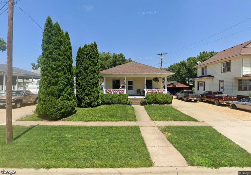
228 8th St de Witt, IA 52742
Estimated Value: $112,632 - $141,000
2
Beds
1
Bath
675
Sq Ft
$182/Sq Ft
Est. Value
About This Home
This home is located at 228 8th St, de Witt, IA 52742 and is currently estimated at $122,908, approximately $182 per square foot. 228 8th St is a home located in Clinton County with nearby schools including Ekstrand Elementary School, Central Dewitt Intermediate School, and Central Dewitt Middle School.
Ownership History
Date
Name
Owned For
Owner Type
Purchase Details
Closed on
Apr 10, 2024
Sold by
Borrink Richard A
Bought by
Owens Michael V
Current Estimated Value
Purchase Details
Closed on
Apr 28, 2008
Sold by
Schmidtke Tamara A and Schmidtke Daniel M
Bought by
Borrink Richard A
Create a Home Valuation Report for This Property
The Home Valuation Report is an in-depth analysis detailing your home's value as well as a comparison with similar homes in the area
Home Values in the Area
Average Home Value in this Area
Purchase History
| Date | Buyer | Sale Price | Title Company |
|---|---|---|---|
| Owens Michael V | $100,000 | None Listed On Document | |
| Borrink Richard A | $75,000 | None Available |
Source: Public Records
Mortgage History
| Date | Status | Borrower | Loan Amount |
|---|---|---|---|
| Closed | Borrink Richard A | $0 |
Source: Public Records
Tax History Compared to Growth
Tax History
| Year | Tax Paid | Tax Assessment Tax Assessment Total Assessment is a certain percentage of the fair market value that is determined by local assessors to be the total taxable value of land and additions on the property. | Land | Improvement |
|---|---|---|---|---|
| 2025 | $1,580 | $101,500 | $13,160 | $88,340 |
| 2024 | $1,580 | $96,100 | $13,160 | $82,940 |
| 2023 | $1,300 | $96,100 | $13,160 | $82,940 |
| 2022 | $1,156 | $85,560 | $13,160 | $72,400 |
| 2021 | $1,120 | $69,300 | $12,960 | $56,340 |
| 2020 | $1,120 | $64,400 | $12,960 | $51,440 |
| 2019 | $1,070 | $61,950 | $0 | $0 |
| 2018 | $1,038 | $61,950 | $0 | $0 |
| 2017 | $1,038 | $61,950 | $0 | $0 |
| 2016 | $1,090 | $64,400 | $0 | $0 |
| 2015 | $1,090 | $64,400 | $0 | $0 |
| 2014 | $1,106 | $64,400 | $0 | $0 |
| 2013 | $1,082 | $0 | $0 | $0 |
Source: Public Records
Map
Nearby Homes