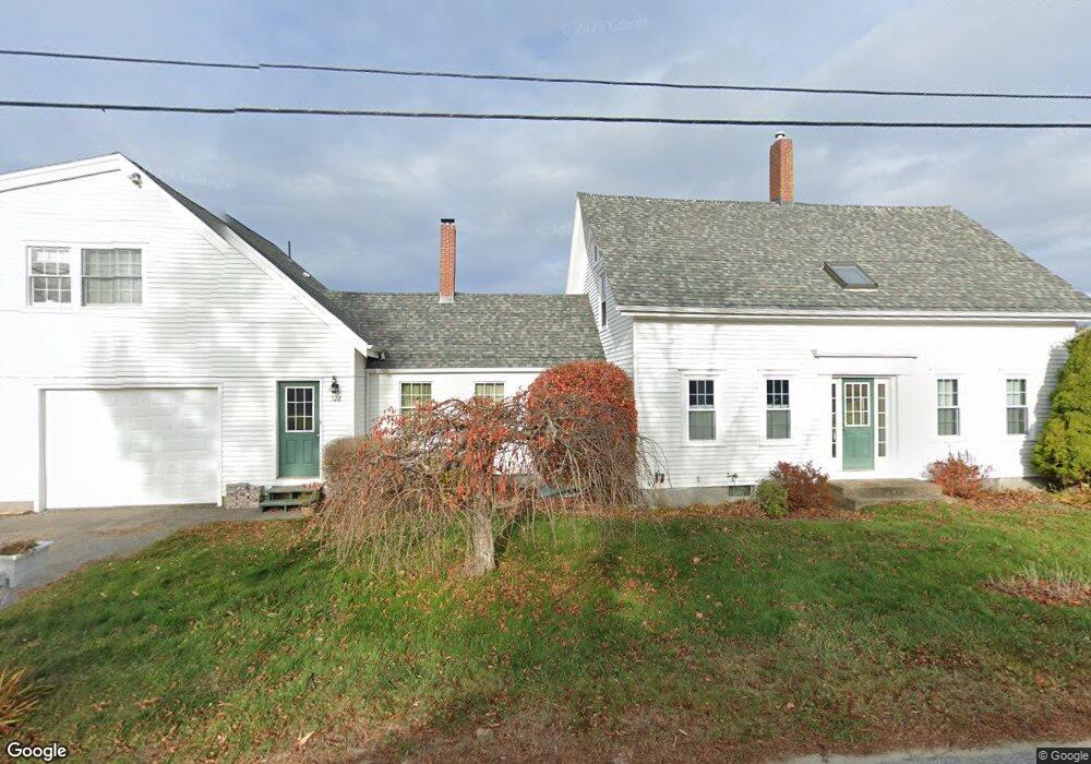
228 Ash Point Rd Harpswell, ME 04079
Harpswell Neck NeighborhoodEstimated Value: $1,012,000 - $1,201,649
4
Beds
4
Baths
2,524
Sq Ft
$430/Sq Ft
Est. Value
About This Home
This home is located at 228 Ash Point Rd, Harpswell, ME 04079 and is currently estimated at $1,086,412, approximately $430 per square foot. 228 Ash Point Rd is a home located in Cumberland County with nearby schools including Mt Ararat High School.
Ownership History
Date
Name
Owned For
Owner Type
Purchase Details
Closed on
Jun 29, 2007
Sold by
Sirva Relocation Llc
Bought by
Omara Erin B
Current Estimated Value
Home Financials for this Owner
Home Financials are based on the most recent Mortgage that was taken out on this home.
Original Mortgage
$336,000
Interest Rate
6.24%
Mortgage Type
Unknown
Create a Home Valuation Report for This Property
The Home Valuation Report is an in-depth analysis detailing your home's value as well as a comparison with similar homes in the area
Home Values in the Area
Average Home Value in this Area
Purchase History
| Date | Buyer | Sale Price | Title Company |
|---|---|---|---|
| Omara Erin B | -- | -- | |
| Sirva Relocation Llc | -- | -- |
Source: Public Records
Mortgage History
| Date | Status | Borrower | Loan Amount |
|---|---|---|---|
| Open | Sirva Relocation Llc | $324,552 | |
| Closed | Sirva Relocation Llc | $336,000 |
Source: Public Records
Tax History Compared to Growth
Tax History
| Year | Tax Paid | Tax Assessment Tax Assessment Total Assessment is a certain percentage of the fair market value that is determined by local assessors to be the total taxable value of land and additions on the property. | Land | Improvement |
|---|---|---|---|---|
| 2024 | $4,874 | $766,400 | $253,000 | $513,400 |
| 2023 | $4,675 | $766,400 | $253,000 | $513,400 |
| 2022 | $4,522 | $766,400 | $253,000 | $513,400 |
| 2021 | $3,922 | $580,200 | $206,600 | $373,600 |
| 2020 | $3,911 | $580,200 | $206,600 | $373,600 |
| 2019 | $3,887 | $580,200 | $206,600 | $373,600 |
| 2018 | $3,760 | $580,200 | $206,600 | $373,600 |
| 2017 | $3,748 | $580,200 | $206,600 | $373,600 |
| 2016 | $3,713 | $580,200 | $206,600 | $373,600 |
| 2015 | $3,620 | $580,200 | $206,600 | $373,600 |
| 2013 | $3,354 | $580,200 | $206,600 | $373,600 |
Source: Public Records
Map
Nearby Homes
- 6 Kane Ln
- 8 & 2 Kane Ln
- 10 S Colony Branch Rd
- 18 Ash Point Rd
- 16 Ash Point Rd Unit 16
- 10 Irene Ave
- 1450 Harpswell Neck Rd
- 30 Osbourne Row
- 19 Hugh Ave
- 20 Spruce Ledge Rd
- 1689 Harpswell Islands Rd
- 1 Mallard Pond Rd
- 87 Lowells Cove Rd
- 41 Spruce Brook Dr
- Lot 2A Allen Point Rd
- Lot 2B Allen Point Rd
- Lot 2 Buxhill Blvd
- Lot 129 Harpswell Neck Rd
- 0 Bayview Rd Unit 2 1632776
- 471 South Rd Unit A
- 224 Ash Point Rd
- 223 Ash Point Rd
- 242 Ash Point Rd
- 233 Ash Point Rd
- 219 Ash Point Rd
- 0 Tide Mill Cove Rd
- 6 Hastings Ln
- 6 Harrington Point
- 11 Harrington Point
- 11 Harrington Pt Rd
- 11 Harrington Point Rd
- 26 Tide Mill Cove Rd
- 212 Ash Point Rd
- 18 Tide Mill Cove Rd
- 209 Ash Point Rd
- 229 Ash Point Rd
- 37 Tide Mill Cove Rd
- 205 Ash Point Rd
- 6 Tide Mill Cove Rd
- 11 Grist Mill Ln