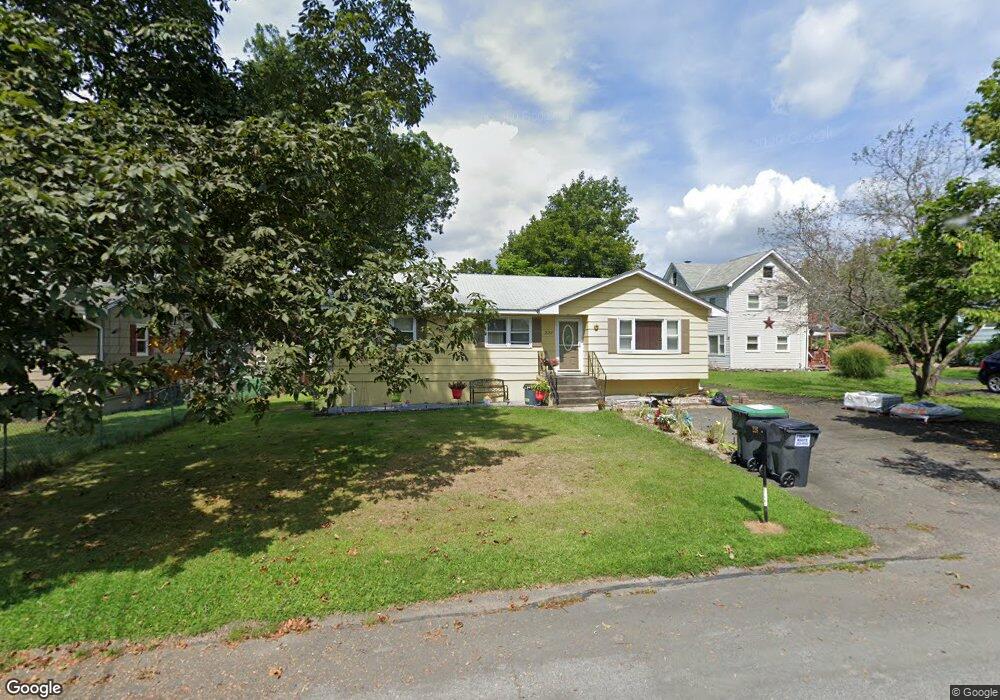
228 Commonwealth Ave Middletown, NY 10940
Estimated Value: $274,695 - $341,000
3
Beds
1
Bath
1,136
Sq Ft
$280/Sq Ft
Est. Value
About This Home
This home is located at 228 Commonwealth Ave, Middletown, NY 10940 and is currently estimated at $318,174, approximately $280 per square foot. 228 Commonwealth Ave is a home located in Orange County with nearby schools including Presidential Park Elementary School, Middletown Twin Towers Middle School, and Monhagen Middle School.
Ownership History
Date
Name
Owned For
Owner Type
Purchase Details
Closed on
Aug 26, 2006
Sold by
Williams Fka Adams Laurel
Bought by
Williams Laurel
Current Estimated Value
Purchase Details
Closed on
Oct 22, 2003
Sold by
Kevin Hill
Bought by
Adams Laurel
Purchase Details
Closed on
Jan 1, 1999
Sold by
Brooks Richard H
Bought by
Hill Kevin
Home Financials for this Owner
Home Financials are based on the most recent Mortgage that was taken out on this home.
Original Mortgage
$70,490
Interest Rate
12.35%
Create a Home Valuation Report for This Property
The Home Valuation Report is an in-depth analysis detailing your home's value as well as a comparison with similar homes in the area
Home Values in the Area
Average Home Value in this Area
Purchase History
| Date | Buyer | Sale Price | Title Company |
|---|---|---|---|
| Williams Laurel | -- | -- | |
| Adams Laurel | $168,920 | Glenn Sharon | |
| Hill Kevin | $100,700 | Fidelity National Title Ins |
Source: Public Records
Mortgage History
| Date | Status | Borrower | Loan Amount |
|---|---|---|---|
| Previous Owner | Hill Kevin | $70,490 |
Source: Public Records
Tax History
| Year | Tax Paid | Tax Assessment Tax Assessment Total Assessment is a certain percentage of the fair market value that is determined by local assessors to be the total taxable value of land and additions on the property. | Land | Improvement |
|---|---|---|---|---|
| 2024 | $4,937 | $31,300 | $7,600 | $23,700 |
| 2023 | $4,937 | $31,300 | $7,600 | $23,700 |
| 2022 | $5,088 | $31,300 | $7,600 | $23,700 |
| 2021 | $5,313 | $31,300 | $7,600 | $23,700 |
| 2020 | $1,498 | $31,300 | $7,600 | $23,700 |
| 2019 | $2,921 | $31,300 | $7,600 | $23,700 |
| 2018 | $4,358 | $31,300 | $7,600 | $23,700 |
| 2017 | $4,378 | $31,300 | $7,600 | $23,700 |
| 2016 | $4,143 | $31,300 | $7,600 | $23,700 |
| 2015 | -- | $31,300 | $7,600 | $23,700 |
| 2014 | -- | $31,300 | $7,600 | $23,700 |
Source: Public Records
Map
Nearby Homes
- 320 Highland Avenue Extension
- 187 Watkins Ave
- 55 Eisenhower Dr
- 43 Woodside Knolls Dr
- 49 Woodside Knolls Dr
- 59 Woodside Knolls Dr
- 115 Vincent Dr
- 53 Cornwall Ln
- 14 Rdean Place
- 143 N Beacon St
- 10 Wisner Ave Unit 12
- 36 Vincent Dr
- 0 Maples Rd Unit KEY883753
- 262 Cottage St
- 24 Rockwell Ave
- 10 Royce Ave
- 235 Maples Rd
- 24 Juniper Cir
- 71 Commonwealth Ave
- 19 Sunflower St
- 230 Commonwealth Ave
- 226 Commonwealth Ave
- 232 Commonwealth Ave
- 155 Rockwell Ave
- 224 Commonwealth Ave
- 165 Rockwell Ave
- 157 Rockwell Ave
- 231 Commonwealth Ave
- 229 Commonwealth Ave
- 234 Commonwealth Ave
- 227 Commonwealth Ave
- 237 Commonwealth Ave
- 162 Rockwell Ave
- 220 Commonwealth Ave
- 164 Rockwell Ave
- 223 Commonwealth Ave
- 19 Rhode Island Ave
- 160 Rockwell Ave
- 239 Commonwealth Ave
- 221 Commonwealth Ave
Your Personal Tour Guide
Ask me questions while you tour the home.