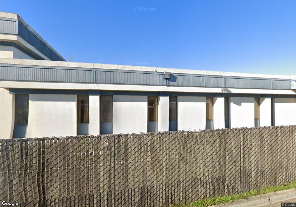
228 N Main St Fort Bragg, CA 95437
Estimated Value: $862,729
--
Bed
--
Bath
9,351
Sq Ft
$92/Sq Ft
Est. Value
About This Home
This home is located at 228 N Main St, Fort Bragg, CA 95437 and is currently estimated at $862,729, approximately $92 per square foot. 228 N Main St is a home located in Mendocino County with nearby schools including Fort Bragg High School and Three Rivers Charter School.
Ownership History
Date
Name
Owned For
Owner Type
Purchase Details
Closed on
Jun 16, 2022
Sold by
Sierra Northern Railway
Bought by
Poos Udo A
Current Estimated Value
Purchase Details
Closed on
Aug 10, 2021
Sold by
Pl Properties No 140 Llc
Bought by
Sierra Northem Railway
Purchase Details
Closed on
Jun 30, 2016
Sold by
First States Investors 5200 Llc
Bought by
Pi Properties No 140 Llc
Purchase Details
Closed on
Sep 24, 2004
Sold by
Bank Of America Na
Bought by
First States Investors 5200 Llc
Create a Home Valuation Report for This Property
The Home Valuation Report is an in-depth analysis detailing your home's value as well as a comparison with similar homes in the area
Home Values in the Area
Average Home Value in this Area
Purchase History
| Date | Buyer | Sale Price | Title Company |
|---|---|---|---|
| Poos Udo A | $975,000 | Redwood Empire Title | |
| Sierra Northem Railway | $800,000 | Redwood Empire Ttl Co Of Men | |
| Pi Properties No 140 Llc | $750,000 | First American Title | |
| First States Investors 5200 Llc | $925,000 | Redwood Empire Title |
Source: Public Records
Tax History Compared to Growth
Tax History
| Year | Tax Paid | Tax Assessment Tax Assessment Total Assessment is a certain percentage of the fair market value that is determined by local assessors to be the total taxable value of land and additions on the property. | Land | Improvement |
|---|---|---|---|---|
| 2025 | $11,553 | $1,014,389 | $611,755 | $402,634 |
| 2023 | $11,553 | $975,000 | $588,000 | $387,000 |
| 2022 | $9,646 | $804,920 | $214,353 | $590,567 |
| 2021 | $9,139 | $789,138 | $210,150 | $578,988 |
| 2020 | $8,945 | $781,043 | $207,995 | $573,048 |
| 2019 | $8,826 | $765,734 | $203,918 | $561,816 |
| 2018 | $8,709 | $750,720 | $199,920 | $550,800 |
| 2017 | $8,361 | $736,000 | $196,000 | $540,000 |
| 2016 | $16,362 | $1,442,174 | $411,736 | $1,030,438 |
| 2015 | $16,102 | $1,420,522 | $405,554 | $1,014,968 |
| 2014 | $15,714 | $1,392,699 | $397,611 | $995,088 |
Source: Public Records
Map
Nearby Homes
- 423 N Franklin St
- 142 S Franklin St
- 119 E Pine St
- 251 S Franklin St
- 459 S Mcpherson St
- 715 West St
- 494 S Whipple St
- 571 S Franklin St
- 575 S Whipple St
- 944 Stewart St
- 517 S Lincoln St
- 924 Glass Beach Dr
- 215 S Sanderson Way
- 854 Woodward St
- 300 N Harbor Dr
- 1184 N Main St Unit 1
- 19351 Del Mar Dr
- 19701 Noyo Acres Dr
- 19171 S Harbor Dr
- 32000 Airport Rd
- 225 N Franklin St
- 221 N Franklin St Unit /223
- 221 N Franklin St
- 221 N Main St
- 118 E Redwood Ave
- 225 N Main St
- 128 E Redwood Ave
- 147 N Franklin St
- 136 N Main St
- 247 N Main St
- 200 E Redwood Ave
- 244 N Franklin St
- 130 N Main St
- 131 E Redwood Ave
- 125 E Redwood Ave
- 220 E Redwood Ave
- 311 N Franklin St
- 126 N Main
- 322 N Main St
- 136 N Franklin St