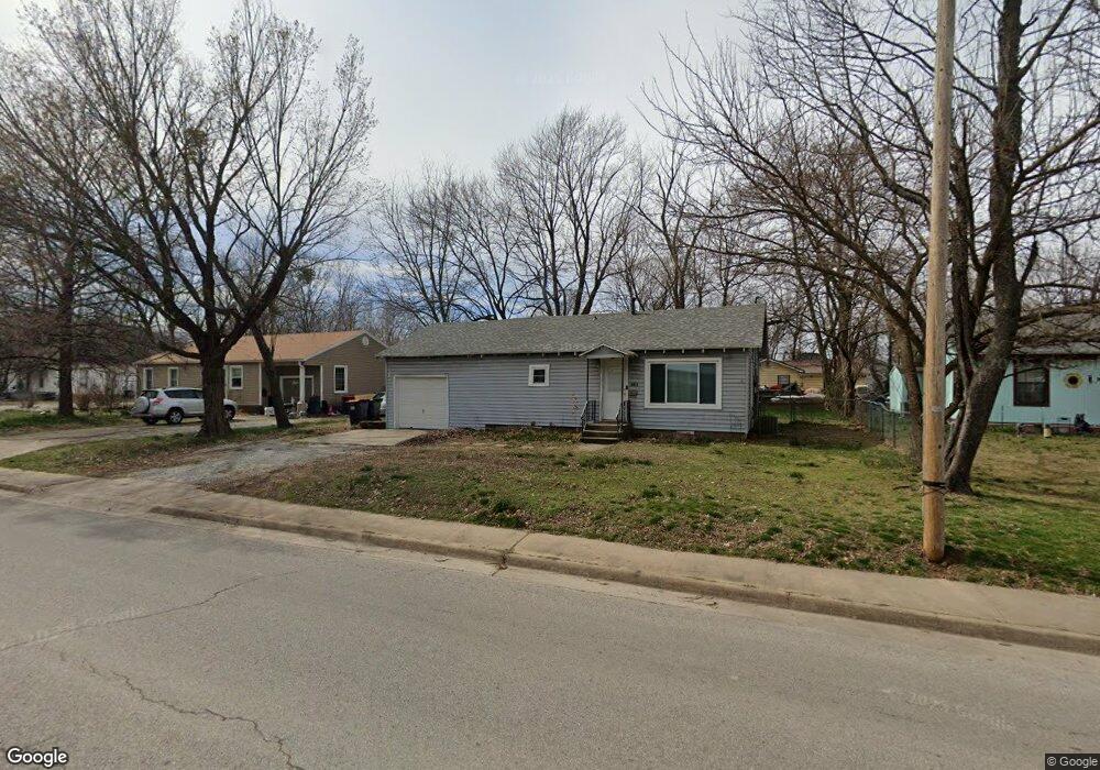
228 N West End St Springdale, AR 72764
Estimated Value: $167,777 - $212,000
2
Beds
1
Bath
875
Sq Ft
$216/Sq Ft
Est. Value
About This Home
This home is located at 228 N West End St, Springdale, AR 72764 and is currently estimated at $188,694, approximately $215 per square foot. 228 N West End St is a home located in Washington County with nearby schools including Westwood Elementary School, Southwest Junior High School, and Helen Tyson Middle School.
Ownership History
Date
Name
Owned For
Owner Type
Purchase Details
Closed on
Jun 5, 2007
Sold by
Robbins Fern G
Bought by
Sweeden Dallas Scott
Current Estimated Value
Home Financials for this Owner
Home Financials are based on the most recent Mortgage that was taken out on this home.
Original Mortgage
$61,500
Outstanding Balance
$37,570
Interest Rate
6.16%
Mortgage Type
Purchase Money Mortgage
Estimated Equity
$151,124
Purchase Details
Closed on
Apr 23, 1985
Bought by
Robbins Johnnie and Robbins Merlene
Create a Home Valuation Report for This Property
The Home Valuation Report is an in-depth analysis detailing your home's value as well as a comparison with similar homes in the area
Home Values in the Area
Average Home Value in this Area
Purchase History
| Date | Buyer | Sale Price | Title Company |
|---|---|---|---|
| Sweeden Dallas Scott | $62,000 | Waco Title Company | |
| Robbins Johnnie | -- | -- |
Source: Public Records
Mortgage History
| Date | Status | Borrower | Loan Amount |
|---|---|---|---|
| Open | Sweeden Dallas Scott | $61,500 |
Source: Public Records
Tax History Compared to Growth
Tax History
| Year | Tax Paid | Tax Assessment Tax Assessment Total Assessment is a certain percentage of the fair market value that is determined by local assessors to be the total taxable value of land and additions on the property. | Land | Improvement |
|---|---|---|---|---|
| 2024 | $826 | $24,900 | $12,600 | $12,300 |
| 2023 | $775 | $24,900 | $12,600 | $12,300 |
| 2022 | $667 | $14,210 | $5,500 | $8,710 |
| 2021 | $615 | $14,210 | $5,500 | $8,710 |
| 2020 | $564 | $14,210 | $5,500 | $8,710 |
| 2019 | $513 | $9,730 | $4,500 | $5,230 |
| 2018 | $163 | $9,730 | $4,500 | $5,230 |
| 2017 | $158 | $9,730 | $4,500 | $5,230 |
| 2016 | $158 | $9,730 | $4,500 | $5,230 |
| 2015 | $158 | $9,730 | $4,500 | $5,230 |
| 2014 | $222 | $10,950 | $4,500 | $6,450 |
Source: Public Records
Map
Nearby Homes
- 1611 Theodore Dr
- 1511 W Huntsville Ave
- 1403 Wilshire Dr
- 1708 Theodore Dr
- 0 Westwood Ave
- 126 Rogers Circle Dr
- 1203 Christian Ave
- 301 Michael St
- 508 Geneva St
- 1304 Rebecca Ln
- 404 Henryetta St
- 603 Thomas Blvd
- 506 Dyer St
- 2003 Dee Ave
- 614 Zachary St
- 510 Maria St
- 710 Hinshaw Dr
- 702 S West End St
- 811 Gail St
- 604 Maria St
- 230 N West End St
- 230 W End St
- 224 N West End St
- 1607 Theodore Dr
- 1604 Horseshoe Dr
- 225 N West End St
- 306 Elm Valley Ln
- 306 N West End St
- 229 N West End St
- 229 W End St
- 212 N West End St
- 1506 Wilshire Dr
- 1606 Horseshoe Dr
- 301 N West End St
- 1610 Theodore Dr
- 1613 Theodore Dr
- 308 N West End St
- 1601 Horseshoe Dr
- 1612 Theodore Dr
- 307 N West End St