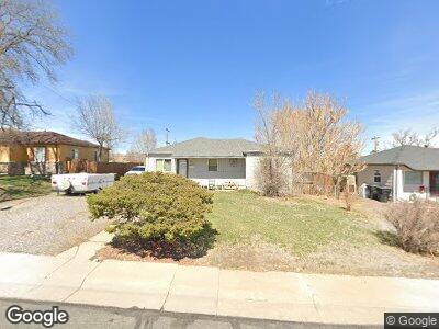
2281 Hoyt Dr Thornton, CO 80229
South Thornton NeighborhoodEstimated Value: $397,589 - $412,000
3
Beds
1
Bath
1,002
Sq Ft
$404/Sq Ft
Est. Value
About This Home
This home is located at 2281 Hoyt Dr, Thornton, CO 80229 and is currently estimated at $404,647, approximately $403 per square foot. 2281 Hoyt Dr is a home located in Adams County with nearby schools including Trailside Academy.
Ownership History
Date
Name
Owned For
Owner Type
Purchase Details
Closed on
Nov 1, 1999
Sold by
Hill James C
Bought by
Duras Stanley Mike and Wood Tarie Lynn
Current Estimated Value
Home Financials for this Owner
Home Financials are based on the most recent Mortgage that was taken out on this home.
Original Mortgage
$63,869
Interest Rate
10.5%
Mortgage Type
Stand Alone Second
Create a Home Valuation Report for This Property
The Home Valuation Report is an in-depth analysis detailing your home's value as well as a comparison with similar homes in the area
Home Values in the Area
Average Home Value in this Area
Purchase History
| Date | Buyer | Sale Price | Title Company |
|---|---|---|---|
| Duras Stanley Mike | $63,869 | -- |
Source: Public Records
Mortgage History
| Date | Status | Borrower | Loan Amount |
|---|---|---|---|
| Open | Duran Stanley Mike | $2,569 | |
| Open | Duran Stanley Mike | $12,969 | |
| Open | Duran Stanley Mike | $88,305 | |
| Closed | Duran Stanley Mike | $88,305 | |
| Closed | Duran Stanley Mike | $63,869 |
Source: Public Records
Tax History Compared to Growth
Tax History
| Year | Tax Paid | Tax Assessment Tax Assessment Total Assessment is a certain percentage of the fair market value that is determined by local assessors to be the total taxable value of land and additions on the property. | Land | Improvement |
|---|---|---|---|---|
| 2024 | $2,009 | $23,320 | $5,630 | $17,690 |
| 2023 | $2,009 | $25,230 | $6,090 | $19,140 |
| 2022 | $2,010 | $20,160 | $5,280 | $14,880 |
| 2021 | $1,896 | $20,160 | $5,280 | $14,880 |
| 2020 | $1,861 | $20,000 | $5,430 | $14,570 |
| 2019 | $1,872 | $20,000 | $5,430 | $14,570 |
| 2018 | $1,536 | $15,450 | $5,180 | $10,270 |
| 2017 | $1,505 | $15,450 | $5,180 | $10,270 |
| 2016 | $1,234 | $12,410 | $2,550 | $9,860 |
| 2015 | $1,079 | $12,410 | $2,550 | $9,860 |
| 2014 | $847 | $9,470 | $1,990 | $7,480 |
Source: Public Records
Map
Nearby Homes
- 2433 E 90th Ave
- 2533 E 90th Place
- 2562 E 90th Place
- 9271 Gaylord St
- 2701 Barnhart St
- 2120 Oak Place
- 9041 Lilly Ct
- 2850 Roosevelt Ave
- 9301 Ciancio St
- 9040 Yucca Way
- 9191 Russell Way
- 9280 Russell Way
- 9030 Hickory Place
- 8881 Lilly Dr
- 9100 Yucca Way
- 2141 Carrol Ct
- 2569 Devonshire Ct Unit 72
- 9400 High St
- 2644 Devonshire Ct
- 2567 Rainbow Dr Unit 80