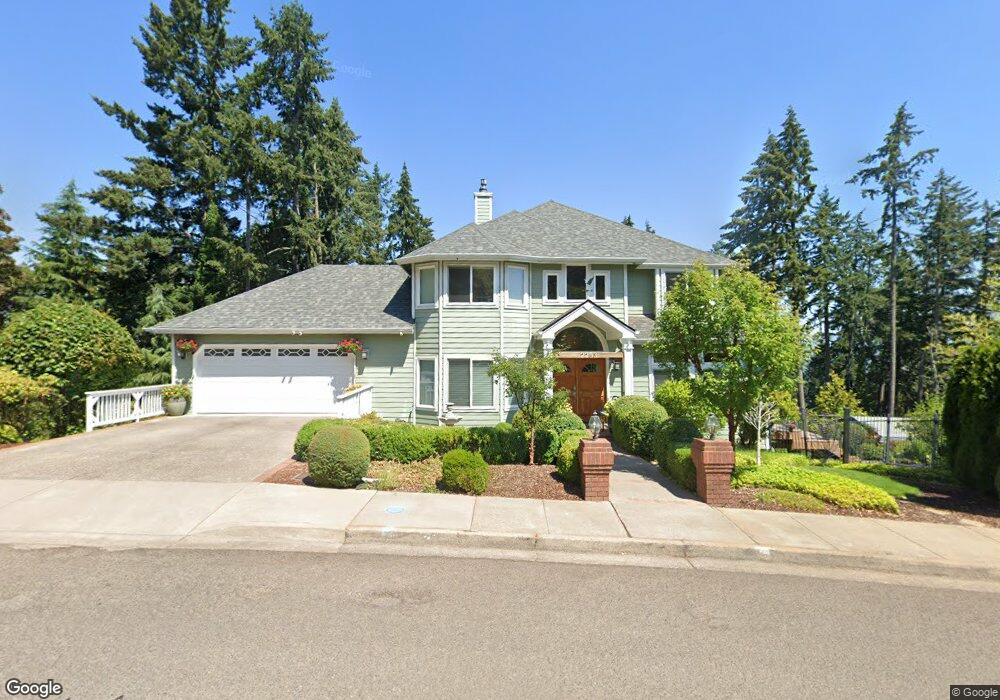
2283 Lasater Blvd Eugene, OR 97405
Crest Drive NeighborhoodEstimated Value: $640,000 - $778,000
4
Beds
3
Baths
2,502
Sq Ft
$285/Sq Ft
Est. Value
About This Home
This home is located at 2283 Lasater Blvd, Eugene, OR 97405 and is currently estimated at $712,552, approximately $284 per square foot. 2283 Lasater Blvd is a home located in Lane County with nearby schools including Adams Elementary School, Arts And Technology Academy At Jefferson, and Churchill High School.
Ownership History
Date
Name
Owned For
Owner Type
Purchase Details
Closed on
Sep 27, 2012
Sold by
Rode George B
Bought by
Rode George B and George Rode Trust
Current Estimated Value
Home Financials for this Owner
Home Financials are based on the most recent Mortgage that was taken out on this home.
Original Mortgage
$310,000
Interest Rate
3.63%
Mortgage Type
New Conventional
Purchase Details
Closed on
Jun 12, 2012
Sold by
Rode George and Rode George B
Bought by
Rode George B and George Rode Trust
Purchase Details
Closed on
Oct 5, 2011
Sold by
Rode George and Rode George B
Bought by
Rode George B and George Rode Revocable Living Trust
Create a Home Valuation Report for This Property
The Home Valuation Report is an in-depth analysis detailing your home's value as well as a comparison with similar homes in the area
Home Values in the Area
Average Home Value in this Area
Purchase History
| Date | Buyer | Sale Price | Title Company |
|---|---|---|---|
| Rode George B | -- | Fidelity National Title Insu | |
| Rode George B | -- | Fidelity National Title Insu | |
| Rode George B | -- | None Available | |
| Rode George B | -- | None Available |
Source: Public Records
Mortgage History
| Date | Status | Borrower | Loan Amount |
|---|---|---|---|
| Closed | Rode George B | $310,000 |
Source: Public Records
Tax History
| Year | Tax Paid | Tax Assessment Tax Assessment Total Assessment is a certain percentage of the fair market value that is determined by local assessors to be the total taxable value of land and additions on the property. | Land | Improvement |
|---|---|---|---|---|
| 2025 | $9,492 | $487,191 | -- | -- |
| 2024 | $9,374 | $473,001 | -- | -- |
| 2023 | $9,374 | $459,225 | $0 | $0 |
| 2022 | $8,782 | $445,850 | $0 | $0 |
| 2021 | $8,003 | $432,865 | $0 | $0 |
| 2020 | $7,792 | $420,258 | $0 | $0 |
| 2019 | $7,494 | $408,018 | $0 | $0 |
| 2018 | $7,095 | $384,596 | $0 | $0 |
| 2017 | $6,687 | $384,596 | $0 | $0 |
| 2016 | $6,400 | $373,394 | $0 | $0 |
| 2015 | $6,266 | $362,518 | $0 | $0 |
| 2014 | $6,123 | $351,959 | $0 | $0 |
Source: Public Records
Map
Nearby Homes
- 3093 Soloman Loop
- 3023 Ashley Loop
- 2455 W 29th Ave
- 2225 W 28th Ave
- 2850 Garfield St
- 2315 W 28th Ave
- 2323 W 28th Ave
- 2037 Morning View Dr
- 2572 W 28th Ave
- 2030 W 34th Ave
- 2673 Garfield St
- 1783 Graham Dr
- 2736 Kismet Way
- 2490 Panorama Dr
- 2870 Hawkins Ln
- 2430 Wilson Dr
- 0 Mclean Blvd Unit 24671448
- 0 Mclean Blvd Unit 697374759
- 0 Hallmark Ln
- 2728 Hallmark Ln
- 2284 Lasater Blvd
- 2272 Lasater Blvd
- 3095 Soloman Loop
- 2344 Shields Ave
- 3093 Solomon Loop
- 2268 Lasater Blvd
- 2346 Shields Ave
- 2334 Shields Ave
- 2180 Shields Ave
- 2292 Shields Ave
- 2256 Lasater Blvd
- 2269 Lasater Blvd
- 2250 Shields Ave
- 2222 Shields Ave
- 2140 Shields Ave
- 2339 Lasater Blvd
- 3091 Soloman Loop
- 2310 Shields Ave
- 2322 Shields Ave
- 2244 Lasater Blvd
Your Personal Tour Guide
Ask me questions while you tour the home.