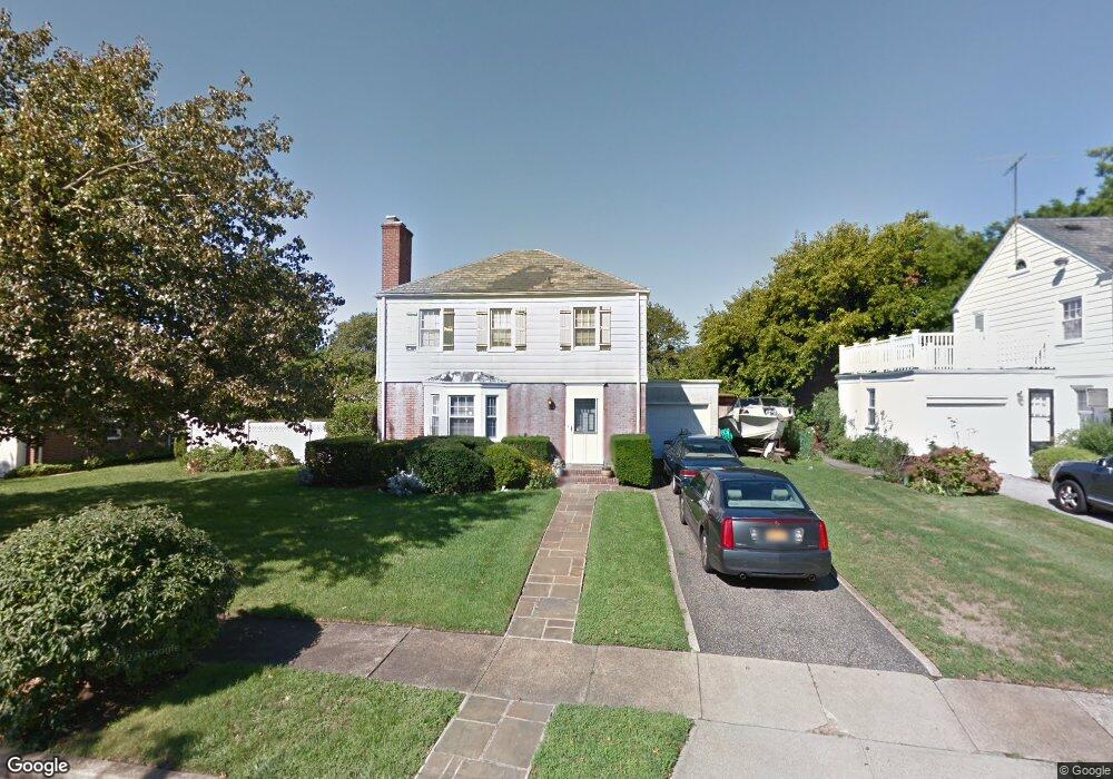
2284 Lancaster Ave Baldwin, NY 11510
Estimated Value: $469,000 - $599,001
Studio
2
Baths
1,440
Sq Ft
$371/Sq Ft
Est. Value
About This Home
This home is located at 2284 Lancaster Ave, Baldwin, NY 11510 and is currently estimated at $534,001, approximately $370 per square foot. 2284 Lancaster Ave is a home located in Nassau County with nearby schools including Baldwin Senior High School and St Agnes Cathedral School.
Ownership History
Date
Name
Owned For
Owner Type
Purchase Details
Closed on
Jun 24, 2021
Sold by
Furlani Barbara
Bought by
Furlani Christopher
Current Estimated Value
Home Financials for this Owner
Home Financials are based on the most recent Mortgage that was taken out on this home.
Original Mortgage
$240,000
Outstanding Balance
$217,290
Interest Rate
2.9%
Mortgage Type
New Conventional
Estimated Equity
$316,711
Purchase Details
Closed on
Apr 12, 2017
Sold by
Furlani Richard J and Furlani Barbara
Bought by
Furlani Barbara
Create a Home Valuation Report for This Property
The Home Valuation Report is an in-depth analysis detailing your home's value as well as a comparison with similar homes in the area
Home Values in the Area
Average Home Value in this Area
Purchase History
| Date | Buyer | Sale Price | Title Company |
|---|---|---|---|
| Furlani Christopher | $300,000 | None Available | |
| Furlani Barbara | -- | None Available |
Source: Public Records
Mortgage History
| Date | Status | Borrower | Loan Amount |
|---|---|---|---|
| Open | Furlani Christopher | $240,000 |
Source: Public Records
Tax History
| Year | Tax Paid | Tax Assessment Tax Assessment Total Assessment is a certain percentage of the fair market value that is determined by local assessors to be the total taxable value of land and additions on the property. | Land | Improvement |
|---|---|---|---|---|
| 2025 | $13,817 | $448 | $172 | $276 |
| 2024 | $3,141 | $434 | $167 | $267 |
Source: Public Records
Map
Nearby Homes
- 4 Lancaster Ave
- 2357 Rockwood Ave
- 590 Haig St Unit 101
- 420 Devonshire Rd
- 495 Brooklyn Ave
- 2270 Edna Ct
- 2355 Pershing Blvd Unit 607
- 2122 Walnut St
- 556 Jackson St
- 2116 Maple St
- 757 Bixby Dr
- 2478 Loft Ave
- 720 New York Ave
- 2316 Harrison Ave
- 425 Jackson St
- 619 Ashland Ave
- 623 Ashland Ave
- 724 Foxhurst Rd
- 2381 Yorktown St
- 840 Robin Ct
- 2292 Lancaster Ave
- 2278 Lancaster Ave
- 2287 Coventry Rd
- 2295 Coventry Rd
- 2279 Coventry Rd
- 2289 Lancaster Ave
- 2295 Lancaster Ave
- 2287 Lancaster Ave
- 2300 Lancaster Ave
- 516 Devonshire Rd
- 506 Devonshire Rd
- 2299 Lancaster Ave
- 2305 Coventry Rd
- 500 Devonshire Rd
- 2277 Lancaster Ave
- 2305 Lancaster Ave
- 2286 Coventry Rd
- 2294 Coventry Rd
- 2294 Coventry Rd
- 2310 Lancaster Ave
Your Personal Tour Guide
Ask me questions while you tour the home.