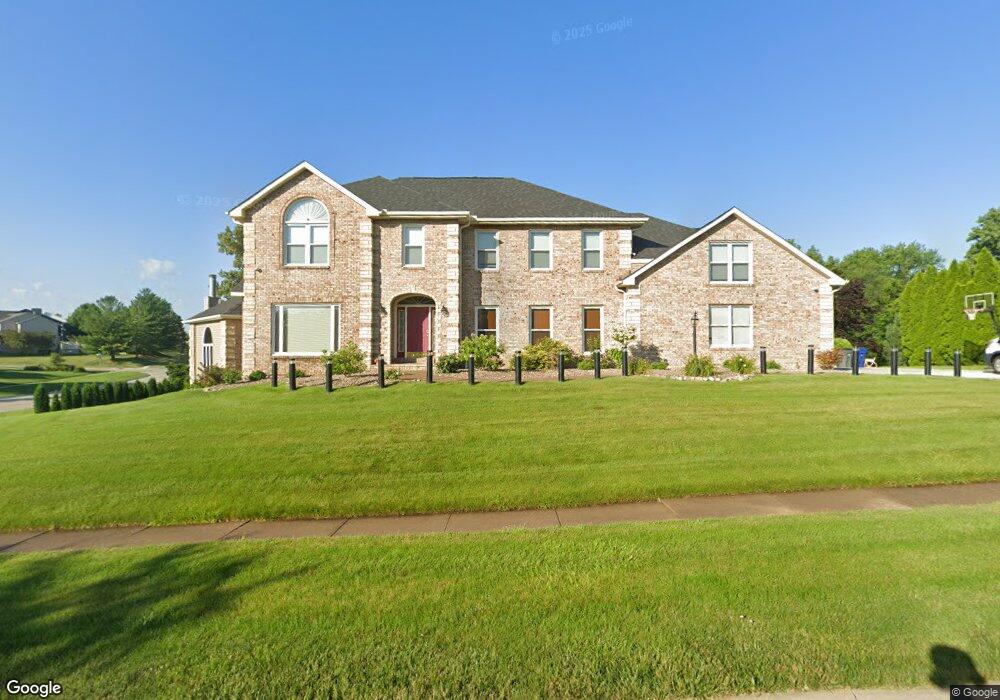
2285 Saint Andrews Cir Bettendorf, IA 52722
Estimated Value: $713,000 - $943,000
6
Beds
5
Baths
4,644
Sq Ft
$179/Sq Ft
Est. Value
About This Home
This home is located at 2285 Saint Andrews Cir, Bettendorf, IA 52722 and is currently estimated at $831,951, approximately $179 per square foot. 2285 Saint Andrews Cir is a home located in Scott County with nearby schools including Grant Wood Elementary School, Bettendorf Middle School, and Bettendorf High School.
Ownership History
Date
Name
Owned For
Owner Type
Purchase Details
Closed on
Sep 10, 2020
Sold by
Frahm Danny A and Frahm Kay L
Bought by
Daughtery David D and Hunter Brian J
Current Estimated Value
Purchase Details
Closed on
Jan 31, 2017
Sold by
Cadaner Shneur and Cadaner Chana
Bought by
Chabad Lubavitch Of The Quad Cities Inc
Purchase Details
Closed on
Jan 26, 2017
Sold by
Fitzpatrick June H
Bought by
Cadaner Shneur and Cadaner Chana
Purchase Details
Closed on
Dec 15, 2016
Sold by
Ancillary Holly Riha
Bought by
Fitzpatrick June H
Create a Home Valuation Report for This Property
The Home Valuation Report is an in-depth analysis detailing your home's value as well as a comparison with similar homes in the area
Home Values in the Area
Average Home Value in this Area
Purchase History
| Date | Buyer | Sale Price | Title Company |
|---|---|---|---|
| Daughtery David D | $565,000 | None Available | |
| Chabad Lubavitch Of The Quad Cities Inc | -- | None Available | |
| Cadaner Shneur | -- | None Available | |
| Fitzpatrick June H | -- | None Available |
Source: Public Records
Tax History Compared to Growth
Tax History
| Year | Tax Paid | Tax Assessment Tax Assessment Total Assessment is a certain percentage of the fair market value that is determined by local assessors to be the total taxable value of land and additions on the property. | Land | Improvement |
|---|---|---|---|---|
| 2025 | -- | $869,500 | $231,600 | $637,900 |
| 2024 | -- | $712,800 | $0 | $0 |
| 2023 | -- | $712,600 | $0 | $0 |
| 2022 | $0 | $584,080 | $0 | $0 |
| 2021 | $0 | $584,080 | $0 | $0 |
| 2020 | $0 | $504,380 | $0 | $0 |
| 2019 | $9,238 | $504,380 | $110,640 | $393,740 |
| 2018 | $9,238 | $504,380 | $110,640 | $393,740 |
| 2017 | $8,168 | $494,550 | $110,640 | $383,910 |
| 2016 | $7,980 | $436,500 | $0 | $0 |
| 2015 | $7,980 | $421,410 | $0 | $0 |
| 2014 | $7,958 | $673,450 | $0 | $0 |
| 2013 | $12,444 | $0 | $0 | $0 |
| 2012 | -- | $679,590 | $134,870 | $544,720 |
Source: Public Records
Map
Nearby Homes
- 2614 Heather Glen Cir
- 2744 Rosehill Ave
- 6202 Crow Valley Dr
- 2605 Hunter Rd
- 4906 Fox Ridge Rd
- 2946 Summertree Ave
- 3115 Meridith Way
- 4725 Kynnelworth Dr Unit 8
- 4150 E 60th St Unit 1004
- 3347 Glenbrook Cir N
- 6559 Cardinal Rd
- 6547 Cardinal Rd
- 6401 Utica Ridge Rd Unit 4
- 3271 Valleywynds Dr
- 9 E 61st Ct
- 3179 Meridith Way
- 2510 Eastberry Ct
- 6501 Blackbird Ln
- 3405 Marynoel Ave
- 6589 Blackbird Ln
- 2285 St Andrews
- 2267 Saint Andrews Cir
- 2267 St Andrews Cir
- 2480 Heather Glen Ave
- 2003 St Andrews
- 2003 Saint Andrews Cir
- 2467 Buckingham Rd
- 2306 56th Ave W
- 2490 Heather Glen Ave
- 2006 Saint Andrews Cir
- 2257 Saint Andrews Cir
- 2257 St Andrews
- 2019 Saint Andrews Cir
- 2510 Heather Glen Ave
- 2499 Buckingham Rd
- 2022 Saint Andrews Cir
- 2252 Saint Andrews Cir
- 5326 Glen Eagles Dr
- 2520 Buckingham Ave