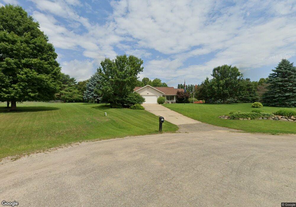
22878 Bluebird Ave Mattawan, MI 49071
Estimated Value: $380,088 - $421,000
3
Beds
2
Baths
1,900
Sq Ft
$209/Sq Ft
Est. Value
About This Home
This home is located at 22878 Bluebird Ave, Mattawan, MI 49071 and is currently estimated at $397,772, approximately $209 per square foot. 22878 Bluebird Ave is a home located in Van Buren County with nearby schools including Mattawan Early Elementary School, Mattawan Early Childhood Education Center, and Mattawan Later Elementary School.
Ownership History
Date
Name
Owned For
Owner Type
Purchase Details
Closed on
Apr 6, 2007
Sold by
Hinze Donald and Hinze Murle L
Bought by
Merriman Wayne A and Owen Kimberly S
Current Estimated Value
Home Financials for this Owner
Home Financials are based on the most recent Mortgage that was taken out on this home.
Original Mortgage
$154,320
Outstanding Balance
$93,818
Interest Rate
6.25%
Mortgage Type
Unknown
Estimated Equity
$303,954
Purchase Details
Closed on
Oct 14, 1998
Bought by
Hinze Donald and Hinze Murle
Purchase Details
Closed on
Jan 28, 1997
Bought by
Hawk Management Inc
Create a Home Valuation Report for This Property
The Home Valuation Report is an in-depth analysis detailing your home's value as well as a comparison with similar homes in the area
Home Values in the Area
Average Home Value in this Area
Purchase History
| Date | Buyer | Sale Price | Title Company |
|---|---|---|---|
| Merriman Wayne A | $192,900 | Metropolitan Title Company | |
| Hinze Donald | $15,000 | -- | |
| Hawk Management Inc | -- | -- |
Source: Public Records
Mortgage History
| Date | Status | Borrower | Loan Amount |
|---|---|---|---|
| Open | Merriman Wayne A | $154,320 |
Source: Public Records
Tax History Compared to Growth
Tax History
| Year | Tax Paid | Tax Assessment Tax Assessment Total Assessment is a certain percentage of the fair market value that is determined by local assessors to be the total taxable value of land and additions on the property. | Land | Improvement |
|---|---|---|---|---|
| 2025 | $1,117 | $189,700 | $0 | $0 |
| 2024 | $1,117 | $181,800 | $0 | $0 |
| 2023 | $1,064 | $169,400 | $0 | $0 |
| 2022 | $3,418 | $148,500 | $0 | $0 |
| 2021 | $3,346 | $122,900 | $22,300 | $100,600 |
| 2020 | $3,165 | $122,900 | $22,300 | $100,600 |
| 2019 | $3,020 | $112,700 | $112,700 | $0 |
| 2018 | $2,951 | $109,700 | $109,700 | $0 |
| 2017 | $2,850 | $101,600 | $0 | $0 |
| 2016 | $2,882 | $98,700 | $0 | $0 |
| 2015 | $2,513 | $98,700 | $0 | $0 |
| 2014 | $2,467 | $96,100 | $0 | $0 |
| 2013 | -- | $87,000 | $87,000 | $0 |
Source: Public Records
Map
Nearby Homes
- 24108 Cr 375
- 23424 38th Ave
- 10696 W L Ave
- 1710 Toscana St
- 10387 W L Ave
- 2109 Toscana St
- 2034 Sienna St
- 1881 Sienna St
- 10145 W Kl Ave
- 24402 Thousand Oaks Dr
- 0 N 1st St
- 10791 W Main St
- 41240 County Road 652
- 22108 W M 43
- 10575 W Main St Unit 10577
- 23440 E McGillen Ave Unit Parcel B
- 23440 E McGillen Ave Unit Parcel A
- 58927 Norton St
- 58418 Norton St
- 937 Josiane Dr
- 22930 Bluebird Ave
- 22822 Bluebird Ave
- 22912 County Road 375
- 39773 23rd St
- 23011 County Road 375
- 22866 County Road 375
- 22903 Bluebird Ave
- 22901 Bluebird Ave
- 22815 County Road 375
- 22100 Robin St
- 22822 County Road 375
- 22821 Bluebird Ave
- 22702 Bluebird Ave
- 22780 County Road 375
- 22640 Bluebird Ave
- 39659 23rd St
- 40404 Robin St
- 22759 Bluebird Ave
- 39346 Sandy Ridge Cir
- 39862 Sparrow St
