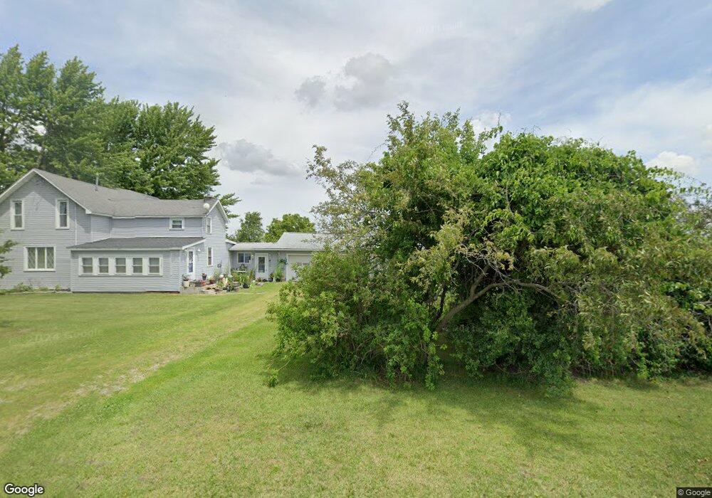
22884 Maplewood Rd Custar, OH 43511
Estimated Value: $194,000 - $249,000
4
Beds
2
Baths
2,044
Sq Ft
$105/Sq Ft
Est. Value
About This Home
This home is located at 22884 Maplewood Rd, Custar, OH 43511 and is currently estimated at $214,869, approximately $105 per square foot. 22884 Maplewood Rd is a home located in Wood County with nearby schools including Bowling Green High School.
Ownership History
Date
Name
Owned For
Owner Type
Purchase Details
Closed on
Jun 30, 2003
Sold by
Bechstein Joan P
Bought by
Carroll William E and Carroll Sandra M
Current Estimated Value
Home Financials for this Owner
Home Financials are based on the most recent Mortgage that was taken out on this home.
Original Mortgage
$59,900
Outstanding Balance
$25,946
Interest Rate
5.51%
Mortgage Type
Purchase Money Mortgage
Estimated Equity
$188,923
Purchase Details
Closed on
Apr 9, 2003
Sold by
Bechstein Joan P
Bought by
Wilhelm Helen E and Helen E Wilhelm Revocable Trust
Purchase Details
Closed on
Jan 1, 1990
Bought by
Bechstein Ivan
Create a Home Valuation Report for This Property
The Home Valuation Report is an in-depth analysis detailing your home's value as well as a comparison with similar homes in the area
Purchase History
| Date | Buyer | Sale Price | Title Company |
|---|---|---|---|
| Carroll William E | $109,900 | -- | |
| Wilhelm Helen E | $47,200 | -- | |
| Bechstein Ivan | -- | -- |
Source: Public Records
Mortgage History
| Date | Status | Borrower | Loan Amount |
|---|---|---|---|
| Open | Carroll William E | $59,900 |
Source: Public Records
Tax History
| Year | Tax Paid | Tax Assessment Tax Assessment Total Assessment is a certain percentage of the fair market value that is determined by local assessors to be the total taxable value of land and additions on the property. | Land | Improvement |
|---|---|---|---|---|
| 2025 | $1,683 | $50,505 | $8,750 | $41,755 |
| 2024 | $1,714 | $50,505 | $8,750 | $41,755 |
| 2023 | $1,714 | $50,510 | $8,750 | $41,760 |
| 2021 | $1,431 | $42,350 | $7,000 | $35,350 |
| 2020 | $1,393 | $42,350 | $7,000 | $35,350 |
| 2019 | $1,179 | $36,230 | $7,000 | $29,230 |
| 2018 | $1,172 | $36,230 | $7,000 | $29,230 |
| 2017 | $1,083 | $36,230 | $7,000 | $29,230 |
| 2016 | $971 | $31,920 | $5,250 | $26,670 |
| 2015 | $971 | $31,920 | $5,250 | $26,670 |
| 2014 | $1,024 | $31,920 | $5,250 | $26,670 |
| 2013 | $1,142 | $31,920 | $5,250 | $26,670 |
Source: Public Records
Map
Nearby Homes
- 21490 Portage Rd
- 23117 Defiance Pike
- 22759 Defiance Pike
- 13439 Ash St
- 20210 Oak St
- 22487 U S 6
- 0 Otsego Pike Unit 6136991
- 0 Sand Ridge Rd Unit 10004038
- 17884 Euler Rd
- 24642 Hammansburg Rd
- 0 Portage Rd Unit 10004034
- 15722 Range Line Rd
- 440 Vine St
- 0 County Road K
- 17566 Wapakoneta Rd
- 520 W North St
- 24432 W 3rd St
- 24526 Village Ln Unit 24526
- 24269 W Second St
- 117 Meadow Ln
- 22899 Maplewood Rd
- 23024 Maplewood Rd
- 22708 Maplewood Rd
- 10836 Custar Rd
- 23179 Maplewood Rd
- 23179 Maplewood Rd
- 10687 Custar Rd
- 10662 Custar Rd
- 11373 Custar Rd
- 23346 Maplewood Rd
- 11645 Custar Rd
- 10509 Custar Rd
- 23438 Maplewood Rd
- 22262 Maplewood Rd
- 22312 Maplewood Rd
- 10843 Milton Rd
- 10781 Milton Rd
- 11192 Milton Rd
- 11275 Milton Rd
- 10503 Poplar St
Your Personal Tour Guide
Ask me questions while you tour the home.