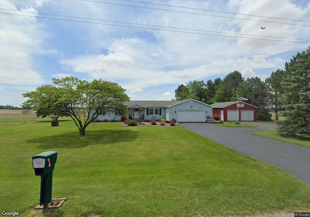
22899 Maplewood Rd Custar, OH 43511
Estimated Value: $166,000 - $244,830
3
Beds
1
Bath
1,924
Sq Ft
$115/Sq Ft
Est. Value
About This Home
This home is located at 22899 Maplewood Rd, Custar, OH 43511 and is currently estimated at $221,458, approximately $115 per square foot. 22899 Maplewood Rd is a home located in Wood County with nearby schools including Bowling Green High School.
Ownership History
Date
Name
Owned For
Owner Type
Purchase Details
Closed on
Jul 30, 2001
Sold by
Steven Goris and Steven Jill L
Bought by
Weiker Thomas D and Weiker Bonnie S
Current Estimated Value
Home Financials for this Owner
Home Financials are based on the most recent Mortgage that was taken out on this home.
Original Mortgage
$100,000
Interest Rate
7.14%
Purchase Details
Closed on
Mar 7, 1990
Bought by
Goris Steven
Create a Home Valuation Report for This Property
The Home Valuation Report is an in-depth analysis detailing your home's value as well as a comparison with similar homes in the area
Purchase History
| Date | Buyer | Sale Price | Title Company |
|---|---|---|---|
| Weiker Thomas D | $125,000 | -- | |
| Goris Steven | -- | -- |
Source: Public Records
Mortgage History
| Date | Status | Borrower | Loan Amount |
|---|---|---|---|
| Closed | Weiker Thomas D | $100,000 |
Source: Public Records
Tax History
| Year | Tax Paid | Tax Assessment Tax Assessment Total Assessment is a certain percentage of the fair market value that is determined by local assessors to be the total taxable value of land and additions on the property. | Land | Improvement |
|---|---|---|---|---|
| 2025 | $2,870 | $68,740 | $8,750 | $59,990 |
| 2024 | $2,854 | $68,740 | $8,750 | $59,990 |
| 2023 | $2,854 | $68,740 | $8,750 | $59,990 |
| 2021 | $2,425 | $56,880 | $7,000 | $49,880 |
| 2020 | $2,362 | $56,880 | $7,000 | $49,880 |
| 2019 | $2,072 | $48,230 | $7,000 | $41,230 |
| 2018 | $2,060 | $48,230 | $7,000 | $41,230 |
| 2017 | $2,034 | $48,230 | $7,000 | $41,230 |
| 2016 | $1,788 | $42,600 | $5,250 | $37,350 |
| 2015 | $1,788 | $42,600 | $5,250 | $37,350 |
| 2014 | $1,886 | $42,600 | $5,250 | $37,350 |
| 2013 | $2,104 | $42,600 | $5,250 | $37,350 |
Source: Public Records
Map
Nearby Homes
- 23117 Defiance Pike
- 22759 Defiance Pike
- 20210 Oak St
- 22487 U S 6
- 0 Otsego Pike Unit 6136991
- 0 Sand Ridge Rd Unit 10004038
- 22888 Wintergreen Rd
- 17884 Euler Rd
- 24642 Hammansburg Rd
- 0 Portage Rd Unit 10004034
- 15722 Range Line Rd
- 0 County Road K
- 440 Vine St
- 17566 Wapakoneta Rd
- 520 W North St
- 117 Meadow Ln
- 115 Meadow Ln
- 113 N Meadow Ln
- 116 Meadow Ln
- 119 N Harvest St
- 22884 Maplewood Rd
- 23024 Maplewood Rd
- 10836 Custar Rd
- 22708 Maplewood Rd
- 23179 Maplewood Rd
- 23179 Maplewood Rd
- 10687 Custar Rd
- 10662 Custar Rd
- 11373 Custar Rd
- 23346 Maplewood Rd
- 10509 Custar Rd
- 11645 Custar Rd
- 23438 Maplewood Rd
- 22262 Maplewood Rd
- 22312 Maplewood Rd
- 10843 Milton Rd
- 10781 Milton Rd
- 11192 Milton Rd
- 10503 Poplar St
- 11275 Milton Rd
Your Personal Tour Guide
Ask me questions while you tour the home.