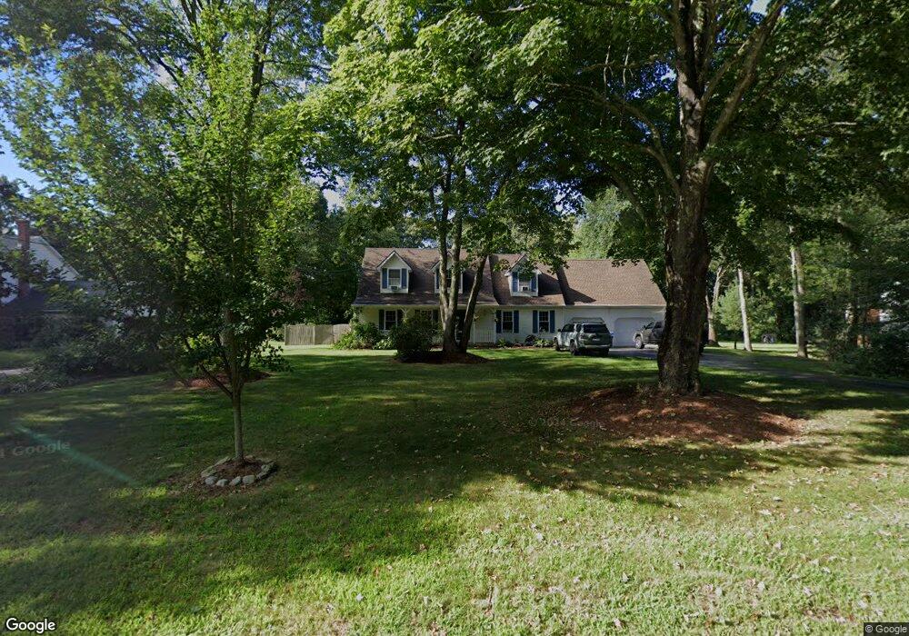
229 Black Ash Rd Oakdale, CT 06370
Estimated Value: $487,635 - $530,000
4
Beds
4
Baths
2,064
Sq Ft
$250/Sq Ft
Est. Value
About This Home
This home is located at 229 Black Ash Rd, Oakdale, CT 06370 and is currently estimated at $515,659, approximately $249 per square foot. 229 Black Ash Rd is a home located in New London County with nearby schools including Leonard J. Tyl Middle School and Montville High School.
Ownership History
Date
Name
Owned For
Owner Type
Purchase Details
Closed on
Jul 31, 2003
Sold by
Carter Robert Thomas and Carter Deborah
Bought by
Robles Patricia
Current Estimated Value
Home Financials for this Owner
Home Financials are based on the most recent Mortgage that was taken out on this home.
Original Mortgage
$220,000
Outstanding Balance
$94,477
Interest Rate
5.28%
Estimated Equity
$421,182
Purchase Details
Closed on
Feb 23, 1998
Sold by
Rtt Dev Inc
Bought by
Carter Robert T and Carter Deborah L
Home Financials for this Owner
Home Financials are based on the most recent Mortgage that was taken out on this home.
Original Mortgage
$163,350
Interest Rate
6.9%
Mortgage Type
Unknown
Create a Home Valuation Report for This Property
The Home Valuation Report is an in-depth analysis detailing your home's value as well as a comparison with similar homes in the area
Home Values in the Area
Average Home Value in this Area
Purchase History
| Date | Buyer | Sale Price | Title Company |
|---|---|---|---|
| Robles Patricia | $275,000 | -- | |
| Robles Patricia | $275,000 | -- | |
| Carter Robert T | $163,500 | -- |
Source: Public Records
Mortgage History
| Date | Status | Borrower | Loan Amount |
|---|---|---|---|
| Open | Carter Robert T | $220,000 | |
| Closed | Carter Robert T | $220,000 | |
| Previous Owner | Carter Robert T | $25,000 | |
| Previous Owner | Carter Robert T | $163,350 |
Source: Public Records
Tax History Compared to Growth
Tax History
| Year | Tax Paid | Tax Assessment Tax Assessment Total Assessment is a certain percentage of the fair market value that is determined by local assessors to be the total taxable value of land and additions on the property. | Land | Improvement |
|---|---|---|---|---|
| 2025 | $7,207 | $249,620 | $34,650 | $214,970 |
| 2024 | $6,932 | $249,620 | $34,650 | $214,970 |
| 2023 | $6,932 | $249,620 | $34,650 | $214,970 |
| 2022 | $6,667 | $249,620 | $34,650 | $214,970 |
| 2021 | $6,683 | $210,490 | $33,330 | $177,160 |
| 2020 | $6,816 | $210,490 | $33,330 | $177,160 |
| 2019 | $6,843 | $210,490 | $33,330 | $177,160 |
| 2018 | $6,679 | $210,490 | $33,340 | $177,150 |
| 2017 | $6,673 | $210,490 | $33,340 | $177,150 |
| 2016 | $6,632 | $216,660 | $41,790 | $174,870 |
| 2015 | $6,632 | $216,660 | $41,790 | $174,870 |
| 2014 | $6,363 | $216,660 | $41,790 | $174,870 |
Source: Public Records
Map
Nearby Homes
- 7 Pennsylvania Ave
- 64 Pennsylvania Ave
- 19 New Hampshire Ln
- 29 Texas Dr
- 17 Manor Rd
- 56 Evergreen Ln
- 485 Chapel Hill Rd
- 23 Glendale Rd
- 69 Forsyth Rd
- 2 Chesterfield Rd
- 15 Jeffrey Manor Rd
- 727 Old Colchester Rd
- 79 Cottonwood Ln
- 636 Connecticut 163
- 33D Laurel Point Dr
- 33A Laurel Point Dr
- 82C Pires Dr
- 53 Lake Dr
- 12 Eddy Ct
- 8 Eddy Ct
- 225 Black Ash Rd
- 233 Black Ash Rd
- 237 Black Ash Rd
- 221 Black Ash Rd
- 1 Partridge Hollow
- 2 Partridge Hollow
- 217 Black Ash Rd
- 5 Partridge Hollow
- 232 Black Ash Rd
- 6 Partridge Hollow
- 213 Black Ash Rd
- 247 Black Ash Rd
- 11 Partridge Hollow
- 214 Black Ash Rd
- 3 Pheasant Run
- 10 Partridge Hollow
- 2 Sandpiper Ln
- 7 Pheasant Run
- 6 Sandpiper Ln
- 11 Pheasant Run