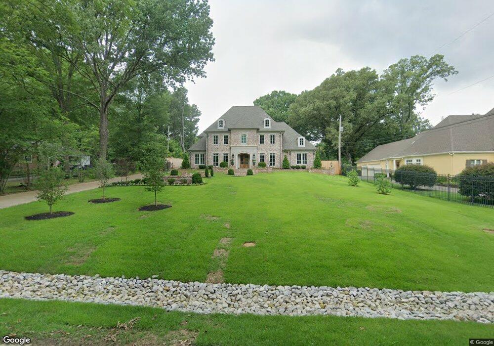
229 Colonial Rd Memphis, TN 38117
Audubon Park NeighborhoodEstimated Value: $1,149,000 - $1,430,647
5
Beds
5
Baths
4,775
Sq Ft
$276/Sq Ft
Est. Value
About This Home
This home is located at 229 Colonial Rd, Memphis, TN 38117 and is currently estimated at $1,317,549, approximately $275 per square foot. 229 Colonial Rd is a home located in Shelby County with nearby schools including White Station Elementary School, White Station High, and White Station Middle.
Ownership History
Date
Name
Owned For
Owner Type
Purchase Details
Closed on
Oct 2, 2017
Sold by
Whitaker Judy Clough
Bought by
Watson John A and Watson Kristen V
Current Estimated Value
Home Financials for this Owner
Home Financials are based on the most recent Mortgage that was taken out on this home.
Original Mortgage
$873,500
Outstanding Balance
$735,978
Interest Rate
3.78%
Mortgage Type
VA
Estimated Equity
$581,571
Purchase Details
Closed on
Jul 14, 1999
Sold by
Le Sandinger Beatrice C and Le Michael C
Bought by
Clough Judy
Home Financials for this Owner
Home Financials are based on the most recent Mortgage that was taken out on this home.
Original Mortgage
$168,150
Interest Rate
7.73%
Create a Home Valuation Report for This Property
The Home Valuation Report is an in-depth analysis detailing your home's value as well as a comparison with similar homes in the area
Home Values in the Area
Average Home Value in this Area
Purchase History
| Date | Buyer | Sale Price | Title Company |
|---|---|---|---|
| Watson John A | $450,000 | Realty Title | |
| Clough Judy | $177,000 | -- |
Source: Public Records
Mortgage History
| Date | Status | Borrower | Loan Amount |
|---|---|---|---|
| Open | Watson John A | $873,500 | |
| Previous Owner | Clough Judy | $168,150 |
Source: Public Records
Tax History Compared to Growth
Tax History
| Year | Tax Paid | Tax Assessment Tax Assessment Total Assessment is a certain percentage of the fair market value that is determined by local assessors to be the total taxable value of land and additions on the property. | Land | Improvement |
|---|---|---|---|---|
| 2025 | $9,024 | $359,600 | $98,450 | $261,150 |
| 2024 | $9,972 | $294,150 | $71,950 | $222,200 |
| 2023 | $17,919 | $294,150 | $71,950 | $222,200 |
| 2022 | $17,919 | $294,150 | $71,950 | $222,200 |
| 2021 | $18,129 | $294,150 | $71,950 | $222,200 |
| 2020 | $17,945 | $247,650 | $71,950 | $175,700 |
| 2019 | $15,740 | $125,600 | $71,950 | $53,650 |
| 2018 | $5,214 | $71,950 | $71,950 | $0 |
| 2017 | $4,095 | $99,625 | $75,725 | $23,900 |
| 2016 | $3,961 | $90,650 | $0 | $0 |
| 2014 | $3,961 | $90,650 | $0 | $0 |
Source: Public Records
Map
Nearby Homes
- 4772 Gwynne Rd
- 4859 Gwynne Rd
- 356 Clove Dr
- 4736 All Spice Dr Unit 71E
- 427 S Perkins Rd Unit 427-2
- 4654 Hemlock Ln
- 378 Caraway Cove Unit 10A
- 154 Perkins Extension
- 137 Perkins Extension
- 4679 Walnut Grove Rd
- 4916 Greenway Ave
- 405 S Perkins Rd Unit 430
- 4926 Greenway Ave
- 4903 Greenway Ave
- 435 Fairfield Cir
- 4563 Aldersgate Rd
- 455 S Perkins Rd Unit 3
- 271 Wakefield Dr
- 453 S Perkins Rd Unit 453-1
- 5071 Anchor Cove
- 217 Colonial Rd
- 4770 Shady Grove Rd
- 241 Colonial Rd
- 4760 Shady Grove Rd
- 207 Colonial Rd
- 4748 Shady Grove Rd
- 4779 Gwynne Rd
- 4810 Shady Grove Rd
- 218 Colonial Rd
- 4795 Gwynne Rd
- 4755 Gwynne Rd
- 208 Colonial Rd
- 4775 Shady Grove Rd
- 4815 Gwynne Rd
- 4732 Shady Grove Rd
- 4761 Shady Grove Rd
- 4795 Shady Grove Rd
- 4828 Shady Grove Rd
- 4711 Gwynne Rd
- 4705 Gwynne Rd