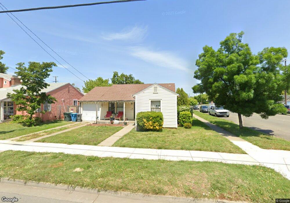
229 E 12th St Marysville, CA 95901
Estimated Value: $255,213 - $321,000
2
Beds
1
Bath
1,112
Sq Ft
$261/Sq Ft
Est. Value
About This Home
This home is located at 229 E 12th St, Marysville, CA 95901 and is currently estimated at $290,053, approximately $260 per square foot. 229 E 12th St is a home located in Yuba County with nearby schools including Kynoch Elementary School, Anna McKenney Intermediate, and Marysville High School.
Ownership History
Date
Name
Owned For
Owner Type
Purchase Details
Closed on
Mar 26, 2010
Sold by
The Salvation Army
Bought by
Stumpf Cory A
Current Estimated Value
Home Financials for this Owner
Home Financials are based on the most recent Mortgage that was taken out on this home.
Original Mortgage
$83,460
Outstanding Balance
$55,366
Interest Rate
4.92%
Mortgage Type
FHA
Estimated Equity
$234,687
Purchase Details
Closed on
May 18, 2006
Sold by
Seawright Mary Silan
Bought by
The Salvation Army
Create a Home Valuation Report for This Property
The Home Valuation Report is an in-depth analysis detailing your home's value as well as a comparison with similar homes in the area
Purchase History
| Date | Buyer | Sale Price | Title Company |
|---|---|---|---|
| Stumpf Cory A | $85,000 | Stewart Title Of Ca Inc | |
| The Salvation Army | -- | None Available | |
| Seawright Mary Silan | -- | None Available |
Source: Public Records
Mortgage History
| Date | Status | Borrower | Loan Amount |
|---|---|---|---|
| Open | Stumpf Cory A | $83,460 |
Source: Public Records
Tax History
| Year | Tax Paid | Tax Assessment Tax Assessment Total Assessment is a certain percentage of the fair market value that is determined by local assessors to be the total taxable value of land and additions on the property. | Land | Improvement |
|---|---|---|---|---|
| 2025 | $1,213 | $109,704 | $25,809 | $83,895 |
| 2023 | $1,213 | $105,445 | $24,807 | $80,638 |
| 2022 | $1,172 | $103,378 | $24,321 | $79,057 |
| 2021 | $1,157 | $101,352 | $23,845 | $77,507 |
| 2020 | $1,147 | $100,314 | $23,601 | $76,713 |
| 2019 | $1,123 | $98,348 | $23,139 | $75,209 |
| 2018 | $1,101 | $96,421 | $22,686 | $73,735 |
| 2017 | $1,067 | $94,532 | $22,242 | $72,290 |
| 2016 | $1,058 | $92,679 | $21,806 | $70,873 |
| 2015 | $1,035 | $91,288 | $21,479 | $69,809 |
| 2014 | $1,019 | $89,501 | $21,059 | $68,442 |
Source: Public Records
Map
Nearby Homes
- 1204 Freeman St
- 1021 Ramirez St
- 1226 Ramirez St
- 1412 Buchanan St
- 1612 Buchanan St
- 131 E 17th St Unit 37
- 1716 Buchanan St
- 1617 E Lake Ct
- 1721 Ramirez St Unit 8
- 306 C St
- 824 C St
- 819 Oak St
- 815 Oak St
- 401 12th St
- 816 Oak St
- 9080 California 70
- 0 California 70
- 2125 Ramirez St
- 2135 Greely Dr
- 614 E 21st St
- 1212 Sampson St
- 225 E 12th St
- 1217 Divver St
- 1216 Sampson St
- 1203 Sampson St
- 1219 Divver St
- 1215 Sampson St
- 224 E 12th St Unit 5
- 224 E 12th St
- 1222 Sampson St
- 309 E 12th St
- 1217 Sampson St
- 215 E 12th St
- 218 E 12th St
- 1221 Divver St
- 1212 Divver St
- 1223 Sampson St
- 1212 Freeman St
- 1230 Sampson St
- 1216 Divver St
Your Personal Tour Guide
Ask me questions while you tour the home.