Estimated Value: $1,613,876 - $2,084,000
4
Beds
3
Baths
3,660
Sq Ft
$502/Sq Ft
Est. Value
About This Home
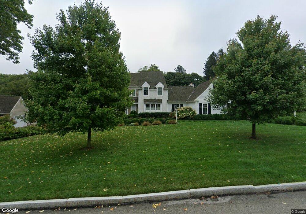
This home is located at 229 Ravenscliff Rd, Wayne, PA 19087 and is currently estimated at $1,837,969, approximately $502 per square foot. 229 Ravenscliff Rd is a home located in Delaware County with nearby schools including Wayne Elementary School, Radnor Middle School, and Radnor Senior High School.
Ownership History
Date
Name
Owned For
Owner Type
Purchase Details
Closed on
Jul 29, 2015
Sold by
Bilsky Steven J and Bilsky Susan K
Bought by
Kovich Elizabeth and Bilsky Jeffrey
Current Estimated Value
Home Financials for this Owner
Home Financials are based on the most recent Mortgage that was taken out on this home.
Original Mortgage
$675,000
Outstanding Balance
$529,799
Interest Rate
3.97%
Mortgage Type
New Conventional
Estimated Equity
$1,308,171
Purchase Details
Closed on
Jun 30, 1994
Sold by
Keane James F
Bought by
Bilsky Steven J and Bilsky Susan K
Home Financials for this Owner
Home Financials are based on the most recent Mortgage that was taken out on this home.
Original Mortgage
$180,500
Interest Rate
4.12%
Mortgage Type
Purchase Money Mortgage
Create a Home Valuation Report for This Property
The Home Valuation Report is an in-depth analysis detailing your home's value as well as a comparison with similar homes in the area
Home Values in the Area
Average Home Value in this Area
Purchase History
| Date | Buyer | Sale Price | Title Company |
|---|---|---|---|
| Kovich Elizabeth | $900,000 | Commonwealth Land Title Insu | |
| Bilsky Steven J | $645,000 | Commonwealth Land Title Ins |
Source: Public Records
Mortgage History
| Date | Status | Borrower | Loan Amount |
|---|---|---|---|
| Open | Kovich Elizabeth | $675,000 | |
| Previous Owner | Bilsky Steven J | $180,500 | |
| Closed | Bilsky Steven J | $400,000 |
Source: Public Records
Tax History Compared to Growth
Tax History
| Year | Tax Paid | Tax Assessment Tax Assessment Total Assessment is a certain percentage of the fair market value that is determined by local assessors to be the total taxable value of land and additions on the property. | Land | Improvement |
|---|---|---|---|---|
| 2025 | $19,000 | $939,730 | $288,650 | $651,080 |
| 2024 | $19,000 | $939,730 | $288,650 | $651,080 |
| 2023 | $18,247 | $939,730 | $288,650 | $651,080 |
| 2022 | $18,048 | $939,730 | $288,650 | $651,080 |
| 2021 | $28,989 | $939,730 | $288,650 | $651,080 |
| 2020 | $20,233 | $581,620 | $205,000 | $376,620 |
| 2019 | $19,662 | $581,620 | $205,000 | $376,620 |
| 2018 | $19,276 | $581,620 | $0 | $0 |
| 2017 | $18,873 | $581,620 | $0 | $0 |
| 2016 | $3,192 | $581,620 | $0 | $0 |
| 2015 | $3,192 | $581,620 | $0 | $0 |
| 2014 | $3,192 | $581,620 | $0 | $0 |
Source: Public Records
Map
Nearby Homes
- 1 Dunminning Rd
- 201 Church Rd
- 3314 Saint Davids Rd
- 144 Eaton Dr
- 203 Church St
- 120 S Devon Ave
- 238 Highland Ave
- 412 Fairview Dr
- 188 Abrahams Ln
- 718 Lot 1 Waterloo
- 328 Conestoga Rd
- 5 Greythorne Woods Cir Unit 5
- 232 Conestoga Rd
- 188 Conestoga Rd
- 641 Andover Rd
- 3111 Sawmill Rd
- 123 Conestoga Rd
- 112 Conestoga Rd
- 0 Greenwell Ln
- 409 Timber Ln
- 231 Ravenscliff Rd
- 215 Ravenscliff Rd
- 217 Ravenscliff Rd
- 225 Ravenscliff Rd
- 233 Ravenscliff Rd
- 256 Ravenscliff Rd
- 213 Ravenscliff Rd
- 219 Ravenscliff Rd
- 254 Ravenscliff Rd
- 221 Ravenscliff Rd
- 252 Ravenscliff Rd
- 223 Ravenscliff Rd
- 211 Ravenscliff Rd
- 258 Ravenscliff Rd
- 250 Ravenscliff Rd
- 235 Ravenscliff Rd
- 260 Ravenscliff Rd
- 209 Ravenscliff Rd
- 230 Ravenscliff Rd
- 234 Ravenscliff Rd