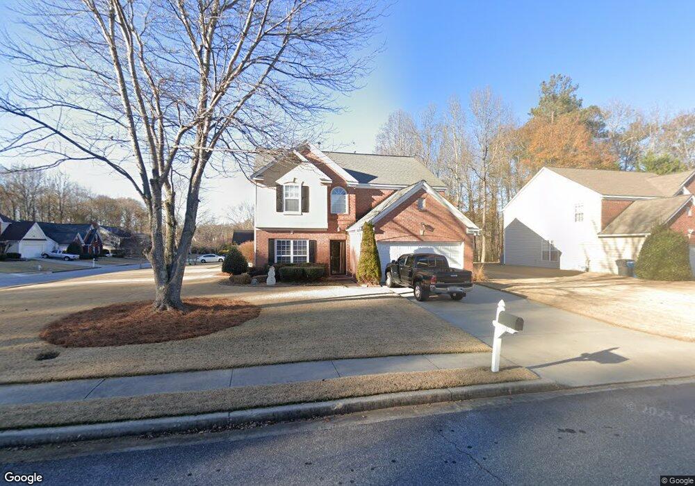
2290 Kirkstone Dr Unit II Buford, GA 30519
Estimated Value: $412,000 - $449,000
3
Beds
3
Baths
2,715
Sq Ft
$159/Sq Ft
Est. Value
About This Home
This home is located at 2290 Kirkstone Dr Unit II, Buford, GA 30519 and is currently estimated at $431,836, approximately $159 per square foot. 2290 Kirkstone Dr Unit II is a home located in Gwinnett County with nearby schools including Freeman's Mill Elementary School, Twin Rivers Middle School, and Mountain View High School.
Ownership History
Date
Name
Owned For
Owner Type
Purchase Details
Closed on
Sep 26, 2002
Sold by
Binder Dean B
Bought by
Binder Dean B and Binder Melanie
Current Estimated Value
Home Financials for this Owner
Home Financials are based on the most recent Mortgage that was taken out on this home.
Original Mortgage
$16,500
Interest Rate
6.18%
Mortgage Type
New Conventional
Purchase Details
Closed on
Aug 30, 1999
Sold by
Centex Homes
Bought by
Binder Dean B
Home Financials for this Owner
Home Financials are based on the most recent Mortgage that was taken out on this home.
Original Mortgage
$144,653
Interest Rate
7.73%
Mortgage Type
FHA
Create a Home Valuation Report for This Property
The Home Valuation Report is an in-depth analysis detailing your home's value as well as a comparison with similar homes in the area
Home Values in the Area
Average Home Value in this Area
Purchase History
| Date | Buyer | Sale Price | Title Company |
|---|---|---|---|
| Binder Dean B | -- | -- | |
| Binder Dean B | $145,900 | -- |
Source: Public Records
Mortgage History
| Date | Status | Borrower | Loan Amount |
|---|---|---|---|
| Closed | Binder Dean B | $16,500 | |
| Previous Owner | Binder Dean B | $144,653 |
Source: Public Records
Tax History Compared to Growth
Tax History
| Year | Tax Paid | Tax Assessment Tax Assessment Total Assessment is a certain percentage of the fair market value that is determined by local assessors to be the total taxable value of land and additions on the property. | Land | Improvement |
|---|---|---|---|---|
| 2025 | $4,383 | $171,760 | $26,000 | $145,760 |
| 2024 | $4,601 | $175,440 | $30,000 | $145,440 |
| 2023 | $4,601 | $178,920 | $30,000 | $148,920 |
| 2022 | $4,082 | $152,000 | $26,000 | $126,000 |
| 2021 | $3,335 | $113,280 | $19,200 | $94,080 |
| 2020 | $3,162 | $104,080 | $16,000 | $88,080 |
| 2019 | $3,092 | $104,080 | $16,000 | $88,080 |
| 2018 | $2,807 | $90,800 | $16,000 | $74,800 |
| 2016 | $2,556 | $78,160 | $12,800 | $65,360 |
| 2015 | $2,426 | $71,360 | $10,800 | $60,560 |
| 2014 | $2,436 | $71,360 | $10,800 | $60,560 |
Source: Public Records
Map
Nearby Homes
- 2147 Saint Albans Place
- 2402 Bancroft Way
- 2238 Saint Albans Place
- 2144 Beacon Crest Dr
- 2365 Valley Mill Dr Unit 1
- 2507 Gristhaven Ln
- 2423 Walnut Tree Ln Unit 1
- 2557 Woodford Ln
- 2493 Walnut Tree Ln Unit 1
- 2115 Sun Valley Ct
- 2500 Sunny Hill Rd
- 2506 Sunny Hill Rd
- 2045 Amber Creek Dr
- 2375 Matlin Way
- 2228 Lakeview Bend Way
- 2305 Braselton Hwy
- 2346 Hampton Park Dr Unit I
- 2299 Misty Ivy Ct
- 2256 Hansford Pass
- 2300 Kirkstone Dr
- 2207 Saint Albans Place
- 2310 Kirkstone Dr
- 2188 Saint Albans Place
- 2198 Saint Albans Place Unit II
- 2295 Kirkstone Dr
- 2217 Saint Albans Place
- 2305 Kirkstone Dr
- 2178 Saint Albans Place
- 2208 Saint Albans Place
- 2208 Saint Albans Place Unit 42
- 2315 Kirkstone Dr
- 2303 Bancroft Way
- 2320 Kirkstone Dr Unit 2
- 2168 Saint Albans Place
- 2218 Saint Albans Place
- 2227 Saint Albans Place
- 2227 Saint Albans Place Unit 2
- 2157 Saint Albans Place Unit 2
- 2313 Bancroft Way