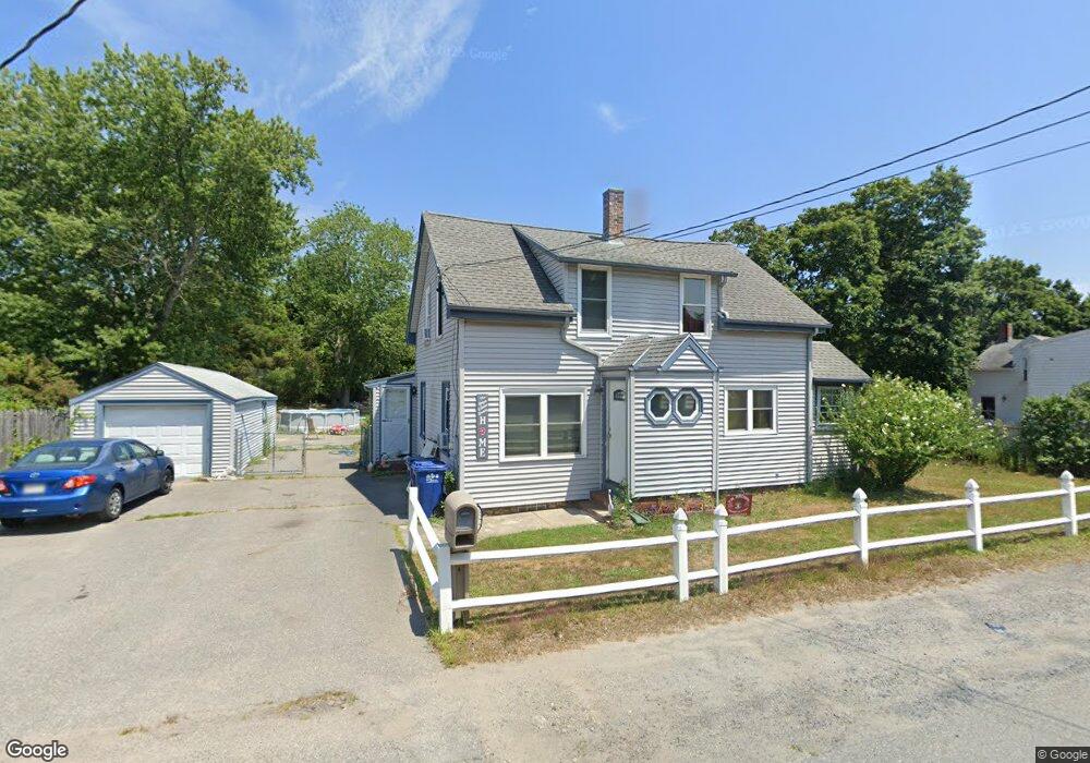
2292 Cranberry Hwy West Wareham, MA 02576
Estimated Value: $462,000 - $483,355
4
Beds
2
Baths
1,617
Sq Ft
$292/Sq Ft
Est. Value
About This Home
This home is located at 2292 Cranberry Hwy, West Wareham, MA 02576 and is currently estimated at $472,839, approximately $292 per square foot. 2292 Cranberry Hwy is a home located in Plymouth County.
Ownership History
Date
Name
Owned For
Owner Type
Purchase Details
Closed on
Jun 14, 2019
Sold by
Monteiro Joseph B and Monteiro Margaret C
Bought by
Leger Melissa A
Current Estimated Value
Home Financials for this Owner
Home Financials are based on the most recent Mortgage that was taken out on this home.
Original Mortgage
$203,500
Outstanding Balance
$178,926
Interest Rate
4.1%
Mortgage Type
FHA
Estimated Equity
$293,913
Create a Home Valuation Report for This Property
The Home Valuation Report is an in-depth analysis detailing your home's value as well as a comparison with similar homes in the area
Home Values in the Area
Average Home Value in this Area
Purchase History
| Date | Buyer | Sale Price | Title Company |
|---|---|---|---|
| Leger Melissa A | $250,000 | -- | |
| Leger Melissa A | $250,000 | -- |
Source: Public Records
Mortgage History
| Date | Status | Borrower | Loan Amount |
|---|---|---|---|
| Open | Leger Melissa A | $203,500 | |
| Closed | Leger Melissa A | $203,500 |
Source: Public Records
Tax History Compared to Growth
Tax History
| Year | Tax Paid | Tax Assessment Tax Assessment Total Assessment is a certain percentage of the fair market value that is determined by local assessors to be the total taxable value of land and additions on the property. | Land | Improvement |
|---|---|---|---|---|
| 2025 | $4,072 | $390,800 | $102,800 | $288,000 |
| 2024 | $4,172 | $371,500 | $81,600 | $289,900 |
| 2023 | $3,725 | $339,000 | $74,100 | $264,900 |
| 2022 | $3,725 | $282,600 | $74,100 | $208,500 |
| 2021 | $3,424 | $254,600 | $74,100 | $180,500 |
| 2020 | $3,278 | $247,200 | $74,100 | $173,100 |
| 2019 | $3,155 | $237,400 | $74,800 | $162,600 |
| 2018 | $2,914 | $213,800 | $74,800 | $139,000 |
| 2017 | $2,876 | $213,800 | $74,800 | $139,000 |
| 2016 | $2,694 | $199,100 | $74,800 | $124,300 |
| 2015 | $2,564 | $196,200 | $74,800 | $121,400 |
| 2014 | $2,652 | $206,400 | $71,000 | $135,400 |
Source: Public Records
Map
Nearby Homes
- 132 Queen Dr
- 51 Crest Dr
- 103 Castle Dr
- 20 Gault Rd
- 67 Crest Dr
- 13 Siesta Dr
- 27 Siesta Dr
- 50 N Carver Rd
- 4 Siesta Dr
- 14 Timber Ln
- 21 Windswept Rd
- 72 Papermill Rd Unit 72
- 64 Papermill Rd
- 64 Papermill Rd Unit 64
- 85 Great Hill Dr
- 421 County Rd
- 44 Great Hill Dr
- 32 Windswept Rd
- 127 Dolittle Ln
- 157 Windswept Rd
- 2292 Cranberry Hwy
- 2292 Cranberry Hwy
- 2294 Cranberry Hwy
- 2286 Cranberry Hwy
- 2288 Cranberry Hwy
- 2291 Cranberry Hwy
- 2290 Cranberry Hwy
- 2297 Cranberry Hwy
- 2298 Cranberry Hwy
- 2289 Cranberry Hwy
- 2293 Cranberry Hwy
- 2297 Cranberry Hwy
- 2 Aunt Maryville Ln
- 2284 Cranberry Hwy
- 2306 Cranberry Hwy
- 2280 Cranberry Hwy
- 0 Aunt Maryville Ln
- 2308 Cranberry Hwy
- 1 Aunt Maryville Ln
- 2281 Cranberry Hwy