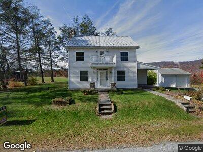
22948 Piper Ln Shade Gap, PA 17255
Estimated Value: $200,504 - $216,000
--
Bed
1
Bath
--
Sq Ft
163
Acres
About This Home
This home is located at 22948 Piper Ln, Shade Gap, PA 17255 and is currently estimated at $208,252. 22948 Piper Ln is a home located in Huntingdon County with nearby schools including Southern Huntingdon County High School/Middle School.
Ownership History
Date
Name
Owned For
Owner Type
Purchase Details
Closed on
Aug 30, 2022
Sold by
M & J Land Acquisitions Llc
Bought by
Piper Matthew L and Piper Brooke A
Current Estimated Value
Purchase Details
Closed on
Mar 19, 2022
Sold by
Piper Donna J
Bought by
Piper Donna J and Snyder Lori A
Home Financials for this Owner
Home Financials are based on the most recent Mortgage that was taken out on this home.
Original Mortgage
$932,000
Interest Rate
3.92%
Mortgage Type
New Conventional
Purchase Details
Closed on
Mar 18, 2022
Sold by
Piper Donna J and Piper Judith A
Bought by
M & J Land Acquisitions Llc
Home Financials for this Owner
Home Financials are based on the most recent Mortgage that was taken out on this home.
Original Mortgage
$932,000
Interest Rate
3.92%
Mortgage Type
New Conventional
Purchase Details
Closed on
Jun 10, 2016
Sold by
Piper Robert C and Piper Donna
Bought by
Hammond Billie P and Hammond John W
Create a Home Valuation Report for This Property
The Home Valuation Report is an in-depth analysis detailing your home's value as well as a comparison with similar homes in the area
Home Values in the Area
Average Home Value in this Area
Purchase History
| Date | Buyer | Sale Price | Title Company |
|---|---|---|---|
| Piper Matthew L | -- | None Listed On Document | |
| Piper William D | -- | None Listed On Document | |
| Piper Donna J | -- | None Listed On Document | |
| M & J Land Acquisitions Llc | $950,000 | Morrison Scott | |
| Hammond Billie P | -- | None Available | |
| Hammond Billie P | -- | None Available |
Source: Public Records
Mortgage History
| Date | Status | Borrower | Loan Amount |
|---|---|---|---|
| Previous Owner | M & J Land Acquisitions Llc | $932,000 |
Source: Public Records
Tax History Compared to Growth
Tax History
| Year | Tax Paid | Tax Assessment Tax Assessment Total Assessment is a certain percentage of the fair market value that is determined by local assessors to be the total taxable value of land and additions on the property. | Land | Improvement |
|---|---|---|---|---|
| 2023 | $2,236 | $34,640 | $11,280 | $23,360 |
| 2022 | $2,255 | $34,640 | $11,280 | $23,360 |
| 2021 | $2,255 | $36,000 | $12,640 | $23,360 |
| 2020 | $2,255 | $36,000 | $12,640 | $23,360 |
| 2019 | $2,120 | $36,000 | $12,640 | $23,360 |
| 2018 | $2,120 | $36,000 | $12,640 | $23,360 |
| 2017 | $2,120 | $36,000 | $12,640 | $23,360 |
| 2016 | $2,015 | $35,920 | $12,560 | $23,360 |
| 2015 | $2,015 | $35,920 | $12,560 | $23,360 |
| 2014 | -- | $33,200 | $9,840 | $23,360 |
Source: Public Records
Map
Nearby Homes
- 0 Main St
- 0 0 Remington Rd
- 0 Remington Rd Unit 2815325
- 20583 Maddensville Pike
- 31710 Great Cove Rd
- 0 Springtown Rd
- 18188 Fannettsburg Rd W
- 17776 Springtown Rd
- 13938 Creek Rd
- LOT 1 Great Cove Rd
- Lots 1 & 2 Great Cove Rd
- lot 2 Great Cove Rd
- 0 Hill Rd
- 107 Brown Rd
- N/A Elliots Run Rd
- 20639 Rio Grande St
- 0 Sheepskin Hollow Rd
- 0 Sunset Dr
- 1814 Iron Bridge Rd
- 2842 N Clear Ridge Rd