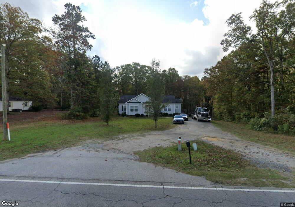
2296 Airport Rd Lancaster, SC 29720
Estimated Value: $238,000 - $297,000
3
Beds
2
Baths
1,781
Sq Ft
$154/Sq Ft
Est. Value
About This Home
This home is located at 2296 Airport Rd, Lancaster, SC 29720 and is currently estimated at $273,522, approximately $153 per square foot. 2296 Airport Rd is a home located in Lancaster County with nearby schools including Brooklyn Springs Elementary School, South Middle School, and Lancaster High School.
Ownership History
Date
Name
Owned For
Owner Type
Purchase Details
Closed on
Jun 12, 2018
Sold by
Campbell Timar D
Bought by
Crosby Patricia Ann and Campbell Patricia Crosby
Current Estimated Value
Purchase Details
Closed on
Sep 17, 2009
Sold by
Hall Ronald A and Hall Christopher B
Bought by
Thomas Justin
Home Financials for this Owner
Home Financials are based on the most recent Mortgage that was taken out on this home.
Original Mortgage
$128,061
Outstanding Balance
$83,410
Interest Rate
5.11%
Mortgage Type
Future Advance Clause Open End Mortgage
Estimated Equity
$190,112
Purchase Details
Closed on
May 7, 2005
Sold by
Mcdonald David W
Bought by
Hall Ronald A and Hall Christopher B
Create a Home Valuation Report for This Property
The Home Valuation Report is an in-depth analysis detailing your home's value as well as a comparison with similar homes in the area
Home Values in the Area
Average Home Value in this Area
Purchase History
| Date | Buyer | Sale Price | Title Company |
|---|---|---|---|
| Crosby Patricia Ann | -- | None Available | |
| Thomas Justin | $125,500 | -- | |
| Hall Ronald A | -- | None Available |
Source: Public Records
Mortgage History
| Date | Status | Borrower | Loan Amount |
|---|---|---|---|
| Open | Thomas Justin | $128,061 |
Source: Public Records
Tax History Compared to Growth
Tax History
| Year | Tax Paid | Tax Assessment Tax Assessment Total Assessment is a certain percentage of the fair market value that is determined by local assessors to be the total taxable value of land and additions on the property. | Land | Improvement |
|---|---|---|---|---|
| 2024 | $853 | $5,556 | $816 | $4,740 |
| 2023 | $850 | $5,556 | $816 | $4,740 |
| 2022 | $847 | $5,556 | $816 | $4,740 |
| 2021 | $829 | $5,556 | $816 | $4,740 |
| 2020 | $779 | $5,076 | $816 | $4,260 |
| 2019 | $1,718 | $5,076 | $816 | $4,260 |
| 2018 | $1,653 | $5,076 | $816 | $4,260 |
| 2017 | $761 | $0 | $0 | $0 |
| 2016 | $742 | $0 | $0 | $0 |
| 2015 | $735 | $0 | $0 | $0 |
| 2014 | $735 | $0 | $0 | $0 |
| 2013 | $735 | $0 | $0 | $0 |
Source: Public Records
Map
Nearby Homes
- 2282 White Pine Ct
- 2315 State Road S-29-395
- TBD Theron Cir
- 0 Powell Ave
- 1678 Old Lynwood Cir
- 3017 Crenson Dr
- 1675 Old Lynwood Cir
- 2132 Athena Rd
- 3005 Crenson Dr
- 3047 Crenson Dr
- 3028 Crenson Dr
- 3038 Crenson Dr
- 3042 Crenson Dr
- 2156 Evans Dr
- 2060 Athena Rd
- 2112 Evans Dr
- Lots 1-5 Evans Dr
- 2085 Athena Rd
- 2040 Athena Rd
- 2089 Athena Rd
- 2306 Airport Rd
- 2295 Airport Rd
- 2303 Airport Rd
- 2283 Airport Rd
- 2316 Airport Rd
- 2311 Airport Rd
- 1855 Bridgewood Dr
- 2267 Airport Rd Unit 41
- 1847 Bridgewood Dr
- 2275 Airport Rd Unit 40
- 2211 Airport Rd
- 1839 Bridgewood Dr
- 1869 Shelton St
- 2247 Airport Rd
- 1975 Country Club Dr
- 1834 Bridgewood Dr
- 2258 White Pine Ct
- 1825 Bridgewood Dr
- 2251 White Pine Ct
- 1820 Bridgewood Dr