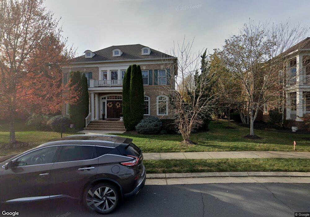
22971 Lois Ln Ashburn, VA 20148
Estimated Value: $1,138,000 - $1,325,000
4
Beds
5
Baths
--
Sq Ft
0.28
Acres
About This Home
This home is located at 22971 Lois Ln, Ashburn, VA 20148 and is currently estimated at $1,245,838. 22971 Lois Ln is a home located in Loudoun County with nearby schools including Legacy Elementary School, Brambleton Middle School, and Independence High School.
Ownership History
Date
Name
Owned For
Owner Type
Purchase Details
Closed on
Jul 15, 2009
Sold by
Gulick Grp Inc
Bought by
Mckay Robert A and Le,Christy
Current Estimated Value
Home Financials for this Owner
Home Financials are based on the most recent Mortgage that was taken out on this home.
Original Mortgage
$687,600
Outstanding Balance
$448,772
Interest Rate
5.31%
Mortgage Type
New Conventional
Estimated Equity
$797,066
Create a Home Valuation Report for This Property
The Home Valuation Report is an in-depth analysis detailing your home's value as well as a comparison with similar homes in the area
Home Values in the Area
Average Home Value in this Area
Purchase History
| Date | Buyer | Sale Price | Title Company |
|---|---|---|---|
| Mckay Robert A | $859,500 | -- |
Source: Public Records
Mortgage History
| Date | Status | Borrower | Loan Amount |
|---|---|---|---|
| Open | Mckay Robert A | $687,600 |
Source: Public Records
Tax History Compared to Growth
Tax History
| Year | Tax Paid | Tax Assessment Tax Assessment Total Assessment is a certain percentage of the fair market value that is determined by local assessors to be the total taxable value of land and additions on the property. | Land | Improvement |
|---|---|---|---|---|
| 2025 | $9,828 | $1,220,930 | $335,900 | $885,030 |
| 2024 | $10,306 | $1,191,500 | $310,900 | $880,600 |
| 2023 | $10,096 | $1,153,860 | $310,900 | $842,960 |
| 2022 | $8,881 | $997,890 | $270,900 | $726,990 |
| 2021 | $8,578 | $875,270 | $245,900 | $629,370 |
| 2020 | $8,793 | $849,610 | $225,900 | $623,710 |
| 2019 | $8,572 | $820,240 | $225,900 | $594,340 |
| 2018 | $8,679 | $799,930 | $200,900 | $599,030 |
| 2017 | $8,873 | $788,710 | $200,900 | $587,810 |
| 2016 | $8,967 | $783,110 | $0 | $0 |
| 2015 | $8,913 | $584,390 | $0 | $584,390 |
| 2014 | $9,408 | $633,660 | $0 | $633,660 |
Source: Public Records
Map
Nearby Homes
- 22995 Lois Ln
- 22966 Cabral Terrace
- 23056 Sullivans Cove Square
- 22879 Ember Brook Cir
- 42473 Tourmaline Ln
- 22838 Arbor View Dr
- 22951 Sullivans Cove Square
- 42533 Magellan Square
- 42628 Emperor Dr
- 42481 Rockrose Square Unit 204
- 42455 Hollyhock Terrace
- 42539 Mayflower Terrace Unit 204
- 42683 Explorer Dr
- 42634 Hollyhock Terrace
- 23156 Horseshoe Trail Square
- 23158 Horseshoe Trail Square
- 22796 Breezy Hollow Dr
- 22687 Blue Elder Terrace Unit 104
- 22691 Blue Elder Terrace Unit 204
- 23251 Christopher Thomas Ln
- 22967 Lois Ln
- 22975 Lois Ln
- 22970 Lois Ln
- 22974 Lois Ln
- 22963 Lois Ln
- 42469 Redstone Terrace
- 22979 Lois Ln
- 22977 White Ibis Dr
- 22975 White Ibis Dr
- 22973 White Ibis Dr
- 42467 Redstone Terrace
- 22978 Lois Ln
- 22971 White Ibis Dr
- 42465 Redstone Terrace
- 22969 White Ibis Dr
- 42463 Redstone Terrace
- 42474 Malachite Terrace
- 22967 White Ibis Dr
- 22959 Lois Ln
- 22981 Lois Ln