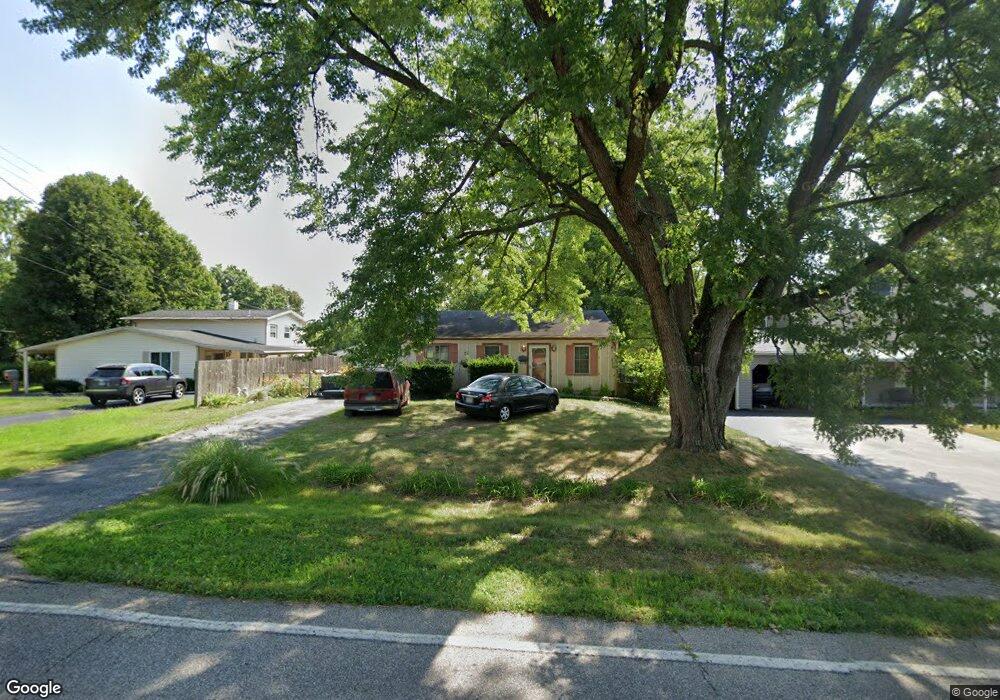
2299 Miles Rd Cincinnati, OH 45231
New Burlington NeighborhoodEstimated Value: $140,000 - $207,000
3
Beds
1
Bath
952
Sq Ft
$178/Sq Ft
Est. Value
About This Home
This home is located at 2299 Miles Rd, Cincinnati, OH 45231 and is currently estimated at $169,778, approximately $178 per square foot. 2299 Miles Rd is a home located in Hamilton County with nearby schools including Mt Healthy High School, Hamilton County Mathematics and Science Academy, and Central Montessori Academy.
Ownership History
Date
Name
Owned For
Owner Type
Purchase Details
Closed on
Nov 16, 2017
Sold by
Bruce Homer C and Bruce Betty J
Bought by
Bruce Kimberly Ann
Current Estimated Value
Purchase Details
Closed on
May 23, 1996
Sold by
Neal R David and Neal Marsha
Bought by
Bruce Homer C and Bruce Betty J
Home Financials for this Owner
Home Financials are based on the most recent Mortgage that was taken out on this home.
Original Mortgage
$41,000
Outstanding Balance
$1,182
Interest Rate
7.99%
Estimated Equity
$168,596
Create a Home Valuation Report for This Property
The Home Valuation Report is an in-depth analysis detailing your home's value as well as a comparison with similar homes in the area
Home Values in the Area
Average Home Value in this Area
Purchase History
| Date | Buyer | Sale Price | Title Company |
|---|---|---|---|
| Bruce Kimberly Ann | -- | None Available | |
| Bruce Homer C | $58,900 | -- |
Source: Public Records
Mortgage History
| Date | Status | Borrower | Loan Amount |
|---|---|---|---|
| Open | Bruce Homer C | $41,000 |
Source: Public Records
Tax History
| Year | Tax Paid | Tax Assessment Tax Assessment Total Assessment is a certain percentage of the fair market value that is determined by local assessors to be the total taxable value of land and additions on the property. | Land | Improvement |
|---|---|---|---|---|
| 2025 | $2,293 | $38,346 | $8,960 | $29,386 |
| 2023 | $2,183 | $38,346 | $8,960 | $29,386 |
| 2022 | $2,460 | $31,207 | $8,712 | $22,495 |
| 2021 | $2,448 | $31,207 | $8,712 | $22,495 |
| 2020 | $2,417 | $31,207 | $8,712 | $22,495 |
| 2019 | $2,051 | $24,574 | $6,860 | $17,714 |
| 2018 | $2,061 | $24,574 | $6,860 | $17,714 |
| 2017 | $1,987 | $24,574 | $6,860 | $17,714 |
| 2016 | $1,740 | $20,948 | $6,332 | $14,616 |
| 2015 | $1,726 | $20,948 | $6,332 | $14,616 |
| 2014 | $1,715 | $20,948 | $6,332 | $14,616 |
| 2013 | $1,907 | $23,807 | $7,196 | $16,611 |
Source: Public Records
Map
Nearby Homes
- 2317 Magdalena Dr
- 2528 Mariposa St
- 9846 Pinedale Dr
- 9500 Ridgemoor Ave
- 2329 Garrison Dr
- 9391 Jericho Dr
- 2473 Schon Dr
- 9925 Grasscreek Ct
- 9287 Coogan Dr
- 2005 Miles Rd
- 2175 Carlsbory Dr
- 9978 Greenriver Dr
- 9224 Comstock Dr
- 9561 Trafalgar Ct
- 2788 Hazelton Ct
- 2908 Libra Ln
- 9151 Tag Dr
- 2792 Wheatfield Dr
- 10073 Pippin Rd
- 10061 Sturgeon Ln
- 2305 Miles Rd
- 2295 Miles Rd
- 2311 Miles Rd
- 2379 Lynnfork Ave
- 2285 Lynnfork Ave
- 2317 Miles Rd
- 9701 Gertrude Ln
- 2300 Miles Rd
- 9693 Gertrude Ln
- 2306 Miles Rd
- 2415 Lynnfork Ave
- 2369 Lynnfork Ave
- 2279 Miles Rd
- 2378 Lynnfork Ave
- 2321 Miles Rd
- 2310 Miles Rd
- 9687 Gertrude Ln
- 2314 Miles Rd
- 2412 Lynnfork Ave
- 9681 Gertrude Ln
Your Personal Tour Guide
Ask me questions while you tour the home.