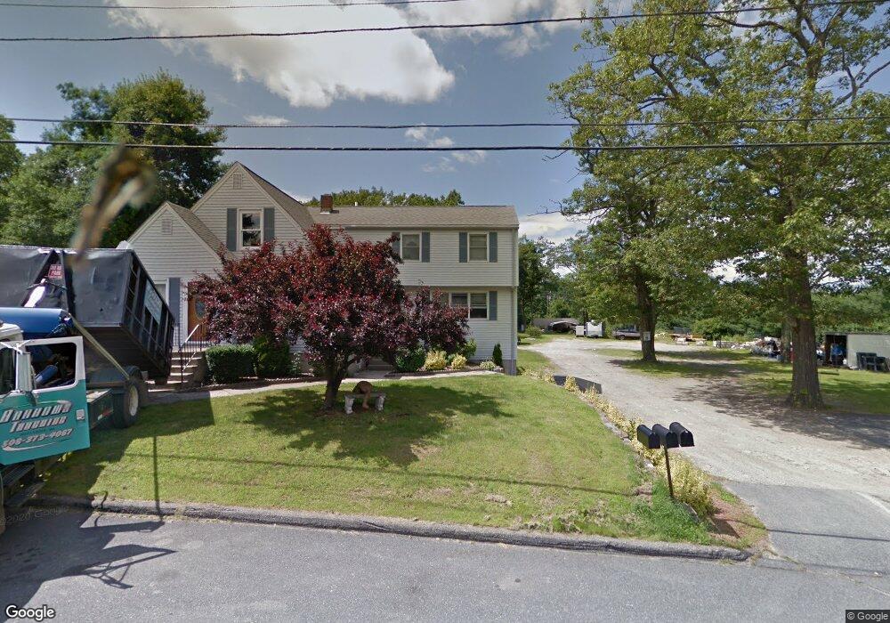
22A Barrows Rd Worcester, MA 01609
West Tatnuck NeighborhoodEstimated Value: $492,000 - $710,000
Studio
1
Bath
--
Sq Ft
53,797
Sq Ft Lot
About This Home
This home is located at 22A Barrows Rd, Worcester, MA 01609 and is currently estimated at $566,450. 22A Barrows Rd is a home located in Worcester County with nearby schools including Chandler Magnet, Jacob Hiatt Magnet School, and Flagg Street School.
Create a Home Valuation Report for This Property
The Home Valuation Report is an in-depth analysis detailing your home's value as well as a comparison with similar homes in the area
Home Values in the Area
Average Home Value in this Area
Tax History
| Year | Tax Paid | Tax Assessment Tax Assessment Total Assessment is a certain percentage of the fair market value that is determined by local assessors to be the total taxable value of land and additions on the property. | Land | Improvement |
|---|---|---|---|---|
| 2025 | $6,222 | $471,700 | $122,800 | $348,900 |
| 2024 | $5,966 | $433,900 | $122,800 | $311,100 |
| 2023 | $5,826 | $406,300 | $107,200 | $299,100 |
| 2022 | $5,596 | $367,900 | $86,400 | $281,500 |
| 2021 | $4,658 | $286,100 | $69,800 | $216,300 |
| 2020 | $4,648 | $273,400 | $69,700 | $203,700 |
| 2019 | $4,606 | $255,900 | $63,400 | $192,500 |
| 2018 | $4,521 | $239,100 | $63,400 | $175,700 |
| 2017 | $4,446 | $231,300 | $63,400 | $167,900 |
| 2016 | $4,464 | $216,600 | $48,900 | $167,700 |
| 2015 | $4,347 | $216,600 | $48,900 | $167,700 |
| 2014 | $4,232 | $216,600 | $48,900 | $167,700 |
Source: Public Records
Map
Nearby Homes
- 770 Salisbury St Unit 517
- 770 Salisbury St Unit 333
- 16 Baiting Brook Ln Unit 64
- 14 Baiting Brook Ln Unit 65
- 10 Baiting Brook Ln Unit 67
- 4004 Brompton Cir
- 7 Primmett Ln
- 8 Salisbury Hill Blvd Unit 79
- 10 Salisbury Hill Blvd Unit 75
- 5 Chartwell Ln Unit 87
- 46 Barry Rd
- 288 Fisher Rd
- 61 Barry Rd
- 28 Lynnwood Ln
- 158 Chester St
- 70 Moreland Green Dr
- 84 Chester St
- 90 Bjorklund Ave
- 163 Moreland St
- 23 Leslie Rd
Your Personal Tour Guide
Ask me questions while you tour the home.