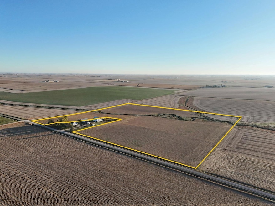
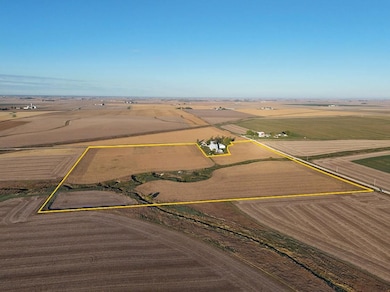
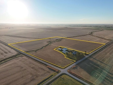
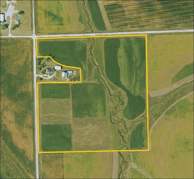
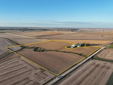
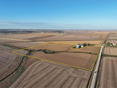
22nd Ave Blairstown, IA 52209
Estimated payment $2,719/month
Total Views
493
34
Acres
$12,750
Price per Acre
1,481,040
Sq Ft Lot
About This Lot
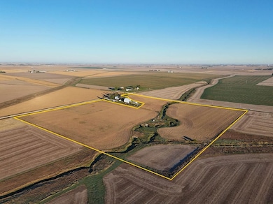
34.00 acres, m/l, located 1 miles north of Blairstown, Iowa on the east side of 22nd Ave. at 75th St.
This gently rolling farm has an estimated 32.08 FSA/Eff. crop acres with a CSR2 of 86.20.
This is a high-quality Benton County farm located in an area utilized for seed-corn production.
Listing Provided By

Property Details
Property Type
- Land
Lot Details
- Current uses include agriculture, row crop
Map
Create a Home Valuation Report for This Property
The Home Valuation Report is an in-depth analysis detailing your home's value as well as a comparison with similar homes in the area
Home Values in the Area
Average Home Value in this Area
Property History
| Date | Event | Price | List to Sale | Price per Sq Ft |
|---|---|---|---|---|
| 11/07/2025 11/07/25 | For Sale | $433,500 | -- | -- |
Nearby Homes
- 610 Commercial Ct
- 3101 Stoney Point Rd SW
- 470 Quail Ct SW
- 5200 16th Ave SW
- 5150 16th Ave SW
- 4419 1st Ave SW
- 4227 21st Ave SW
- 2155 Westdale Dr SW
- 1210 Auburn Dr SW
- 1308 Adair Ct SW
- 3320 Queen Dr
- 3404 Queen Dr SW
- 1270 Edgewood Rd NW
- 321 28th St NW
- 2202-2238 River Bluffs Dr
- 1601 30th St NW
- 2415 River Bluff Dr NW
- 2200 Buckingham Dr NW
- 702 9th St SW Unit 1
- 702 9th St SW Unit 2