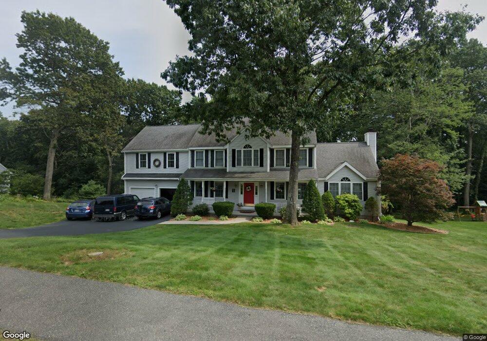
23 Albert Ray Dr Ashland, MA 01721
Estimated Value: $954,527 - $1,108,000
4
Beds
3
Baths
2,856
Sq Ft
$368/Sq Ft
Est. Value
About This Home
This home is located at 23 Albert Ray Dr, Ashland, MA 01721 and is currently estimated at $1,050,132, approximately $367 per square foot. 23 Albert Ray Dr is a home located in Middlesex County with nearby schools including William Pittaway Elementary School, David Mindess Elementary School, and Henry E. Warren Elementary School.
Ownership History
Date
Name
Owned For
Owner Type
Purchase Details
Closed on
Sep 12, 1997
Sold by
Ballard Hill Est Rt and Bianchi Fermo
Bought by
Smart Jeffrey E and Smart Angela R
Current Estimated Value
Create a Home Valuation Report for This Property
The Home Valuation Report is an in-depth analysis detailing your home's value as well as a comparison with similar homes in the area
Home Values in the Area
Average Home Value in this Area
Purchase History
| Date | Buyer | Sale Price | Title Company |
|---|---|---|---|
| Smart Jeffrey E | $276,400 | -- |
Source: Public Records
Mortgage History
| Date | Status | Borrower | Loan Amount |
|---|---|---|---|
| Open | Smart Jeffrey E | $50,000 | |
| Open | Smart Jeffrey E | $180,000 | |
| Closed | Smart Jeffrey E | $15,000 | |
| Closed | Smart Jeffrey E | $147,500 |
Source: Public Records
Tax History
| Year | Tax Paid | Tax Assessment Tax Assessment Total Assessment is a certain percentage of the fair market value that is determined by local assessors to be the total taxable value of land and additions on the property. | Land | Improvement |
|---|---|---|---|---|
| 2025 | $12,003 | $939,900 | $297,200 | $642,700 |
| 2024 | $11,560 | $873,100 | $297,200 | $575,900 |
| 2023 | $10,658 | $774,000 | $283,700 | $490,300 |
| 2022 | $10,776 | $678,600 | $257,600 | $421,000 |
| 2021 | $10,313 | $647,400 | $257,600 | $389,800 |
| 2020 | $10,186 | $630,300 | $257,600 | $372,700 |
| 2019 | $9,980 | $613,000 | $257,600 | $355,400 |
| 2018 | $9,835 | $592,100 | $255,100 | $337,000 |
| 2017 | $9,601 | $574,900 | $255,100 | $319,800 |
| 2016 | $9,374 | $551,400 | $255,100 | $296,300 |
| 2015 | $9,162 | $529,600 | $241,000 | $288,600 |
| 2014 | $9,050 | $520,400 | $225,100 | $295,300 |
Source: Public Records
Map
Nearby Homes
- 37 Riverview Dr
- 15 Bellmore Rd
- 327 Singletary Ln
- 51 Crest Rd
- 94 Myrtle St
- 45 Daytona Ave
- 10 Rhubena St
- 768 Waverley St
- 431 America Blvd Unit 64D
- 12 & 14 Waverly St
- 437 America Blvd Unit 437
- 257-259 Main St
- 0 Ballard Highland Marietta Unit 73391306
- 20 Mulhall Dr
- 81 Edgewater Dr
- 96 Pleasant St Unit 96
- 66 Cedar Hill Rd
- 131 Mellen St Unit 3B
- 10 Metropolitan Ave
- 203 Pleasant St
- 19 Albert Ray Dr
- 27 Albert Ray Dr
- 30 Cutler Dr
- 24 Cutler Dr
- 36 Cutler Dr
- 22 Albert Ray Dr
- 15 Albert Ray Dr
- 7 Enslin Cir
- 22 Cutler Dr
- 4 Dearth Cir
- 40 Cutler Dr
- 31 Cutler Dr
- 25 Cutler Dr
- 26 Albert Ray Dr
- 5 Lucy French Cir -Lot 5
- 11 Albert Ray Dr
- 37 Cutler Dr
- 21 Cutler Dr
- 7 Dearth Cir
- 3 Lucy French Way
Your Personal Tour Guide
Ask me questions while you tour the home.