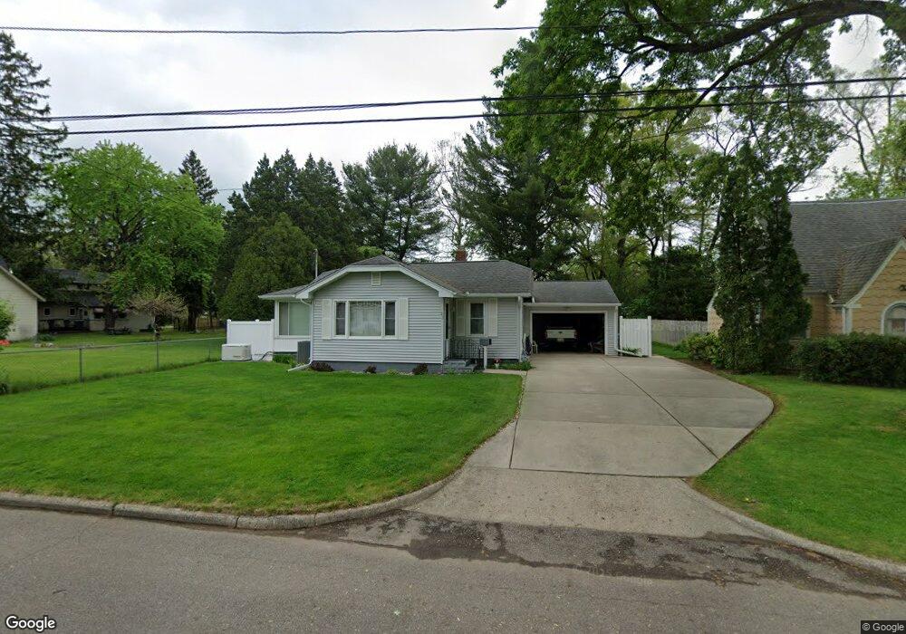
23 Allene St Battle Creek, MI 49037
Urbandale NeighborhoodEstimated Value: $148,000 - $182,949
3
Beds
2
Baths
1,344
Sq Ft
$124/Sq Ft
Est. Value
About This Home
This home is located at 23 Allene St, Battle Creek, MI 49037 and is currently estimated at $166,237, approximately $123 per square foot. 23 Allene St is a home located in Calhoun County with nearby schools including Northwestern Middle School, Battle Creek Central High School, and Endeavor Charter Academy.
Ownership History
Date
Name
Owned For
Owner Type
Purchase Details
Closed on
May 12, 2021
Sold by
Hyslop Edward J and Hyslop Cinthia S
Bought by
Hyslop Edward J and Hyslop Cinthia S
Current Estimated Value
Purchase Details
Closed on
Feb 23, 2000
Sold by
Hyslop Trust Robert H and Hyslop Trust Cherry N
Bought by
Hyslop Edward J and Hyslop Cinthia S
Purchase Details
Closed on
Nov 12, 1997
Sold by
Hyslop Et Al Robert H
Bought by
Hyslop Trustees
Create a Home Valuation Report for This Property
The Home Valuation Report is an in-depth analysis detailing your home's value as well as a comparison with similar homes in the area
Home Values in the Area
Average Home Value in this Area
Purchase History
| Date | Buyer | Sale Price | Title Company |
|---|---|---|---|
| Hyslop Edward J | -- | None Available | |
| Edward J Hyslop And Cinthia S Hyslop Living T | -- | None Listed On Document | |
| Hyslop Edward J | $7,200 | -- | |
| Hyslop Trustees | -- | -- |
Source: Public Records
Tax History Compared to Growth
Tax History
| Year | Tax Paid | Tax Assessment Tax Assessment Total Assessment is a certain percentage of the fair market value that is determined by local assessors to be the total taxable value of land and additions on the property. | Land | Improvement |
|---|---|---|---|---|
| 2025 | -- | $81,400 | $0 | $0 |
| 2024 | $1,517 | $76,473 | $0 | $0 |
| 2023 | $1,734 | $62,820 | $0 | $0 |
| 2022 | $1,370 | $52,615 | $0 | $0 |
| 2021 | $1,636 | $49,589 | $0 | $0 |
| 2020 | $1,539 | $46,632 | $0 | $0 |
| 2019 | $1,539 | $46,084 | $0 | $0 |
| 2018 | $1,539 | $41,362 | $1,155 | $40,207 |
| 2017 | $1,486 | $34,089 | $0 | $0 |
| 2016 | $1,483 | $33,226 | $0 | $0 |
| 2015 | $1,453 | $32,486 | $3,275 | $29,211 |
| 2014 | $1,453 | $31,531 | $3,275 | $28,256 |
Source: Public Records
Map
Nearby Homes
- 35 Avery Ave
- 1528 Michigan Ave W
- 163 Spaulding Ave W
- 1823 Michigan Ave W
- 33 Shellenberger Ave
- 116 Geneva Ave
- 53 Lamora Ave
- 180 Woodlawn Ave N
- 84 Lamora Ave
- 81 Taylor Ave
- 40 Kellogg St
- 213 Broadway Blvd
- 137 Dunning Ave
- 232 Woodlawn Ave N
- 51 Dunning Ave
- 244 Woodlawn Ave N
- 134 Willard Ave E
- 133 Mosher Ave
- 217 Creekview Dr
- 430 Presidential Dr