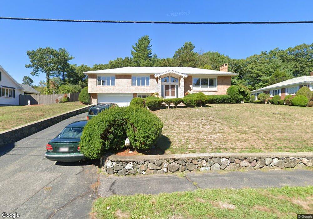
23 Azalea Rd Waltham, MA 02452
Piety Corner NeighborhoodEstimated Value: $1,286,131 - $1,487,000
3
Beds
3
Baths
2,795
Sq Ft
$506/Sq Ft
Est. Value
About This Home
This home is located at 23 Azalea Rd, Waltham, MA 02452 and is currently estimated at $1,413,033, approximately $505 per square foot. 23 Azalea Rd is a home located in Middlesex County with nearby schools including Northeast Elementary School, John F Kennedy Middle School, and Waltham Sr High School.
Ownership History
Date
Name
Owned For
Owner Type
Purchase Details
Closed on
Oct 15, 1999
Sold by
Mele Peter M and Mele Lee E
Bought by
Melkeshian Hossep H
Current Estimated Value
Home Financials for this Owner
Home Financials are based on the most recent Mortgage that was taken out on this home.
Original Mortgage
$380,000
Outstanding Balance
$114,475
Interest Rate
7.8%
Mortgage Type
Purchase Money Mortgage
Estimated Equity
$1,298,558
Create a Home Valuation Report for This Property
The Home Valuation Report is an in-depth analysis detailing your home's value as well as a comparison with similar homes in the area
Home Values in the Area
Average Home Value in this Area
Purchase History
| Date | Buyer | Sale Price | Title Company |
|---|---|---|---|
| Melkeshian Hossep H | $475,000 | -- |
Source: Public Records
Mortgage History
| Date | Status | Borrower | Loan Amount |
|---|---|---|---|
| Open | Melkeshian Hossep H | $380,000 | |
| Previous Owner | Melkeshian Hossep H | $450,000 | |
| Previous Owner | Melkeshian Hossep H | $475,000 |
Source: Public Records
Tax History Compared to Growth
Tax History
| Year | Tax Paid | Tax Assessment Tax Assessment Total Assessment is a certain percentage of the fair market value that is determined by local assessors to be the total taxable value of land and additions on the property. | Land | Improvement |
|---|---|---|---|---|
| 2025 | $10,098 | $1,028,300 | $579,800 | $448,500 |
| 2024 | $9,583 | $994,100 | $552,800 | $441,300 |
| 2023 | $9,503 | $920,800 | $502,800 | $418,000 |
| 2022 | $9,626 | $864,100 | $462,800 | $401,300 |
| 2021 | $9,315 | $822,900 | $442,800 | $380,100 |
| 2020 | $9,004 | $753,500 | $412,800 | $340,700 |
| 2019 | $9,318 | $736,000 | $407,800 | $328,200 |
| 2018 | $0 | $638,600 | $377,800 | $260,800 |
| 2017 | $7,581 | $603,600 | $342,800 | $260,800 |
| 2016 | $7,143 | $583,600 | $322,800 | $260,800 |
| 2015 | $7,698 | $586,300 | $317,800 | $268,500 |
Source: Public Records
Map
Nearby Homes
- 70 Rosewood Dr
- 116 Raffaele Dr
- 511 Lexington St
- 28 College Farm Rd Unit 2
- 49 Lincoln St
- 34 Cedar Hill Ln
- 266 Linden St
- 155 Marguerite Ave
- 44 Sachem St
- 326 Bacon St
- 214 Church St
- 158 Church St
- 55 Circle Dr
- 14 Piedmont Ave
- 16 Winter St Unit 26C
- 65 Montclair Ave
- 750 Trapelo Rd
- 129 Lake St
- 23 Wight St
- 30 Jacqueline Rd Unit C