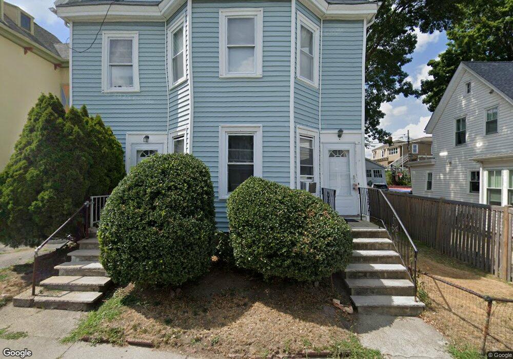
23 Cohasset St Unit 25 Roslindale, MA 02131
Roslindale NeighborhoodEstimated Value: $812,000 - $1,003,499
5
Beds
2
Baths
2,400
Sq Ft
$372/Sq Ft
Est. Value
About This Home
This home is located at 23 Cohasset St Unit 25, Roslindale, MA 02131 and is currently estimated at $892,375, approximately $371 per square foot. 23 Cohasset St Unit 25 is a home located in Suffolk County with nearby schools including Brooke Charter School Roslindale, Sacred Heart STEM School, and St. Clare High School.
Ownership History
Date
Name
Owned For
Owner Type
Purchase Details
Closed on
Apr 22, 2016
Sold by
Kettendorf Charles W
Bought by
Kettendorf Charles W and Kettendorf Joan M
Current Estimated Value
Purchase Details
Closed on
Jan 30, 1990
Sold by
Blanche Kettenforf
Bought by
Kettendorf Charles W
Create a Home Valuation Report for This Property
The Home Valuation Report is an in-depth analysis detailing your home's value as well as a comparison with similar homes in the area
Home Values in the Area
Average Home Value in this Area
Purchase History
| Date | Buyer | Sale Price | Title Company |
|---|---|---|---|
| Kettendorf Charles W | -- | -- | |
| Kettendorf Charles W | $85,000 | -- |
Source: Public Records
Mortgage History
| Date | Status | Borrower | Loan Amount |
|---|---|---|---|
| Previous Owner | Kettendorf Charles W | $300,000 | |
| Previous Owner | Kettendorf Charles W | $125,000 | |
| Previous Owner | Kettendorf Charles W | $125,000 | |
| Previous Owner | Kettendorf Charles W | $100,000 |
Source: Public Records
Tax History Compared to Growth
Tax History
| Year | Tax Paid | Tax Assessment Tax Assessment Total Assessment is a certain percentage of the fair market value that is determined by local assessors to be the total taxable value of land and additions on the property. | Land | Improvement |
|---|---|---|---|---|
| 2025 | $9,755 | $842,400 | $282,800 | $559,600 |
| 2024 | $9,002 | $825,900 | $256,600 | $569,300 |
| 2023 | $8,369 | $779,200 | $242,100 | $537,100 |
| 2022 | $7,775 | $714,600 | $222,000 | $492,600 |
| 2021 | $7,331 | $687,100 | $213,500 | $473,600 |
| 2020 | $6,043 | $572,300 | $199,500 | $372,800 |
| 2019 | $5,685 | $539,400 | $165,500 | $373,900 |
| 2018 | $4,541 | $433,300 | $165,500 | $267,800 |
| 2017 | $4,542 | $428,900 | $165,500 | $263,400 |
| 2016 | $4,329 | $393,500 | $165,500 | $228,000 |
| 2015 | $3,885 | $320,800 | $144,700 | $176,100 |
| 2014 | $3,897 | $309,800 | $144,700 | $165,100 |
Source: Public Records
Map
Nearby Homes
- 65 Birch St Unit 3
- 15 S Fairview St Unit 3
- 80 Roslindale Ave Unit 3
- 103 Belgrade Ave Unit 2
- 112 Roslindale Ave Unit 2
- 142 Birch St
- 142 Birch St Unit 1
- 142 Birch St Unit 2
- 67 Cummins Hwy Unit 101
- 79 Robert St Unit 3
- 17 Metcalf St
- 108 Florence St Unit 3
- 108 Florence St Unit 4
- 55 Metropolitan Ave
- 25 Crandall St
- 69 Metropolitan Ave
- 0 Averton St
- 34 Averton St
- 250 Poplar St Unit 1
- 15 Newburg St Unit 1
- 23 Cohasset St Unit 2
- 23-25 Cohasset St Unit 2
- 25 Cohasset St
- 29 Cohasset St Unit 3
- 29 Cohasset St Unit 2
- 29 Cohasset St Unit 1
- 31 Cohasset St
- 31 Cohasset St Unit 1
- 21 Cohasset St
- 19 Cohasset St
- 33 Cohasset St
- 33 Cohasset St Unit 2
- 48 Birch St
- 44 Birch St
- 52 Birch St
- 40 Birch St
- 26 Cohasset St
- 22 Cohasset St
- 56 Birch St
- 30 Cohasset St