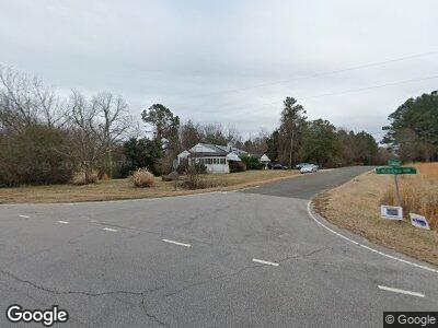
23 Frank Bullock Rd Manson, NC 27553
Estimated Value: $157,000 - $257,000
2
Beds
1
Bath
1,008
Sq Ft
$208/Sq Ft
Est. Value
About This Home
This home is located at 23 Frank Bullock Rd, Manson, NC 27553 and is currently estimated at $210,064, approximately $208 per square foot. 23 Frank Bullock Rd is a home located in Vance County with nearby schools including E.O. Young Jr. Elementary School, Eaton-Johnson Middle School, and Vance County High School.
Ownership History
Date
Name
Owned For
Owner Type
Purchase Details
Closed on
Jun 9, 2020
Sold by
Johnson Natasha M
Bought by
Hatch Michael R and Hatch Sara
Current Estimated Value
Home Financials for this Owner
Home Financials are based on the most recent Mortgage that was taken out on this home.
Original Mortgage
$103,500
Outstanding Balance
$93,942
Interest Rate
3.2%
Mortgage Type
New Conventional
Purchase Details
Closed on
Aug 5, 2016
Sold by
Kuffer John
Bought by
Johnson Natasha
Create a Home Valuation Report for This Property
The Home Valuation Report is an in-depth analysis detailing your home's value as well as a comparison with similar homes in the area
Home Values in the Area
Average Home Value in this Area
Purchase History
| Date | Buyer | Sale Price | Title Company |
|---|---|---|---|
| Hatch Michael R | $115,000 | None Available | |
| Johnson Natasha | -- | None Available |
Source: Public Records
Mortgage History
| Date | Status | Borrower | Loan Amount |
|---|---|---|---|
| Open | Hatch Michael R | $103,500 |
Source: Public Records
Tax History Compared to Growth
Tax History
| Year | Tax Paid | Tax Assessment Tax Assessment Total Assessment is a certain percentage of the fair market value that is determined by local assessors to be the total taxable value of land and additions on the property. | Land | Improvement |
|---|---|---|---|---|
| 2024 | $1,374 | $159,537 | $72,554 | $86,983 |
| 2023 | $786 | $68,030 | $35,379 | $32,651 |
| 2022 | $786 | $68,030 | $35,379 | $32,651 |
| 2021 | $666 | $68,030 | $35,379 | $32,651 |
| 2020 | $783 | $68,030 | $35,379 | $32,651 |
| 2019 | $778 | $68,030 | $35,379 | $32,651 |
| 2018 | $635 | $68,030 | $35,379 | $32,651 |
| 2017 | $740 | $68,030 | $35,379 | $32,651 |
| 2016 | $939 | $78,019 | $45,368 | $32,651 |
| 2015 | $776 | $91,590 | $58,834 | $32,756 |
| 2014 | $899 | $93,688 | $58,834 | $34,854 |
Source: Public Records
Map
Nearby Homes
- 71 George H Bullock Ln
- 96 Holly Cir
- 55 Spring Ln
- 89 Mount Pleasant Ln
- 420 Spring Ln
- 212 Ellington's Path
- 4715 Jacksontown Rd
- 198 S Piney Grove Rd
- Lot 2E Bent Tree Ln
- 55 Waters Edge Loop
- 675 Anderson Creek Rd
- 158 S B Harrison Ln
- 50 Tyler Ct
- 150 Sandpipers Ln
- 946 Jacksontown Rd
- 41 Sandpipers Ln
- 1031 Jackson Royster Rd
- 358 Pool Rock Shores Ln
- 20 Pool Rock Rd
- 582 Pollyanna Rd
- 23 Frank Bullock Rd
- 23 Frank Bullock Rd
- 1990 Bullocksville Rd
- 1990 Bullocksville Park Rd
- 1990 Bullocksville Park Rd
- 60 Frank Bullock Rd
- 1936 Bullocksville Park Rd
- 110 Frank Bullock Rd
- 163 Frank Bullock Rd
- 1855 Bullocksville Park Rd
- 0 Frank Bullock Rd Unit 1745445
- 0 Frank Bullock Rd Unit 3 TR1745445
- 2181 Bullocksville Park Rd
- 2215 Bullocksville Park Rd
- 77 George H Bullock Ln
- 77 George Bullock Rd
- 1821 Bullocksville Park Rd
- 79 George Bullock Ln
- 200 Frank Bullock Rd
- 81 George Bullock Ln