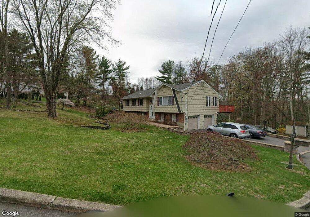
23 Glenda Dr West Milford, NJ 07480
Estimated Value: $603,000 - $690,000
--
Bed
--
Bath
2,428
Sq Ft
$264/Sq Ft
Est. Value
About This Home
This home is located at 23 Glenda Dr, West Milford, NJ 07480 and is currently estimated at $641,842, approximately $264 per square foot. 23 Glenda Dr is a home located in Passaic County with nearby schools including Macopin Middle School and West Milford High School.
Ownership History
Date
Name
Owned For
Owner Type
Purchase Details
Closed on
Oct 13, 2011
Sold by
Perry Mase Contracting Llc
Bought by
Cadena Henry and Cadena Linda
Current Estimated Value
Home Financials for this Owner
Home Financials are based on the most recent Mortgage that was taken out on this home.
Original Mortgage
$256,000
Outstanding Balance
$175,022
Interest Rate
4.15%
Mortgage Type
Purchase Money Mortgage
Estimated Equity
$466,820
Purchase Details
Closed on
Aug 26, 2010
Sold by
Rolando Maurice and Rolando Donna
Bought by
Perry Mase Contracting Llc
Purchase Details
Closed on
Nov 15, 1995
Sold by
Zavada Dennis
Bought by
Rolando Maurice and Rolando Donna
Home Financials for this Owner
Home Financials are based on the most recent Mortgage that was taken out on this home.
Original Mortgage
$149,000
Interest Rate
7.13%
Create a Home Valuation Report for This Property
The Home Valuation Report is an in-depth analysis detailing your home's value as well as a comparison with similar homes in the area
Home Values in the Area
Average Home Value in this Area
Purchase History
| Date | Buyer | Sale Price | Title Company |
|---|---|---|---|
| Cadena Henry | $320,000 | -- | |
| Perry Mase Contracting Llc | $253,000 | -- | |
| Rolando Maurice | $180,000 | -- |
Source: Public Records
Mortgage History
| Date | Status | Borrower | Loan Amount |
|---|---|---|---|
| Open | Cadena Henry | $256,000 | |
| Previous Owner | Rolando Maurice | $149,000 |
Source: Public Records
Tax History Compared to Growth
Tax History
| Year | Tax Paid | Tax Assessment Tax Assessment Total Assessment is a certain percentage of the fair market value that is determined by local assessors to be the total taxable value of land and additions on the property. | Land | Improvement |
|---|---|---|---|---|
| 2025 | $12,661 | $312,300 | $112,900 | $199,400 |
| 2024 | $12,726 | $312,300 | $112,900 | $199,400 |
| 2022 | $12,080 | $312,300 | $112,900 | $199,400 |
| 2021 | $11,821 | $312,300 | $112,900 | $199,400 |
| 2020 | $11,696 | $312,300 | $112,900 | $199,400 |
| 2019 | $11,539 | $312,300 | $112,900 | $199,400 |
| 2018 | $11,511 | $312,300 | $112,900 | $199,400 |
| 2017 | $11,564 | $312,300 | $112,900 | $199,400 |
| 2016 | $11,583 | $312,300 | $112,900 | $199,400 |
| 2015 | $11,449 | $312,300 | $112,900 | $199,400 |
| 2014 | $11,171 | $312,300 | $112,900 | $199,400 |
Source: Public Records
Map
Nearby Homes
- 5 Bisset Dr
- 97 Wesley Dr
- 43 Bisset Dr
- 54 Nosenzo Pond Rd
- 34 Gould Rd
- 66 Lindys Dr
- 0 Post Brook Rd Unit 25008921
- 0 Post Brook Rd Unit 3952366
- 16 Pond View Dr
- 112 Timber Ln
- 3 Broadway
- 95 Morris Ave
- 9 Somerset Place
- 54 Broadway
- 0 Rock Ledge Rd Unit 25030488
- 0 Rock Ledge Rd Unit 3983243
- 853 Union Valley Rd
- 11 Eagles Nest Terrace
- 24 Eagles Nest Terrace
- 29 Eagles Nest Terrace