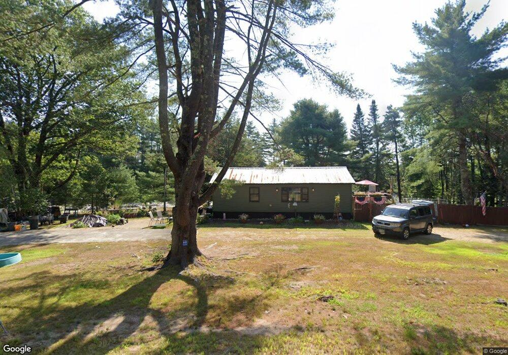
23 Maple Rd Chocorua, NH 03817
Estimated Value: $224,000 - $327,000
1
Bed
1
Bath
796
Sq Ft
$328/Sq Ft
Est. Value
About This Home
This home is located at 23 Maple Rd, Chocorua, NH 03817 and is currently estimated at $261,001, approximately $327 per square foot. 23 Maple Rd is a home located in Carroll County with nearby schools including Kenneth A. Brett School.
Ownership History
Date
Name
Owned For
Owner Type
Purchase Details
Closed on
Jun 15, 2012
Sold by
Jackson George N and Jackson Barbara
Bought by
Peloquin Thomas M and Peloquin Jennifer J
Current Estimated Value
Purchase Details
Closed on
Jun 27, 2001
Sold by
Capuci Ruth A
Bought by
Peloquin Jennifer J
Home Financials for this Owner
Home Financials are based on the most recent Mortgage that was taken out on this home.
Original Mortgage
$39,300
Interest Rate
7.14%
Mortgage Type
Purchase Money Mortgage
Create a Home Valuation Report for This Property
The Home Valuation Report is an in-depth analysis detailing your home's value as well as a comparison with similar homes in the area
Home Values in the Area
Average Home Value in this Area
Purchase History
| Date | Buyer | Sale Price | Title Company |
|---|---|---|---|
| Peloquin Thomas M | -- | -- | |
| Peloquin Jennifer J | $43,700 | -- |
Source: Public Records
Mortgage History
| Date | Status | Borrower | Loan Amount |
|---|---|---|---|
| Previous Owner | Peloquin Jennifer J | $39,300 |
Source: Public Records
Tax History Compared to Growth
Tax History
| Year | Tax Paid | Tax Assessment Tax Assessment Total Assessment is a certain percentage of the fair market value that is determined by local assessors to be the total taxable value of land and additions on the property. | Land | Improvement |
|---|---|---|---|---|
| 2024 | $2,491 | $172,600 | $76,500 | $96,100 |
| 2023 | $2,679 | $106,200 | $45,000 | $61,200 |
| 2022 | $2,524 | $106,200 | $45,000 | $61,200 |
| 2021 | $2,351 | $106,200 | $45,000 | $61,200 |
| 2020 | $2,318 | $103,100 | $41,900 | $61,200 |
| 2019 | $2,221 | $103,100 | $41,900 | $61,200 |
| 2018 | $1,836 | $79,600 | $14,900 | $64,700 |
| 2017 | $1,807 | $79,600 | $14,900 | $64,700 |
| 2016 | $1,826 | $79,600 | $14,900 | $64,700 |
| 2015 | $1,819 | $79,600 | $14,900 | $64,700 |
| 2013 | $1,822 | $91,100 | $24,800 | $66,300 |
Source: Public Records
Map
Nearby Homes
- 1118 Turkey St
- 80 Elliot Ln
- 17 Amidon Ln
- 78 Berry Ln
- 24 Flynn Ln
- Lot 18.1 White Mountain Hwy
- 10 Margo Ln
- 198 White Tail Ln
- 330 Benjamin Wentworth Dr
- 23 Poco Dr
- 51 Poco Dr
- 1785 White Mountain Hwy
- 748 Plains Rd
- 70 White Mountain Hwy
- 49 Deer Hill Rd
- 00 Alden Washburn Dr
- 0 Alden Washburn Dr Unit 5066667
- 12 Logan Way
- 40 Logan Way
- 63 Whipples Way
- 89 Maple Rd
- 70 Maple Rd
- 14 Maple Rd
- 32 Whittier Rd
- 124 Maple Rd
- 115 Maple Rd
- 105 Maple Rd
- 112 Maple Rd
- 187 Whittier Rd
- 0 Whittier Rd
- 551 New Hampshire 16
- 0 White Mountain Highway (Rt 16) Unit 73119762
- 0 White Mountain Highway (Rt 16) Unit 73062565
- 0 White Mountain Highway (Rt 16) Unit 72981844
- 138 Maple Rd
- 24 Chocorua River Dr
- 5 Bay Cir
- 91 Whittier Rd
- 19 Bay Cir
- 1167 Turkey St