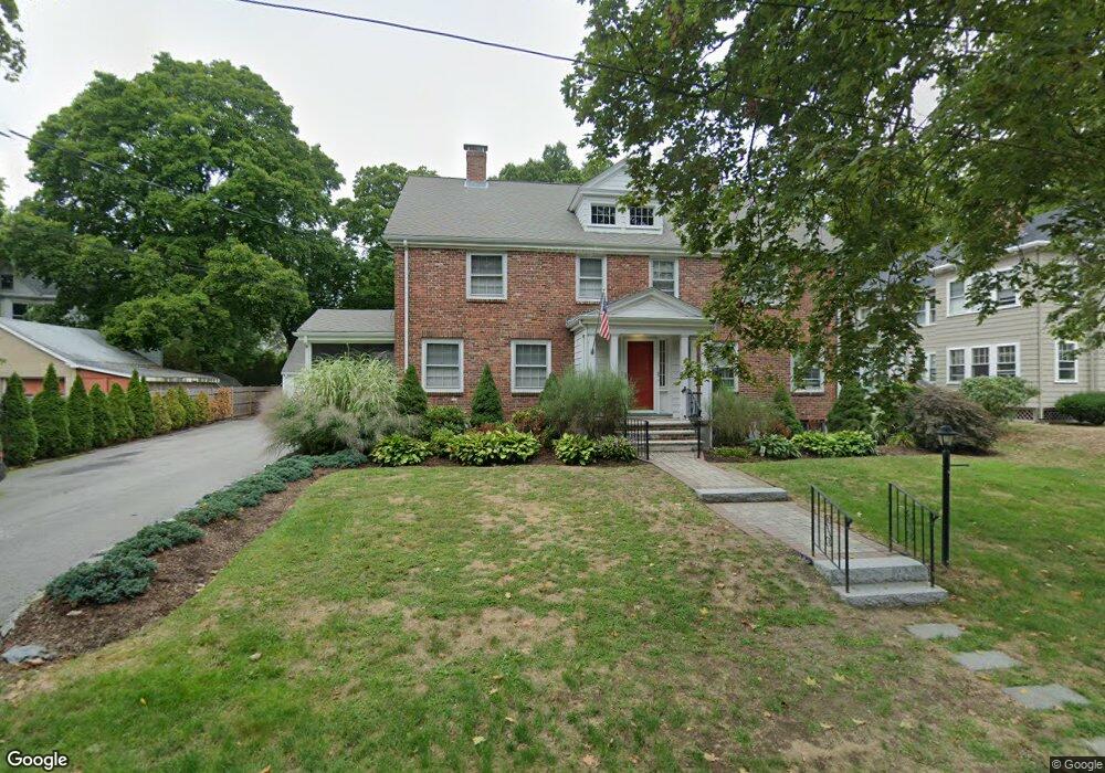
23 Maple St Unit 25 Auburndale, MA 02466
Auburndale NeighborhoodEstimated Value: $1,358,000 - $1,809,110
5
Beds
4
Baths
3,150
Sq Ft
$480/Sq Ft
Est. Value
About This Home
This home is located at 23 Maple St Unit 25, Auburndale, MA 02466 and is currently estimated at $1,512,278, approximately $480 per square foot. 23 Maple St Unit 25 is a home located in Middlesex County with nearby schools including Williams Elementary School, Charles E Brown Middle School, and Newton South High School.
Ownership History
Date
Name
Owned For
Owner Type
Purchase Details
Closed on
Sep 12, 2025
Sold by
Mullaney Michael C and Mullaney Tatiana C
Bought by
Mullaney Ft and Mullaney
Current Estimated Value
Purchase Details
Closed on
Mar 24, 2014
Sold by
Mullaney Michael C and Mullaney Tatiana C
Bought by
Mullaney Michael C and Mullaney Tatiana C
Purchase Details
Closed on
Mar 22, 2013
Sold by
Lindgren Charlotte H
Bought by
Mullaney Michael C and Casale Tatiana
Home Financials for this Owner
Home Financials are based on the most recent Mortgage that was taken out on this home.
Original Mortgage
$533,850
Interest Rate
3.57%
Mortgage Type
Purchase Money Mortgage
Create a Home Valuation Report for This Property
The Home Valuation Report is an in-depth analysis detailing your home's value as well as a comparison with similar homes in the area
Home Values in the Area
Average Home Value in this Area
Purchase History
| Date | Buyer | Sale Price | Title Company |
|---|---|---|---|
| Mullaney Ft | -- | -- | |
| Mullaney Michael C | -- | -- | |
| Mullaney Michael C | -- | -- | |
| Mullaney Michael C | $740,000 | -- | |
| Mullaney Michael C | $740,000 | -- |
Source: Public Records
Mortgage History
| Date | Status | Borrower | Loan Amount |
|---|---|---|---|
| Previous Owner | Mullaney Michael C | $533,850 |
Source: Public Records
Tax History
| Year | Tax Paid | Tax Assessment Tax Assessment Total Assessment is a certain percentage of the fair market value that is determined by local assessors to be the total taxable value of land and additions on the property. | Land | Improvement |
|---|---|---|---|---|
| 2025 | $15,138 | $1,544,700 | $921,100 | $623,600 |
| 2024 | $14,637 | $1,499,700 | $894,300 | $605,400 |
| 2023 | $14,125 | $1,387,500 | $734,200 | $653,300 |
| 2022 | $13,515 | $1,284,700 | $679,800 | $604,900 |
| 2021 | $12,682 | $1,178,600 | $623,700 | $554,900 |
| 2020 | $11,696 | $1,120,300 | $623,700 | $496,600 |
| 2019 | $10,941 | $1,047,000 | $582,900 | $464,100 |
| 2018 | $11,107 | $1,026,500 | $548,400 | $478,100 |
| 2017 | $10,472 | $941,700 | $503,100 | $438,600 |
| 2016 | $9,831 | $863,900 | $461,600 | $402,300 |
| 2015 | $9,374 | $807,400 | $431,400 | $376,000 |
Source: Public Records
Map
Nearby Homes
- 194 Auburn St
- 226 Auburn St Unit 226
- 1919 Commonwealth Ave Unit 1919
- 1917 Commonwealth Ave Unit 1917
- 7 Sharon Ave Unit 7
- 283 Melrose St
- 305 Webster St Unit 2
- 17 Lasell St
- 232 Melrose St Unit 2
- 10 Higgins St
- 2202 Commonwealth Ave Unit 1
- 0 Duncan Rd Unit 72925240
- 160 Pine St Unit 15
- 160 Pine St Unit 12
- 12 Oakwood Rd
- 27 Tennyson Rd
- 49 Staniford St
- 214 River St Unit 214
- 101-103 Lexington St
- 40 Sewall St
- 23 Maple St
- 23 Maple St
- 25 Maple St Unit 1
- 23 Maple St Unit right side
- 17 Maple St Unit 19
- 17 Maple St Unit 17
- 17 Maple St Unit 2
- 17-19 Maple St Unit 1
- 17-19 Maple St Unit 2
- 19 Maple St Unit 19
- 75 Central St Unit 77
- 81 Central St
- 85 Central St
- 9 Maple St Unit 11
- 9 Maple St Unit 9
- 26 Maple St
- 214 Auburn St
- 61 Central St
- 22 Maple St
- 95 Central St
Your Personal Tour Guide
Ask me questions while you tour the home.