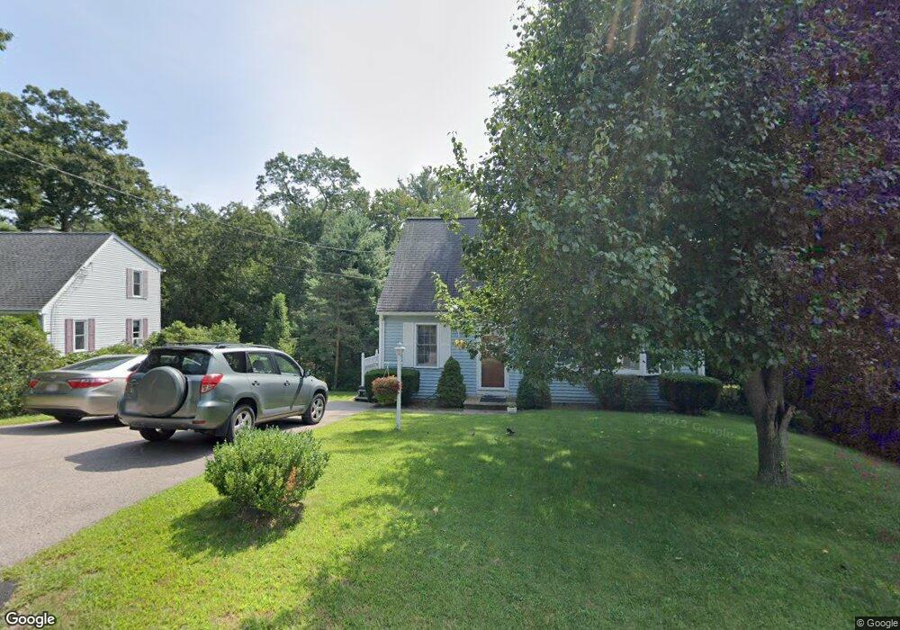
23 Mary St Bellingham, MA 02019
Estimated Value: $481,000 - $552,000
3
Beds
2
Baths
1,344
Sq Ft
$376/Sq Ft
Est. Value
About This Home
This home is located at 23 Mary St, Bellingham, MA 02019 and is currently estimated at $505,336, approximately $375 per square foot. 23 Mary St is a home located in Norfolk County with nearby schools including Joseph F. DiPietro Elementary, Bellingham High School, and Benjamin Franklin Classical Charter Public School.
Ownership History
Date
Name
Owned For
Owner Type
Purchase Details
Closed on
Feb 21, 2002
Sold by
Amati Scott and Amati Andrea B
Bought by
Horbert Doreen M and Horbert Frank E
Current Estimated Value
Purchase Details
Closed on
Nov 30, 2001
Sold by
Amati Scott and Amati Andrea B
Bought by
Hobert Doreen M and Hobert Frank E
Home Financials for this Owner
Home Financials are based on the most recent Mortgage that was taken out on this home.
Original Mortgage
$190,000
Interest Rate
6.66%
Mortgage Type
Purchase Money Mortgage
Purchase Details
Closed on
Nov 20, 1998
Sold by
Grondin Steven E and Grondin Linda J
Bought by
Amati Scott
Create a Home Valuation Report for This Property
The Home Valuation Report is an in-depth analysis detailing your home's value as well as a comparison with similar homes in the area
Home Values in the Area
Average Home Value in this Area
Purchase History
| Date | Buyer | Sale Price | Title Company |
|---|---|---|---|
| Horbert Doreen M | $200,000 | -- | |
| Hobert Doreen M | $200,000 | -- | |
| Amati Scott | $130,000 | -- |
Source: Public Records
Mortgage History
| Date | Status | Borrower | Loan Amount |
|---|---|---|---|
| Open | Amati Scott | $164,025 | |
| Closed | Amati Scott | $35,000 | |
| Previous Owner | Hobert Doreen M | $190,000 | |
| Previous Owner | Amati Scott | $15,000 |
Source: Public Records
Tax History Compared to Growth
Tax History
| Year | Tax Paid | Tax Assessment Tax Assessment Total Assessment is a certain percentage of the fair market value that is determined by local assessors to be the total taxable value of land and additions on the property. | Land | Improvement |
|---|---|---|---|---|
| 2025 | $4,924 | $392,000 | $112,200 | $279,800 |
| 2024 | $4,712 | $366,400 | $102,400 | $264,000 |
| 2023 | $4,540 | $347,900 | $97,600 | $250,300 |
| 2022 | $4,470 | $317,500 | $81,400 | $236,100 |
| 2021 | $4,299 | $298,300 | $81,400 | $216,900 |
| 2020 | $4,041 | $284,200 | $81,400 | $202,800 |
| 2019 | $3,935 | $276,900 | $81,400 | $195,500 |
| 2018 | $3,630 | $251,900 | $82,100 | $169,800 |
| 2017 | $3,513 | $245,000 | $82,100 | $162,900 |
| 2016 | $3,402 | $238,100 | $85,400 | $152,700 |
| 2015 | $3,262 | $228,900 | $82,100 | $146,800 |
| 2014 | $3,257 | $222,200 | $79,200 | $143,000 |
Source: Public Records
Map
Nearby Homes
- 89 Lakeview Ave
- 1 Clover Dr
- 19 Geordan Ave
- 0 Prospect St
- 46 Douglas Dr
- 26 Iris Ln
- 352 Lake St
- 11 Silver Ave
- 975 S Main St
- 17 Susan Ln
- 8 Bubbling Brook Rd
- 0 North St Unit 73440626
- 1303 Old Bridge Ln Unit 1303
- 501 Old Bridge Ln Unit 501
- 1501 Old Bridge Ln Unit 1501
- 125 Blackstone St
- 203 Old Bridge Ln Unit 203
- 211 S Main St
- 7 Debra Ln
- 1099 S Main St
- 19 Mary St
- 24 Mary St
- 35 Blackmar St
- 12 Mary St
- 9 Bertine St
- 39 Blackmar St
- 15 Mary St
- 33 Blackmar St
- 31 Blackmar St
- 2 Bertine St
- 41 Blackmar St
- 30 Blackmar St
- 27 Lakeview Ave
- 15 Lakeview Ave
- 15 Lakeview Ave Unit 1
- 17 Lakeview Ave
- 43 Bertine St
- 29 Lakeview Ave
- 29 Lakeview Ave Unit 1
- 29 Lakeview Ave Unit 29