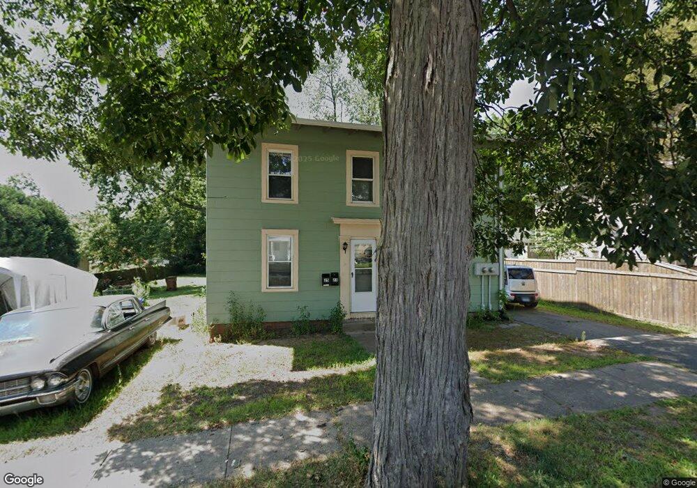
23 N Maple St Enfield, CT 06082
Estimated Value: $281,530 - $341,000
5
Beds
1
Bath
2,368
Sq Ft
$133/Sq Ft
Est. Value
About This Home
This home is located at 23 N Maple St, Enfield, CT 06082 and is currently estimated at $314,133, approximately $132 per square foot. 23 N Maple St is a home located in Hartford County with nearby schools including Hazardville Memorial Elementary School, Eli Whitney Elementary School, and John F. Kennedy Middle School.
Ownership History
Date
Name
Owned For
Owner Type
Purchase Details
Closed on
Jan 11, 2022
Sold by
Acorn Holdings Llc
Bought by
Binns Richard
Current Estimated Value
Purchase Details
Closed on
May 2, 2017
Sold by
Sikora Thomas J and Sikora Debra Y
Bought by
Acorn Holdings Llc
Home Financials for this Owner
Home Financials are based on the most recent Mortgage that was taken out on this home.
Original Mortgage
$112,000
Interest Rate
12%
Mortgage Type
New Conventional
Purchase Details
Closed on
Nov 10, 2011
Sold by
Polaski Steven J
Bought by
Sikora Debre
Purchase Details
Closed on
Mar 18, 1996
Sold by
Fnma
Bought by
Baisuck Debra and Sikora Thomas
Create a Home Valuation Report for This Property
The Home Valuation Report is an in-depth analysis detailing your home's value as well as a comparison with similar homes in the area
Home Values in the Area
Average Home Value in this Area
Purchase History
| Date | Buyer | Sale Price | Title Company |
|---|---|---|---|
| Binns Richard | -- | None Available | |
| Acorn Holdings Llc | $180,000 | -- | |
| Sikora Debre | -- | -- | |
| Baisuck Debra | $88,000 | -- |
Source: Public Records
Mortgage History
| Date | Status | Borrower | Loan Amount |
|---|---|---|---|
| Previous Owner | Baisuck Debra | $112,000 | |
| Previous Owner | Baisuck Debra | $112,000 | |
| Previous Owner | Baisuck Debra | $89,700 |
Source: Public Records
Tax History Compared to Growth
Tax History
| Year | Tax Paid | Tax Assessment Tax Assessment Total Assessment is a certain percentage of the fair market value that is determined by local assessors to be the total taxable value of land and additions on the property. | Land | Improvement |
|---|---|---|---|---|
| 2025 | $5,535 | $157,700 | $61,500 | $96,200 |
| 2024 | $5,332 | $157,700 | $61,500 | $96,200 |
| 2023 | $5,292 | $157,700 | $61,500 | $96,200 |
| 2022 | $4,871 | $157,700 | $61,500 | $96,200 |
| 2021 | $4,760 | $126,710 | $55,100 | $71,610 |
| 2020 | $4,729 | $126,710 | $55,100 | $71,610 |
| 2019 | $4,722 | $126,710 | $55,100 | $71,610 |
| 2018 | $4,596 | $126,710 | $55,100 | $71,610 |
| 2017 | $4,318 | $126,710 | $55,100 | $71,610 |
| 2016 | $4,382 | $131,350 | $55,100 | $76,250 |
| 2015 | $4,248 | $131,350 | $55,100 | $76,250 |
| 2014 | $4,141 | $131,350 | $55,100 | $76,250 |
Source: Public Records
Map
Nearby Homes
- 56 N Maple St
- 6 Cedar St
- 287 Hazard Ave
- 34 Ridgefield Rd
- 102 N Maple St Unit 1A
- 3 Avon Street Extension
- 83 Oldefield Farms Unit 83
- 85 Oldefield Farms Unit 85
- 3 Coolidge Dr
- 33 Liberty Ln
- 38 Liberty Ln
- 52 Liberty Ln
- 37 Liberty Ln
- 35 Liberty Ln
- 436 Taylor Rd
- 46 Beech Rd
- 45 Monroe Rd
- 4 Bradley Cir Unit D
- 181 Candlewood Dr Unit 181
- 2 Georgetown Dr Unit G