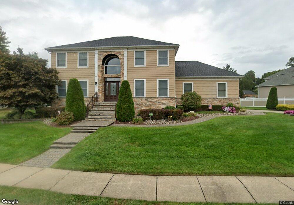
23 Presidential Path Atlantic Highlands, NJ 07716
New Monmouth NeighborhoodEstimated Value: $1,122,167 - $1,456,000
4
Beds
3
Baths
2,552
Sq Ft
$488/Sq Ft
Est. Value
About This Home
This home is located at 23 Presidential Path, Atlantic Highlands, NJ 07716 and is currently estimated at $1,244,792, approximately $487 per square foot. 23 Presidential Path is a home located in Monmouth County with nearby schools including Leonardo Elementary School, Bayshore Middle School, and Middletown - South High School.
Ownership History
Date
Name
Owned For
Owner Type
Purchase Details
Closed on
Apr 19, 1995
Sold by
Spatial Design
Bought by
Cavalieri Robert and Cavalieri Roula
Current Estimated Value
Create a Home Valuation Report for This Property
The Home Valuation Report is an in-depth analysis detailing your home's value as well as a comparison with similar homes in the area
Home Values in the Area
Average Home Value in this Area
Purchase History
| Date | Buyer | Sale Price | Title Company |
|---|---|---|---|
| Cavalieri Robert | $350,000 | -- |
Source: Public Records
Tax History Compared to Growth
Tax History
| Year | Tax Paid | Tax Assessment Tax Assessment Total Assessment is a certain percentage of the fair market value that is determined by local assessors to be the total taxable value of land and additions on the property. | Land | Improvement |
|---|---|---|---|---|
| 2025 | $13,994 | $930,000 | $381,900 | $548,100 |
| 2024 | $14,618 | $850,700 | $312,700 | $538,000 |
| 2023 | $14,618 | $841,100 | $261,900 | $579,200 |
| 2022 | $15,531 | $813,400 | $261,900 | $551,500 |
| 2021 | $15,531 | $746,700 | $250,600 | $496,100 |
| 2020 | $15,778 | $738,000 | $253,100 | $484,900 |
| 2019 | $15,641 | $740,600 | $253,100 | $487,500 |
| 2018 | $15,559 | $718,000 | $253,100 | $464,900 |
| 2017 | $13,980 | $658,200 | $253,100 | $405,100 |
| 2016 | $14,721 | $690,800 | $305,400 | $385,400 |
| 2015 | $15,749 | $737,300 | $381,400 | $355,900 |
| 2014 | $14,010 | $640,000 | $381,400 | $258,600 |
Source: Public Records
Map
Nearby Homes
- 630 Kings Hwy E
- 46 Hosford Ave
- 34 Serpentine Dr
- 152 Sleepy Hollow Rd
- 303 Hillside Ave
- 2 Pomo Ct
- 125 Oakland Ave
- 119 Chestnut Ave
- 786 Leonardville Rd
- 185 Monmouth Ave
- HAMPSHIRE Plan at Central Ave
- 498 Central Ave
- 18 Middletown Ave
- 500 Central Ave
- 502 Central Ave
- 6998 Prospect Ave
- 7100 Prospect Ave
- 43 Washington Ave
- 17 Washington Ave
- 6 Augustus Dr
- 21 Presidential Path
- 25 Presidential Path
- 27 Presidential Path
- 19 Presidential Path
- 20 Presidential Path
- 22 Presidential Path
- 24 Presidential Path
- 26 Presidential Path
- 17 Presidential Path
- 29 Presidential Path
- 28 Presidential Path
- 30 Presidential Path
- 32 Presidential Path
- 15 Presidential Path
- 16 Presidential Path
- 11 Presidential Path
- 14 Presidential Path
- 726 Kings Hwy E
- 9 Presidential Path
- 720 Kings Hwy E