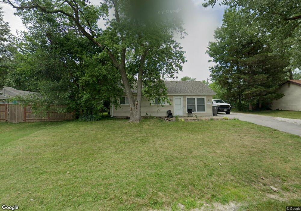
23 Ronnie Dr O Fallon, MO 63366
Estimated Value: $231,000 - $251,000
3
Beds
2
Baths
1,260
Sq Ft
$191/Sq Ft
Est. Value
About This Home
This home is located at 23 Ronnie Dr, O Fallon, MO 63366 and is currently estimated at $241,261, approximately $191 per square foot. 23 Ronnie Dr is a home located in St. Charles County with nearby schools including Joseph L. Mudd Elementary School, Forest Park Elementary School, and Fort Zumwalt North Middle School.
Ownership History
Date
Name
Owned For
Owner Type
Purchase Details
Closed on
Jul 24, 2012
Sold by
Vomund Chad M and Vomund Michelle M
Bought by
Vomund Chad M and Vomund Michelle M
Current Estimated Value
Purchase Details
Closed on
May 26, 2000
Sold by
Kolkedy Robert J and Kolkedy Tamara J
Bought by
Rehkop Todd B and Rehkop Diane M
Home Financials for this Owner
Home Financials are based on the most recent Mortgage that was taken out on this home.
Original Mortgage
$48,600
Interest Rate
8.17%
Create a Home Valuation Report for This Property
The Home Valuation Report is an in-depth analysis detailing your home's value as well as a comparison with similar homes in the area
Home Values in the Area
Average Home Value in this Area
Purchase History
| Date | Buyer | Sale Price | Title Company |
|---|---|---|---|
| Vomund Chad M | -- | Assured Title Company | |
| Vomund Chad | -- | Atc | |
| Rehkop Chelsy | $54,000 | Atc | |
| Rehkop Todd B | -- | -- |
Source: Public Records
Mortgage History
| Date | Status | Borrower | Loan Amount |
|---|---|---|---|
| Previous Owner | Rehkop Todd B | $48,600 |
Source: Public Records
Tax History
| Year | Tax Paid | Tax Assessment Tax Assessment Total Assessment is a certain percentage of the fair market value that is determined by local assessors to be the total taxable value of land and additions on the property. | Land | Improvement |
|---|---|---|---|---|
| 2025 | $2,382 | $37,158 | -- | -- |
| 2023 | $2,383 | $35,754 | $0 | $0 |
| 2022 | $1,889 | $26,266 | $0 | $0 |
| 2021 | $1,890 | $26,266 | $0 | $0 |
| 2020 | $1,704 | $22,971 | $0 | $0 |
| 2019 | $1,708 | $22,971 | $0 | $0 |
| 2018 | $1,576 | $20,225 | $0 | $0 |
| 2017 | $1,546 | $20,225 | $0 | $0 |
| 2016 | $1,326 | $17,271 | $0 | $0 |
| 2015 | $1,233 | $17,271 | $0 | $0 |
| 2014 | $1,173 | $16,173 | $0 | $0 |
Source: Public Records
Map
Nearby Homes
- 203 Saint Margaret Ln
- 205 E Elm St
- 409 Saint Joseph Ave
- 105 Wabash Spur Dr
- 309 E Pitman St
- 805 Saint Joseph Ave
- 201 Allen Dr
- 512 Sonderen St
- 328 Wabash Manor
- 31 Piepers Glen Ct
- 713 Plaza Dr
- 0 Tom Ginnever Ave
- 302 Birmingham Dr
- 333 Villa Tuscany Ct Unit 5B
- 84 Green Park Ln
- 1215 Cypress Dr
- 1155 Villa Flora Dr
- 632 Homerun Dr Unit 33N
- 218 Centerfield Dr
- 17 Homefield Gardens Dr
- 25 Ronnie Dr
- 403 Eggering Dr
- 22 Saint Margaret Ln
- 401 Eggering Dr
- 24 Saint Margaret Ln
- 22 Ronnie Dr
- 27 Ronnie Dr
- 20 Ronnie Dr
- 26 Saint Margaret Ln
- 404 Saint Patrick Dr
- 23 Roland Ave
- 413 Eggering Dr
- 28 Ronnie Dr
- 17 Ronnie Dr
- 402 Saint Patrick Dr
- 23 Saint Margaret Ln
- 404 Eggering Dr
- 25 Roland Ave
- 25 Saint Margaret Ln
- 303 Eggering Dr
Your Personal Tour Guide
Ask me questions while you tour the home.