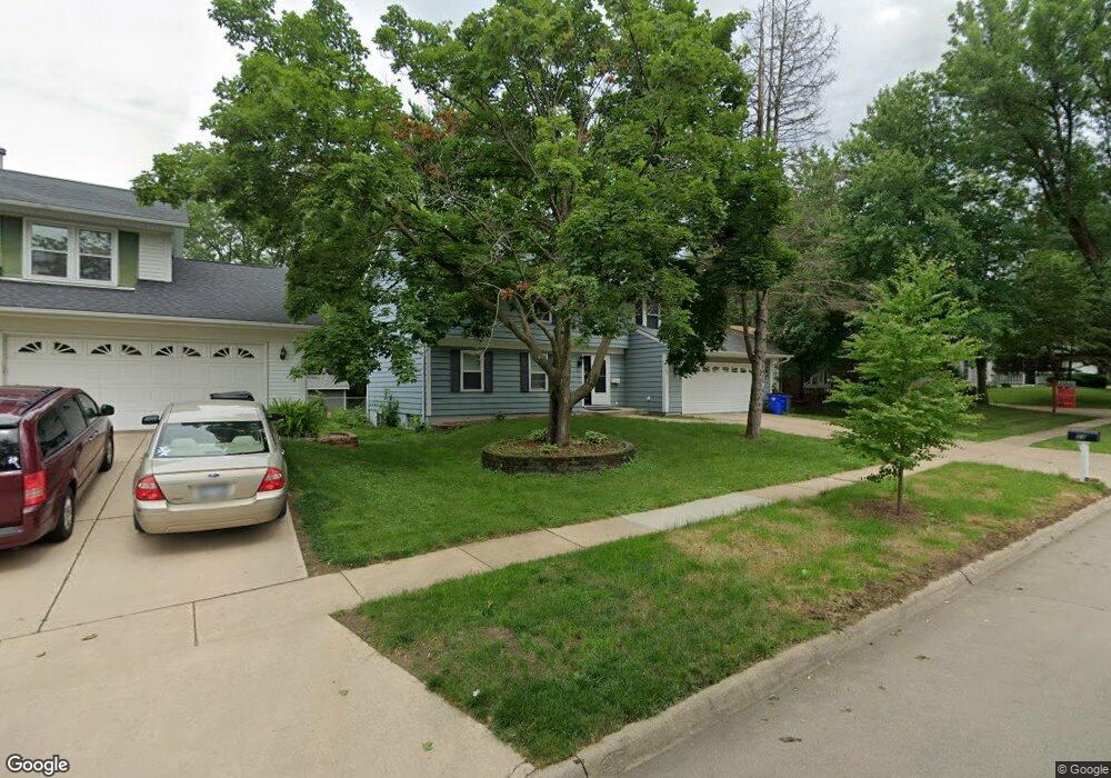
23 Roxbury Dr NW Cedar Rapids, IA 52405
Estimated Value: $253,176 - $301,000
5
Beds
4
Baths
2,100
Sq Ft
$136/Sq Ft
Est. Value
About This Home
This home is located at 23 Roxbury Dr NW, Cedar Rapids, IA 52405 and is currently estimated at $284,794, approximately $135 per square foot. 23 Roxbury Dr NW is a home located in Linn County with nearby schools including Junction City Elementary School, Hoover Elementary School, and Kentucky Tech - Ashland Reg Tech Center.
Ownership History
Date
Name
Owned For
Owner Type
Purchase Details
Closed on
Jul 23, 2018
Sold by
Heasty Robert F and Heasty Lisa L
Bought by
Atchou Catherine Mawusi and Atchou Dzignon
Current Estimated Value
Home Financials for this Owner
Home Financials are based on the most recent Mortgage that was taken out on this home.
Original Mortgage
$169,200
Outstanding Balance
$146,330
Interest Rate
4.5%
Mortgage Type
New Conventional
Estimated Equity
$138,464
Purchase Details
Closed on
Mar 30, 2011
Sold by
Creative Equity Lc
Bought by
Heasty Robert F and Heasty Lisa L
Home Financials for this Owner
Home Financials are based on the most recent Mortgage that was taken out on this home.
Original Mortgage
$140,189
Interest Rate
5.04%
Mortgage Type
Future Advance Clause Open End Mortgage
Purchase Details
Closed on
Feb 15, 2011
Sold by
Davidson Kenneth Lee
Bought by
Creative Equity Lc Series 18
Home Financials for this Owner
Home Financials are based on the most recent Mortgage that was taken out on this home.
Original Mortgage
$140,189
Interest Rate
5.04%
Mortgage Type
Future Advance Clause Open End Mortgage
Purchase Details
Closed on
Jul 29, 2005
Sold by
Freeman John and Freeman Julie
Bought by
Davidson Kenneth Lee
Home Financials for this Owner
Home Financials are based on the most recent Mortgage that was taken out on this home.
Original Mortgage
$98,759
Interest Rate
5.74%
Mortgage Type
Unknown
Purchase Details
Closed on
Jul 23, 2004
Sold by
Freeman John and Freeman Julie
Bought by
Davidson Kenneth Lee
Home Financials for this Owner
Home Financials are based on the most recent Mortgage that was taken out on this home.
Original Mortgage
$78,500
Interest Rate
7.5%
Mortgage Type
Seller Take Back
Create a Home Valuation Report for This Property
The Home Valuation Report is an in-depth analysis detailing your home's value as well as a comparison with similar homes in the area
Home Values in the Area
Average Home Value in this Area
Purchase History
| Date | Buyer | Sale Price | Title Company |
|---|---|---|---|
| Atchou Catherine Mawusi | $188,000 | None Available | |
| Heasty Robert F | $124,500 | None Available | |
| Creative Equity Lc Series 18 | $80,902 | None Available | |
| Davidson Kenneth Lee | $158,000 | -- | |
| Davidson Kenneth Lee | $158,500 | -- |
Source: Public Records
Mortgage History
| Date | Status | Borrower | Loan Amount |
|---|---|---|---|
| Open | Atchou Catherine Mawusi | $169,200 | |
| Previous Owner | Heasty Robert F | $140,189 | |
| Previous Owner | Creative Equity Lc Series 18 | $165,000 | |
| Previous Owner | Davidson Kenneth Lee | $98,759 | |
| Previous Owner | Davidson Kenneth Lee | $78,500 |
Source: Public Records
Tax History Compared to Growth
Tax History
| Year | Tax Paid | Tax Assessment Tax Assessment Total Assessment is a certain percentage of the fair market value that is determined by local assessors to be the total taxable value of land and additions on the property. | Land | Improvement |
|---|---|---|---|---|
| 2025 | $3,690 | $243,000 | $41,000 | $202,000 |
| 2024 | $4,338 | $208,500 | $37,400 | $171,100 |
| 2023 | $4,338 | $208,500 | $37,400 | $171,100 |
| 2022 | $4,044 | $205,700 | $37,400 | $168,300 |
| 2021 | $4,172 | $195,200 | $33,900 | $161,300 |
| 2020 | $4,172 | $189,100 | $32,100 | $157,000 |
| 2019 | $3,684 | $170,900 | $32,100 | $138,800 |
| 2018 | $3,608 | $170,900 | $32,100 | $138,800 |
| 2017 | $3,608 | $165,500 | $32,100 | $133,400 |
| 2016 | $3,348 | $157,500 | $29,700 | $127,800 |
| 2015 | $3,364 | $158,051 | $29,700 | $128,351 |
| 2014 | $3,364 | $158,051 | $29,700 | $128,351 |
| 2013 | $3,292 | $158,051 | $29,700 | $128,351 |
Source: Public Records
Map
Nearby Homes
- 56 Julia Ann Dr NW
- 3724 2nd Ave SW
- 3416 Sue Ln NW
- 3403 1st Ave SW
- 4622 1st Ave NW Unit E
- 4619 1st Ave SW Unit 3
- 3701 16th Ave SW Unit 47
- 4101 16th Ave SW Unit 64A
- 201 Edgewood Rd NW
- 211 Edgewood Rd NW
- 208 Lenora Dr NW
- 3600 Midway Dr NW
- 3109 12th Ave SW
- 3013 Sue Ln NW
- 229 Jacolyn Dr NW
- 3918 21st Avenue Place SW
- 4910 Gordon Ave NW
- 327 NW Edgewood Rd Unit 324, 330, 336, 342 C
- 225 31st St NW
- 4819 Ford Ave NW
- 25 Roxbury Dr NW
- 21 Roxbury Dr NW
- 28 Clive Dr NW
- 29 Roxbury Dr NW
- 24 Clive Dr NW
- 17 Roxbury Dr NW
- 32 Clive Dr NW
- 20 Clive Dr NW
- 20 Roxbury Dr NW
- 36 Clive Dr NW
- 24 Roxbury Dr NW
- 16 Roxbury Dr NW
- 31 Roxbury Dr NW
- 11 Roxbury Dr NW
- 28 Roxbury Dr NW
- 16 Clive Dr NW
- 40 Clive Dr NW
- 10 Roxbury Dr NW
- 1004 1st Ave NW
- 10 Clive Dr NW