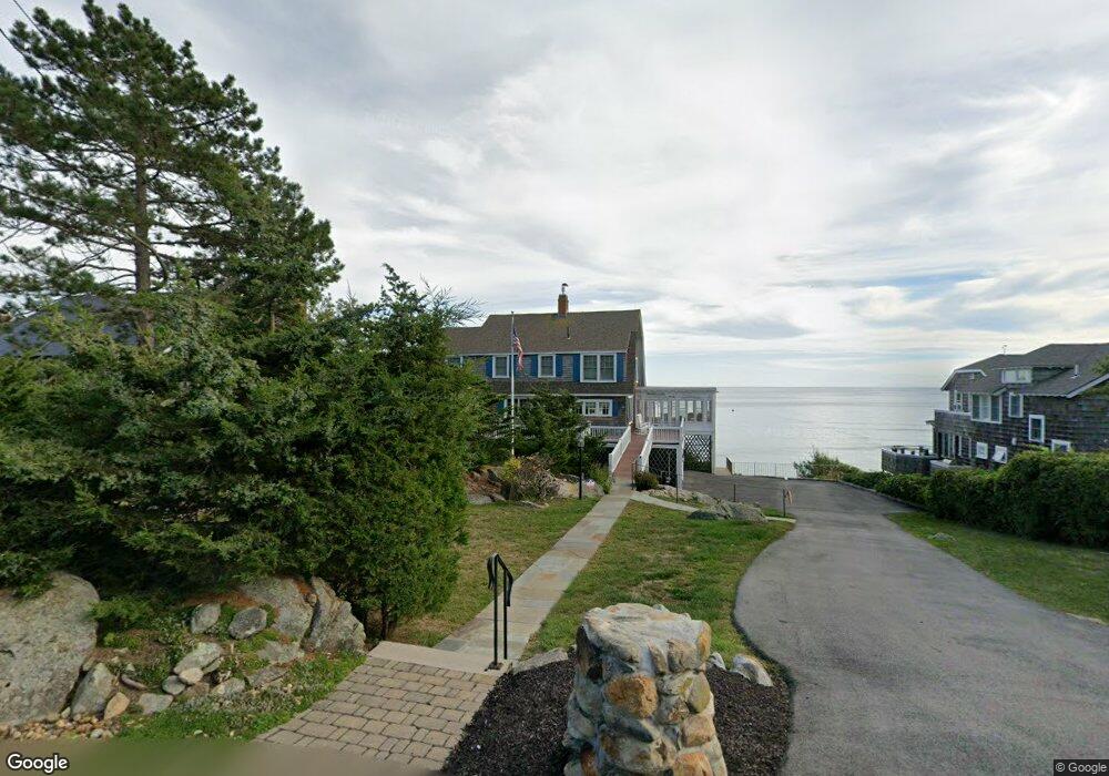
23 Salt Island Rd Gloucester, MA 01930
East Gloucester NeighborhoodEstimated Value: $1,229,000 - $3,533,000
5
Beds
3
Baths
2,250
Sq Ft
$1,112/Sq Ft
Est. Value
About This Home
This home is located at 23 Salt Island Rd, Gloucester, MA 01930 and is currently estimated at $2,502,808, approximately $1,112 per square foot. 23 Salt Island Rd is a home located in Essex County with nearby schools including East Gloucester Elementary School, Ralph B O'maley Middle School, and Gloucester High School.
Ownership History
Date
Name
Owned For
Owner Type
Purchase Details
Closed on
Oct 13, 2020
Sold by
Smallwood Betty A
Bought by
Betty A Smallwood Ret
Current Estimated Value
Purchase Details
Closed on
Sep 30, 2014
Sold by
Smallwood John M and Smallwood Betty A
Bought by
Smallwood Betty A
Create a Home Valuation Report for This Property
The Home Valuation Report is an in-depth analysis detailing your home's value as well as a comparison with similar homes in the area
Home Values in the Area
Average Home Value in this Area
Purchase History
| Date | Buyer | Sale Price | Title Company |
|---|---|---|---|
| Betty A Smallwood Ret | -- | None Available | |
| Smallwood Betty A | -- | -- |
Source: Public Records
Tax History
| Year | Tax Paid | Tax Assessment Tax Assessment Total Assessment is a certain percentage of the fair market value that is determined by local assessors to be the total taxable value of land and additions on the property. | Land | Improvement |
|---|---|---|---|---|
| 2025 | $28,771 | $2,960,000 | $2,081,200 | $878,800 |
| 2024 | $27,829 | $2,860,100 | $1,981,300 | $878,800 |
| 2023 | $25,504 | $2,408,300 | $1,691,400 | $716,900 |
| 2022 | $25,659 | $2,187,500 | $1,470,000 | $717,500 |
| 2021 | $24,743 | $1,989,000 | $1,336,400 | $652,600 |
| 2020 | $24,442 | $1,982,300 | $1,336,400 | $645,900 |
| 2019 | $23,468 | $1,849,300 | $1,274,200 | $575,100 |
| 2018 | $22,852 | $1,767,400 | $1,243,200 | $524,200 |
| 2017 | $22,170 | $1,680,800 | $1,184,000 | $496,800 |
| 2016 | $21,353 | $1,568,900 | $1,131,600 | $437,300 |
| 2015 | $20,602 | $1,509,300 | $1,105,900 | $403,400 |
Source: Public Records
Map
Nearby Homes
- 25 Salt Island Rd
- 26 Marina Dr
- 87 Atlantic Rd Unit 2
- 9 & 11 Helens Way
- 33 Highview Rd
- 29 Harrison Ave
- 36 Links Rd
- 30 Chapel St Unit B
- 197 E Main St Unit 1
- 197 E Main St Unit 2
- 160 Prospect St Unit 3
- 27 Hodgkins Rd
- 16 Hodgkins Rd Unit 2
- 10 Oak St Unit 3
- 4 Mount Vernon St
- 10 Seaview Rd
- 118 Prospect St
- 73 Rocky Neck Ave Unit 2
- 177 Main St
- 40 Sargent St
- 21 Salt Island Rd
- 27 Salt Island Rd
- 22 Salt Island Rd
- 19 Salt Island Rd
- 29 Salt Island Rd
- 24 Salt Island Rd
- 26 Salt Island Rd Unit WINTER
- 26 Salt Island Rd
- 18 Salt Island Rd
- 20 Salt Island Rd
- 4 Cliff Rd
- 31 Salt Island Rd
- 17 Salt Island Rd
- 28 Salt Island Rd
- 1 Brier Neck Rd
- 30 Salt Island Rd
- 5 Cliff Rd
- 5 Cliff Rd Unit 3
- 5 Cliff Rd Unit 5
- 20 Cliff Rd