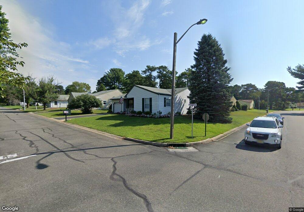
23 Stonybrook Rd Whiting, NJ 08759
Manchester Township NeighborhoodEstimated Value: $245,969 - $290,000
2
Beds
2
Baths
1,219
Sq Ft
$219/Sq Ft
Est. Value
About This Home
This home is located at 23 Stonybrook Rd, Whiting, NJ 08759 and is currently estimated at $266,492, approximately $218 per square foot. 23 Stonybrook Rd is a home located in Ocean County with nearby schools including Manchester Township High School.
Ownership History
Date
Name
Owned For
Owner Type
Purchase Details
Closed on
Aug 4, 2004
Sold by
Dealmeida Joyce
Bought by
Fisher William and Fisher Viola
Current Estimated Value
Purchase Details
Closed on
Mar 31, 2004
Sold by
Yakenbach Florence and Yakenback Florence
Bought by
Dealmeida Joyce
Home Financials for this Owner
Home Financials are based on the most recent Mortgage that was taken out on this home.
Original Mortgage
$10,000
Interest Rate
5.58%
Mortgage Type
Unknown
Create a Home Valuation Report for This Property
The Home Valuation Report is an in-depth analysis detailing your home's value as well as a comparison with similar homes in the area
Home Values in the Area
Average Home Value in this Area
Purchase History
| Date | Buyer | Sale Price | Title Company |
|---|---|---|---|
| Fisher William | $150,000 | Transnation Title Ins Co Inc | |
| Dealmeida Joyce | $115,000 | Commonwealth Land Title Insu |
Source: Public Records
Mortgage History
| Date | Status | Borrower | Loan Amount |
|---|---|---|---|
| Previous Owner | Dealmeida Joyce | $10,000 | |
| Previous Owner | Dealmeida Joyce | $105,763 |
Source: Public Records
Tax History Compared to Growth
Tax History
| Year | Tax Paid | Tax Assessment Tax Assessment Total Assessment is a certain percentage of the fair market value that is determined by local assessors to be the total taxable value of land and additions on the property. | Land | Improvement |
|---|---|---|---|---|
| 2025 | $2,944 | $243,200 | $57,000 | $186,200 |
| 2024 | $2,544 | $119,900 | $12,000 | $107,900 |
| 2023 | $2,406 | $119,900 | $12,000 | $107,900 |
| 2022 | $2,656 | $119,900 | $12,000 | $107,900 |
| 2021 | $2,348 | $119,900 | $12,000 | $107,900 |
| 2020 | $2,530 | $119,900 | $12,000 | $107,900 |
| 2019 | $2,285 | $89,100 | $12,000 | $77,100 |
| 2018 | $2,277 | $89,100 | $12,000 | $77,100 |
| 2017 | $2,285 | $89,100 | $12,000 | $77,100 |
| 2016 | $2,008 | $89,100 | $12,000 | $77,100 |
| 2015 | $1,966 | $89,100 | $12,000 | $77,100 |
| 2014 | $1,920 | $89,100 | $12,000 | $77,100 |
Source: Public Records
Map
Nearby Homes
- 1B Greenwood Ln Unit B
- 7B Greenwood Ln Unit 62
- 69D Sunset Rd Unit 60
- 9A Greenwood Ln
- 41C Stonybrook Rd Unit A
- 4 Stonybrook Ct Unit 60
- 6 Ardmore St Unit A
- 6B Ardmore St
- 11 Ardmore St
- 51A Sunset Rd
- 13A Quincy Dr
- 36 Penwood Dr Unit 55
- 19B Medford Rd Unit 61
- 48B Auburn St Unit 54B
- 44B Sunset Rd Unit 55
- 153A Sunset Rd
- 81A Milford Ave
- 14A Penwood Dr Unit A
- 46 Milford Ave Unit A
- 3 Amherst Rd Unit 63
- 87 Sunset Rd
- 21 Stonybrook Rd
- 21 Stonybrook Rd Unit 60
- 84 Sunset Rd
- 84 Sunset Rd Unit 60
- 89 Sunset Rd
- 85 Sunset Rd
- 85 Sunset Rd Unit 60
- 19 Stonybrook Rd
- 19 Stonybrook Rd Unit 60
- 86 Sunset Rd
- 86 Sunset Rd Unit 60
- 8 Stonybrook Rd
- 8 Stonybrook Rd Unit 60
- 82A Sunset Rd
- 82B Sunset Rd
- 82B Sunset Rd Unit B
- 8 Brooklane Ct
- 7 Brooklane Ct
- 7 Brooklane Ct Unit 60