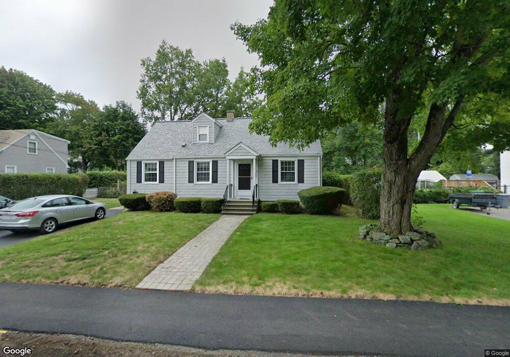
23 Sylvester Rd Natick, MA 01760
Estimated Value: $733,068 - $909,000
4
Beds
2
Baths
1,500
Sq Ft
$535/Sq Ft
Est. Value
About This Home
This home is located at 23 Sylvester Rd, Natick, MA 01760 and is currently estimated at $802,017, approximately $534 per square foot. 23 Sylvester Rd is a home located in Middlesex County with nearby schools including Natick High School, J F Kennedy Middle School, and Johnson Elementary School.
Ownership History
Date
Name
Owned For
Owner Type
Purchase Details
Closed on
Oct 20, 2025
Sold by
Rozon Donna M and Foley Patricia
Bought by
Donna M Rozon Lt and Rozon
Current Estimated Value
Purchase Details
Closed on
Jul 17, 2024
Sold by
Rozon Mary L
Bought by
Rozon Donna M and Foley Patricia
Purchase Details
Closed on
Jan 23, 2015
Sold by
Rozon Donald J and Rozon Mary L
Bought by
Rozon Donald J and Rozon Mary L
Purchase Details
Closed on
Jul 6, 1970
Bought by
Rozon Donald J and Rozon Mary L
Create a Home Valuation Report for This Property
The Home Valuation Report is an in-depth analysis detailing your home's value as well as a comparison with similar homes in the area
Home Values in the Area
Average Home Value in this Area
Purchase History
| Date | Buyer | Sale Price | Title Company |
|---|---|---|---|
| Donna M Rozon Lt | $800,000 | -- | |
| Rozon Donna M | -- | None Available | |
| Rozon Donna M | -- | None Available | |
| Rozon Donald J | -- | -- | |
| Rozon Donald J | -- | -- | |
| Rozon Donald J | -- | -- |
Source: Public Records
Tax History Compared to Growth
Tax History
| Year | Tax Paid | Tax Assessment Tax Assessment Total Assessment is a certain percentage of the fair market value that is determined by local assessors to be the total taxable value of land and additions on the property. | Land | Improvement |
|---|---|---|---|---|
| 2025 | $7,880 | $658,900 | $427,300 | $231,600 |
| 2024 | $7,623 | $621,800 | $402,200 | $219,600 |
| 2023 | $7,609 | $602,000 | $386,900 | $215,100 |
| 2022 | $7,413 | $555,700 | $351,500 | $204,200 |
| 2021 | $4,611 | $521,300 | $331,500 | $189,800 |
| 2020 | $6,889 | $506,200 | $316,400 | $189,800 |
| 2019 | $6,434 | $506,200 | $316,400 | $189,800 |
| 2018 | $5,113 | $459,700 | $301,300 | $158,400 |
| 2017 | $5,561 | $412,200 | $256,700 | $155,500 |
| 2016 | $5,288 | $389,700 | $235,700 | $154,000 |
| 2015 | $5,234 | $378,700 | $235,700 | $143,000 |
Source: Public Records
Map
Nearby Homes
- 1 Fern St
- 4 Sylvia Ave
- 91 Speen St
- 46 Silver Hill Ln Unit 1
- 40 Silver Hill Ln Unit 4
- 26 Walden Dr Unit 4
- 9 Silver Hill Ln Unit 19
- 16 West St
- 32 Silver Hill Ln Unit 1
- 12 Walden Dr Unit 19
- 2 Lodge Rd
- 25 Forest Ave
- 216-218 S Main St
- 47 High St
- 57 Village Brook Ln Unit 5
- 50 Village Brook Ln Unit 4
- 51 Village Brook Ln Unit 16
- 10 Kelsey Rd
- 105 N Main St
- 6 Ambler Ct