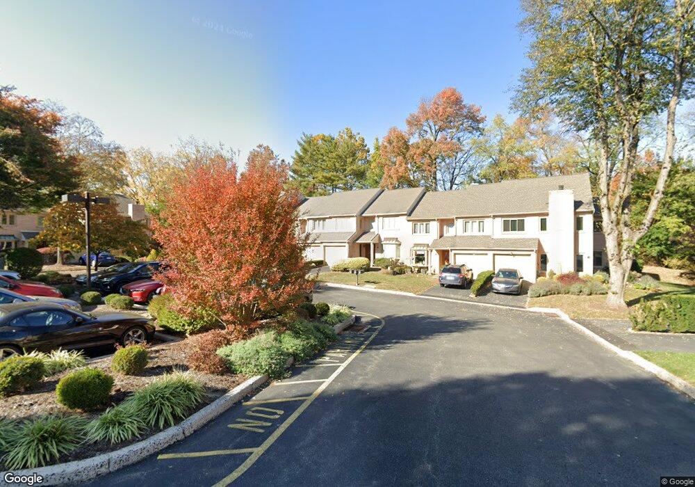
23 Treaty Dr Chesterbrook, PA 19087
Estimated Value: $580,198 - $621,000
3
Beds
3
Baths
1,864
Sq Ft
$324/Sq Ft
Est. Value
About This Home
This home is located at 23 Treaty Dr, Chesterbrook, PA 19087 and is currently estimated at $603,050, approximately $323 per square foot. 23 Treaty Dr is a home located in Chester County with nearby schools including Valley Forge Elementary School, Valley Forge Middle School, and Conestoga Senior High School.
Ownership History
Date
Name
Owned For
Owner Type
Purchase Details
Closed on
Nov 29, 2012
Sold by
Sullivan Kathleen P
Bought by
Pennsylvania Turnpike Commission
Current Estimated Value
Purchase Details
Closed on
Oct 18, 1996
Sold by
Klippen Kenneth L and Klippen Patricia G
Bought by
Sullivan Kathleen P
Home Financials for this Owner
Home Financials are based on the most recent Mortgage that was taken out on this home.
Original Mortgage
$152,550
Interest Rate
8.1%
Purchase Details
Closed on
Dec 30, 1994
Sold by
Miller Paul C
Bought by
Klippen Kenneth L and Klippen Patricia G
Home Financials for this Owner
Home Financials are based on the most recent Mortgage that was taken out on this home.
Original Mortgage
$163,800
Interest Rate
9.23%
Create a Home Valuation Report for This Property
The Home Valuation Report is an in-depth analysis detailing your home's value as well as a comparison with similar homes in the area
Home Values in the Area
Average Home Value in this Area
Purchase History
| Date | Buyer | Sale Price | Title Company |
|---|---|---|---|
| Pennsylvania Turnpike Commission | -- | None Available | |
| Sullivan Kathleen P | $169,500 | -- | |
| Klippen Kenneth L | $172,500 | -- |
Source: Public Records
Mortgage History
| Date | Status | Borrower | Loan Amount |
|---|---|---|---|
| Previous Owner | Sullivan Kathleen P | $152,550 | |
| Previous Owner | Klippen Kenneth L | $163,800 |
Source: Public Records
Tax History Compared to Growth
Tax History
| Year | Tax Paid | Tax Assessment Tax Assessment Total Assessment is a certain percentage of the fair market value that is determined by local assessors to be the total taxable value of land and additions on the property. | Land | Improvement |
|---|---|---|---|---|
| 2025 | $5,442 | $154,500 | $40,320 | $114,180 |
| 2024 | $5,442 | $154,500 | $40,320 | $114,180 |
| 2023 | $5,112 | $154,500 | $40,320 | $114,180 |
| 2022 | $4,980 | $154,500 | $40,320 | $114,180 |
| 2021 | $4,885 | $154,500 | $40,320 | $114,180 |
| 2020 | $4,751 | $154,500 | $40,320 | $114,180 |
| 2019 | $4,601 | $154,500 | $40,320 | $114,180 |
| 2018 | $4,509 | $154,500 | $40,320 | $114,180 |
| 2017 | $4,402 | $154,500 | $40,320 | $114,180 |
| 2016 | -- | $154,500 | $40,320 | $114,180 |
| 2015 | -- | $154,500 | $40,320 | $114,180 |
| 2014 | -- | $154,500 | $40,320 | $114,180 |
Source: Public Records
Map
Nearby Homes
- 68 Amity Dr
- 293 Valley Stream Ln
- 0 Valley Stream Ln Unit PACT2109946
- 413 Cannon Ct Unit 413
- 412 Cannon Ct Unit 412
- 19 Painters Ln
- 307 Cheswold Ct Unit 307
- 1586 Salomon Ln
- 108 Valley Stream Cir Unit 108A
- 620 Washington Place Unit 20
- 1410 Washington Place Unit 10
- 301 Hanover Ct
- 204 Camsten Ct
- 107 Reveille Rd
- 32 Main St
- 793 Tory Hollow Rd
- 170, 200, 220 Old State Rd
- 463 Old Forge Crossing Unit 463
- 232 Old Forge Crossing
- 363 Old Forge Crossing