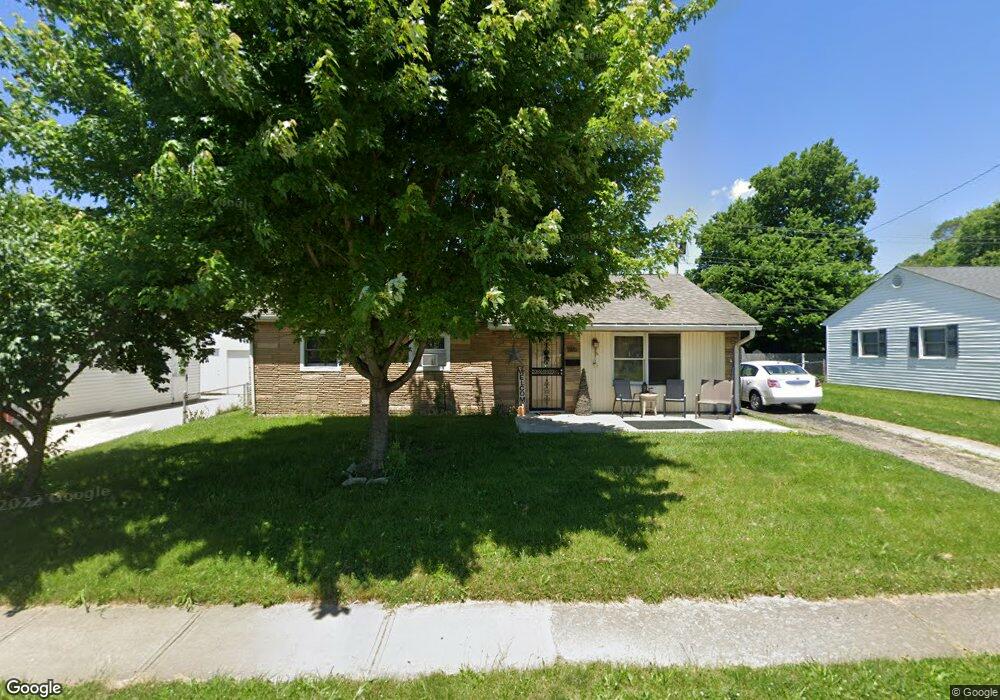
23 W Doris Dr Fairborn, OH 45324
Estimated Value: $141,000 - $159,000
3
Beds
2
Baths
1,008
Sq Ft
$148/Sq Ft
Est. Value
About This Home
This home is located at 23 W Doris Dr, Fairborn, OH 45324 and is currently estimated at $149,128, approximately $147 per square foot. 23 W Doris Dr is a home located in Greene County with nearby schools including Fairborn Primary School, Fairborn Intermediate School, and Fairborn Middle School.
Ownership History
Date
Name
Owned For
Owner Type
Purchase Details
Closed on
Mar 21, 2007
Sold by
Lucca Rebecca L
Bought by
Morita Robert and Morita Martha
Current Estimated Value
Home Financials for this Owner
Home Financials are based on the most recent Mortgage that was taken out on this home.
Original Mortgage
$73,500
Interest Rate
6.27%
Mortgage Type
Unknown
Purchase Details
Closed on
Nov 14, 2006
Sold by
Va
Bought by
Lucca Rebecca L
Purchase Details
Closed on
May 26, 2006
Sold by
Burns Scott I
Bought by
Va
Purchase Details
Closed on
May 23, 2006
Sold by
Burns Scott I
Bought by
Va
Purchase Details
Closed on
Jun 30, 2004
Sold by
Rutherford Dennis and Rutherford Kazue M
Bought by
Burns Scott I
Home Financials for this Owner
Home Financials are based on the most recent Mortgage that was taken out on this home.
Original Mortgage
$74,299
Interest Rate
6.37%
Mortgage Type
VA
Purchase Details
Closed on
Mar 11, 1997
Sold by
Templeton Jeanne S
Bought by
Rutherford Dennis
Create a Home Valuation Report for This Property
The Home Valuation Report is an in-depth analysis detailing your home's value as well as a comparison with similar homes in the area
Home Values in the Area
Average Home Value in this Area
Purchase History
| Date | Buyer | Sale Price | Title Company |
|---|---|---|---|
| Morita Robert | $77,400 | Attorney | |
| Lucca Rebecca L | -- | None Available | |
| Va | $55,522 | None Available | |
| Va | $55,522 | None Available | |
| Burns Scott I | $72,700 | -- | |
| Rutherford Dennis | $47,947 | -- |
Source: Public Records
Mortgage History
| Date | Status | Borrower | Loan Amount |
|---|---|---|---|
| Closed | Morita Robert | $73,500 | |
| Previous Owner | Burns Scott I | $74,299 |
Source: Public Records
Tax History
| Year | Tax Paid | Tax Assessment Tax Assessment Total Assessment is a certain percentage of the fair market value that is determined by local assessors to be the total taxable value of land and additions on the property. | Land | Improvement |
|---|---|---|---|---|
| 2024 | $1,704 | $35,320 | $8,740 | $26,580 |
| 2023 | $1,692 | $35,320 | $8,740 | $26,580 |
| 2022 | $1,295 | $22,770 | $6,720 | $16,050 |
| 2021 | $1,314 | $22,770 | $6,720 | $16,050 |
| 2020 | $1,321 | $22,770 | $6,720 | $16,050 |
| 2019 | $1,236 | $21,330 | $6,590 | $14,740 |
| 2018 | $1,249 | $21,330 | $6,590 | $14,740 |
| 2017 | $1,222 | $21,330 | $6,590 | $14,740 |
| 2016 | $1,251 | $21,350 | $6,590 | $14,760 |
| 2015 | $1,193 | $21,350 | $6,590 | $14,760 |
| 2014 | $1,154 | $21,350 | $6,590 | $14,760 |
Source: Public Records
Map
Nearby Homes
- 1222 Hemlock Dr
- 1108 Lexington Ave
- 1267 Beech St
- 0 W Garland Ave
- 135 E Garland Ave
- 239-241 Euclid Ave
- 201 State St
- 1878 Wildflower Rd
- 256 Euclid Ave
- 38 Lindway Dr
- 1408 Mapleridge Dr
- 818 Flintridge Dr
- 45 Regina Dr
- 1463 Maplegrove Dr
- 849 Flintridge Dr
- 153 Diana Ln N
- 504 Greene St
- 349 Forest St
- 315 Greene St
- 35 S Grand Ave Unit 33
- 105 W Doris Dr
- 17 W Doris Dr
- 26 W Robbins Ave
- 22 W Robbins Ave
- 111 W Doris Dr
- 102 W Robbins Ave
- 18 W Robbins Ave
- 108 W Robbins Ave
- 108 W Robbins Ave
- 1153 Date St
- 1152 Date St
- 117 W Doris Dr
- 1135 S Central Ave
- 110 W Doris Dr
- 10 W Doris Dr
- 2 W Robbins Ave
- 1120 Harvard Ave
- 1158 Date St
- 33 W Robbins Ave
- 114 W Doris Dr
Your Personal Tour Guide
Ask me questions while you tour the home.