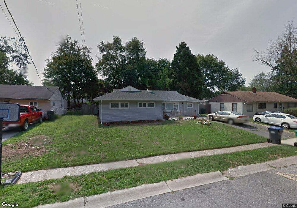
23 W Stephen Dr Newark, DE 19713
Estimated Value: $271,000 - $332,000
3
Beds
2
Baths
1,282
Sq Ft
$238/Sq Ft
Est. Value
About This Home
This home is located at 23 W Stephen Dr, Newark, DE 19713 and is currently estimated at $304,716, approximately $237 per square foot. 23 W Stephen Dr is a home located in New Castle County with nearby schools including Smith (Jennie E.) Elementary School, Kirk (George V.) Middle School, and Christiana High School.
Ownership History
Date
Name
Owned For
Owner Type
Purchase Details
Closed on
Jul 28, 2005
Sold by
Morgan Ronald C
Bought by
Mcelrone Robert L and Mcelrone Pamela A
Current Estimated Value
Home Financials for this Owner
Home Financials are based on the most recent Mortgage that was taken out on this home.
Original Mortgage
$164,700
Outstanding Balance
$96,209
Interest Rate
7.45%
Mortgage Type
Purchase Money Mortgage
Estimated Equity
$208,507
Purchase Details
Closed on
Apr 7, 2005
Sold by
Bush John Andrew
Bought by
Morgan Ronald C
Purchase Details
Closed on
Jan 22, 2004
Sold by
Bush John Andrew and Bush Rebecca Ellen
Bought by
Bush John Andrew
Home Financials for this Owner
Home Financials are based on the most recent Mortgage that was taken out on this home.
Original Mortgage
$125,600
Interest Rate
9.25%
Mortgage Type
New Conventional
Create a Home Valuation Report for This Property
The Home Valuation Report is an in-depth analysis detailing your home's value as well as a comparison with similar homes in the area
Home Values in the Area
Average Home Value in this Area
Purchase History
| Date | Buyer | Sale Price | Title Company |
|---|---|---|---|
| Mcelrone Robert L | $183,000 | The Security Title Guarantee | |
| Morgan Ronald C | $149,528 | -- | |
| Bush John Andrew | -- | First Title & Escrow |
Source: Public Records
Mortgage History
| Date | Status | Borrower | Loan Amount |
|---|---|---|---|
| Open | Mcelrone Robert L | $164,700 | |
| Previous Owner | Bush John Andrew | $125,600 |
Source: Public Records
Tax History
| Year | Tax Paid | Tax Assessment Tax Assessment Total Assessment is a certain percentage of the fair market value that is determined by local assessors to be the total taxable value of land and additions on the property. | Land | Improvement |
|---|---|---|---|---|
| 2024 | $1,926 | $44,200 | $8,000 | $36,200 |
| 2023 | $1,874 | $44,200 | $8,000 | $36,200 |
| 2022 | $1,862 | $44,200 | $8,000 | $36,200 |
| 2021 | $1,823 | $44,200 | $8,000 | $36,200 |
| 2020 | $1,776 | $44,200 | $8,000 | $36,200 |
| 2019 | $4,359 | $44,200 | $8,000 | $36,200 |
| 2018 | $1,533 | $44,200 | $8,000 | $36,200 |
| 2017 | $1,480 | $44,200 | $8,000 | $36,200 |
| 2016 | $1,474 | $44,200 | $8,000 | $36,200 |
| 2015 | $1,345 | $44,200 | $8,000 | $36,200 |
| 2014 | $1,345 | $44,200 | $8,000 | $36,200 |
Source: Public Records
Map
Nearby Homes
- 3 Marlyn Rd
- 47 Carole Rd
- 620 Ilse Dr
- 112 Lynch Farm Dr
- 221 S Dillwyn Rd
- 11 Carnegie Ct
- 5 Acapella Ct
- 17 Pearson Dr
- 91 Old Red Mill Rd
- 120 Hopkins Ct
- 148 Brookside Blvd
- 2 Magnolia Cir
- 14 S Dillwyn Rd
- 119 Felix Dr
- 704 Birchwood Dr
- 235 Felix Dr
- 6 Fleming St
- 179 Rhythm Ct
- 135 Salem Church Rd
- 410 Woodlawn Ave
Your Personal Tour Guide
Ask me questions while you tour the home.