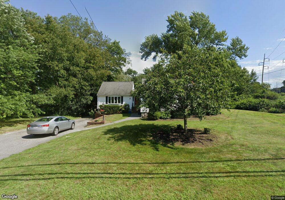
23 Webster St Andover, MA 01810
Far West Andover NeighborhoodEstimated Value: $634,085 - $769,000
3
Beds
2
Baths
1,880
Sq Ft
$369/Sq Ft
Est. Value
About This Home
This home is located at 23 Webster St, Andover, MA 01810 and is currently estimated at $694,271, approximately $369 per square foot. 23 Webster St is a home located in Essex County with nearby schools including High Plain Elementary School, Wood Hill Middle School, and Andover High School.
Ownership History
Date
Name
Owned For
Owner Type
Purchase Details
Closed on
Feb 13, 2014
Sold by
Johnson Edward R and Johnson Dale E
Bought by
Johnson Rt and Johnson
Current Estimated Value
Create a Home Valuation Report for This Property
The Home Valuation Report is an in-depth analysis detailing your home's value as well as a comparison with similar homes in the area
Home Values in the Area
Average Home Value in this Area
Purchase History
| Date | Buyer | Sale Price | Title Company |
|---|---|---|---|
| Johnson Rt | -- | -- | |
| Johnson Rt | -- | -- |
Source: Public Records
Mortgage History
| Date | Status | Borrower | Loan Amount |
|---|---|---|---|
| Previous Owner | Johnson Rt | $50,000 | |
| Previous Owner | Johnson Rt | $100,000 | |
| Previous Owner | Johnson Rt | $100,000 |
Source: Public Records
Tax History Compared to Growth
Tax History
| Year | Tax Paid | Tax Assessment Tax Assessment Total Assessment is a certain percentage of the fair market value that is determined by local assessors to be the total taxable value of land and additions on the property. | Land | Improvement |
|---|---|---|---|---|
| 2024 | $5,711 | $443,400 | $228,600 | $214,800 |
| 2023 | $5,459 | $399,600 | $206,000 | $193,600 |
| 2022 | $5,237 | $358,700 | $182,300 | $176,400 |
| 2021 | $5,006 | $327,400 | $165,600 | $161,800 |
| 2020 | $4,802 | $319,900 | $161,400 | $158,500 |
| 2019 | $4,752 | $311,200 | $156,700 | $154,500 |
| 2018 | $4,536 | $290,000 | $147,900 | $142,100 |
| 2017 | $4,335 | $285,600 | $145,000 | $140,600 |
| 2016 | $4,098 | $276,500 | $135,700 | $140,800 |
| 2015 | $4,180 | $279,200 | $146,300 | $132,900 |
Source: Public Records
Map
Nearby Homes
- 750 Brookside Dr Unit G
- 29 Glenwood Dr
- 0
- 11 Devonshire St
- 96 Beacon St
- 450 Riverside Dr Unit 1
- 439-443 Riverside Dr
- 37 Tewksbury St Unit 39
- 18 Ames St
- 8 Packard St
- 54 Amherst St
- 5 Marc Ln
- 15 Beaconsfield St
- 19 Oregon Ave
- 42 Beresford St
- 95 Hancock St
- 629 Andover St
- 33 Jefferson St
- 1008 Essex St Unit 1010
- 30-32 Linden St
- 27 Webster St
- 20 Webster St
- 17 Webster St
- 18 Webster St
- 19 Webster Ct
- 15 Webster St
- 19 Ballard Rd
- 10 Webster St
- 12 Webster St
- 1 Ballard Way
- 3 Ballard Way Unit 302/304
- 5 Ballard Way Unit 502
- 3 Ballard Way Unit 302
- 3 Ballard Way
- 1 Ballard Way Unit 102
- 1 Ballard Way Unit 103
- 13 Webster St
- 11 Webster St
- 19 Webster St
- 14 Webster St