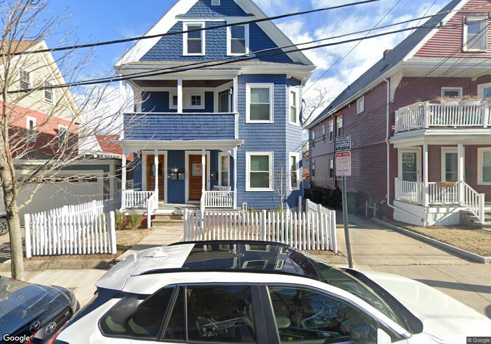
23 Westminster St Unit 3 Somerville, MA 02144
West Somerville NeighborhoodEstimated Value: $819,000 - $934,000
2
Beds
1
Bath
1,125
Sq Ft
$772/Sq Ft
Est. Value
About This Home
This home is located at 23 Westminster St Unit 3, Somerville, MA 02144 and is currently estimated at $868,544, approximately $772 per square foot. 23 Westminster St Unit 3 is a home located in Middlesex County with nearby schools including Somerville High School, St. Clement Elementary School, and International School of Boston.
Ownership History
Date
Name
Owned For
Owner Type
Purchase Details
Closed on
Jul 1, 2009
Sold by
Pinehurst 23 Wmin Llc
Bought by
Fiarman Sarah
Current Estimated Value
Home Financials for this Owner
Home Financials are based on the most recent Mortgage that was taken out on this home.
Original Mortgage
$312,375
Outstanding Balance
$199,163
Interest Rate
4.86%
Mortgage Type
Purchase Money Mortgage
Estimated Equity
$669,381
Create a Home Valuation Report for This Property
The Home Valuation Report is an in-depth analysis detailing your home's value as well as a comparison with similar homes in the area
Home Values in the Area
Average Home Value in this Area
Purchase History
| Date | Buyer | Sale Price | Title Company |
|---|---|---|---|
| Fiarman Sarah | $416,500 | -- |
Source: Public Records
Mortgage History
| Date | Status | Borrower | Loan Amount |
|---|---|---|---|
| Open | Fiarman Sarah | $312,375 |
Source: Public Records
Tax History Compared to Growth
Tax History
| Year | Tax Paid | Tax Assessment Tax Assessment Total Assessment is a certain percentage of the fair market value that is determined by local assessors to be the total taxable value of land and additions on the property. | Land | Improvement |
|---|---|---|---|---|
| 2025 | $8,317 | $762,300 | $0 | $762,300 |
| 2024 | $7,858 | $747,000 | $0 | $747,000 |
| 2023 | $7,656 | $740,400 | $0 | $740,400 |
| 2022 | $7,254 | $712,600 | $0 | $712,600 |
| 2021 | $7,105 | $697,300 | $0 | $697,300 |
| 2020 | $6,812 | $675,100 | $0 | $675,100 |
| 2019 | $6,710 | $623,600 | $0 | $623,600 |
| 2018 | $6,736 | $595,600 | $0 | $595,600 |
| 2017 | $6,059 | $519,200 | $0 | $519,200 |
| 2016 | $6,200 | $494,800 | $0 | $494,800 |
| 2015 | $5,624 | $446,000 | $0 | $446,000 |
Source: Public Records
Map
Nearby Homes
- 29 Packard Ave
- 55 Packard Ave Unit 1
- 11 Watson St Unit 1
- 11 Watson St Unit 2
- 22 Ossipee Rd Unit 2
- 23 Ossipee Rd
- 20 Electric Ave Unit 2
- 202 Powder House Blvd Unit 2
- 34 Belknap St
- 33 Conwell Ave
- 69 Clarendon Ave Unit A
- 235 Powder House Blvd
- 6 Hamilton Rd Unit 6
- 57 Garrison Ave
- 39 Seven Pines Ave
- 67-69 Cameron Ave
- 24 Washburn Ave Unit 1
- 32 Cameron Ave
- 16 High St Unit 2
- 50 Howard St Unit 5
- 23 Westminster St
- 23 Westminster St Unit 2
- 17 Westminster St
- 88 Electric Ave
- 88 Electric Ave Unit 2
- 86 Electric Ave
- 15 Westminster St
- 82 Electric Ave
- 82 Electric Ave Unit 2
- 20 Lovell St
- 98 Electric Ave Unit 3
- 98 Electric Ave Unit 2
- 98 Electric Ave Unit 1
- 98 Electric Ave Unit B
- 11 Westminster St
- 11 Westminster St
- 11 Westminster St Unit 2
- 22 Lovell St Unit 1
- 22 Lovell St
- 22 Westminster St