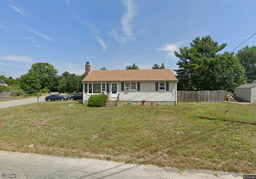
23 Whipoorwill Way Wareham, MA 02571
Estimated Value: $385,000 - $452,000
3
Beds
1
Bath
960
Sq Ft
$440/Sq Ft
Est. Value
About This Home
This home is located at 23 Whipoorwill Way, Wareham, MA 02571 and is currently estimated at $422,438, approximately $440 per square foot. 23 Whipoorwill Way is a home located in Plymouth County.
Ownership History
Date
Name
Owned For
Owner Type
Purchase Details
Closed on
Jan 24, 1992
Sold by
Whell Stephanie M
Bought by
Pennington Henry B and Pennington Doris A
Current Estimated Value
Home Financials for this Owner
Home Financials are based on the most recent Mortgage that was taken out on this home.
Original Mortgage
$40,000
Interest Rate
8.45%
Mortgage Type
Purchase Money Mortgage
Create a Home Valuation Report for This Property
The Home Valuation Report is an in-depth analysis detailing your home's value as well as a comparison with similar homes in the area
Purchase History
| Date | Buyer | Sale Price | Title Company |
|---|---|---|---|
| Pennington Henry B | $51,500 | -- |
Source: Public Records
Mortgage History
| Date | Status | Borrower | Loan Amount |
|---|---|---|---|
| Open | Pennington Henry B | $45,000 | |
| Closed | Pennington Henry B | $40,000 | |
| Previous Owner | Pennington Henry B | $56,947 | |
| Previous Owner | Pennington Henry B | $36,950 |
Source: Public Records
Tax History
| Year | Tax Paid | Tax Assessment Tax Assessment Total Assessment is a certain percentage of the fair market value that is determined by local assessors to be the total taxable value of land and additions on the property. | Land | Improvement |
|---|---|---|---|---|
| 2025 | $3,779 | $362,700 | $110,000 | $252,700 |
| 2024 | $3,878 | $345,300 | $86,000 | $259,300 |
| 2023 | $3,505 | $309,700 | $78,200 | $231,500 |
| 2022 | $3,505 | $265,900 | $78,200 | $187,700 |
| 2021 | $3,466 | $257,700 | $78,200 | $179,500 |
| 2020 | $3,237 | $244,100 | $78,200 | $165,900 |
| 2019 | $3,010 | $226,500 | $75,300 | $151,200 |
| 2018 | $2,828 | $207,500 | $75,300 | $132,200 |
| 2017 | $2,668 | $198,400 | $75,300 | $123,100 |
| 2016 | $2,425 | $179,200 | $73,000 | $106,200 |
| 2015 | $2,342 | $179,200 | $73,000 | $106,200 |
| 2014 | $2,200 | $171,200 | $69,400 | $101,800 |
Source: Public Records
Map
Nearby Homes
- 2697 Cranberry Hwy Unit 21
- 2711 Cranberry Hwy
- 2743 Cranberry Hwy Unit 5D
- 2645 Cranberry Hwy Unit A
- 156 Sandwich Rd
- 12 Oakdale St
- 12 Linwood Ave
- 110 Mayflower Ridge Dr
- 10 Oak St
- 2838 Cranberry Hwy
- 437 Main St
- 0 Charge Pond Rd
- 124 Minot Ave Unit 1
- 1 Nimrod Way
- 7 Knowles Ave
- 9 Old Glen Charlie Rd
- 91 Agawam Lake Shore Dr
- 7 Cranberry Ln
- 10 Longmeadow Dr
- 6 Bourne Terrace
- 21 Whipoorwill Way
- 4 Pheasant Ave
- 18 Whipoorwill Way
- 5 Pheasant Ave Unit 1/A
- 5 Pheasant Ave
- 5 Pheasant Ave Unit 4
- 5 Pheasant Ave Unit 3
- 5 Pheasant Ave Unit 2
- 5 Pheasant Ave Unit 1
- 5 Pheasant Ave Unit 3
- 5 Pheasant Ave Unit 4
- 5 Pheasant Ave Unit 3
- 5 Pheasant Ave Unit 1
- 5 Pheasant Ave Unit 5
- 16 Whippoorwill Way
- 19 Whippoorwill Way
- 16 Whipoorwill Way
- 19 Whipoorwill Way
- 2 Pheasant Ave
- 3 Pheasant Ave
Your Personal Tour Guide
Ask me questions while you tour the home.