Estimated Value: $259,000 - $310,000
3
Beds
2
Baths
1,774
Sq Ft
$159/Sq Ft
Est. Value
About This Home
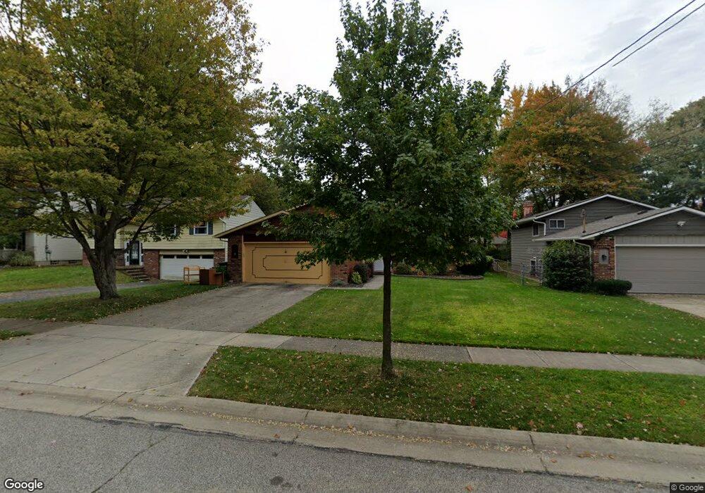
This home is located at 230 Dorland Ave, Berea, OH 44017 and is currently estimated at $281,282, approximately $158 per square foot. 230 Dorland Ave is a home located in Cuyahoga County with nearby schools including Grindstone Elementary School, Berea-Midpark Middle School, and Berea-Midpark High School.
Ownership History
Date
Name
Owned For
Owner Type
Purchase Details
Closed on
May 27, 2022
Sold by
Dole David J and Dole Sharyl D
Bought by
Dole David J and Dole Sharyl D
Current Estimated Value
Purchase Details
Closed on
Jun 5, 2002
Sold by
Widmann Jody L
Bought by
Dole David J and Dole Sharyl D
Home Financials for this Owner
Home Financials are based on the most recent Mortgage that was taken out on this home.
Original Mortgage
$58,000
Interest Rate
6.95%
Purchase Details
Closed on
Aug 10, 2000
Sold by
Sowers Mary H
Bought by
Sowers Mary H
Purchase Details
Closed on
Jan 25, 1978
Sold by
Mehnert Timothy W and Mehnert Carole A
Bought by
Sowers Mary H
Purchase Details
Closed on
Jan 1, 1975
Bought by
Mehnert Timothy W and Mehnert Carole A
Create a Home Valuation Report for This Property
The Home Valuation Report is an in-depth analysis detailing your home's value as well as a comparison with similar homes in the area
Home Values in the Area
Average Home Value in this Area
Purchase History
| Date | Buyer | Sale Price | Title Company |
|---|---|---|---|
| Dole David J | -- | Wargo And Wargo Co Lpa | |
| Dole David J | $148,000 | Executive Title Agency Corp | |
| Sowers Mary H | -- | -- | |
| Sowers Mary H | $58,000 | -- | |
| Mehnert Timothy W | -- | -- |
Source: Public Records
Mortgage History
| Date | Status | Borrower | Loan Amount |
|---|---|---|---|
| Previous Owner | Dole David J | $58,000 |
Source: Public Records
Tax History Compared to Growth
Tax History
| Year | Tax Paid | Tax Assessment Tax Assessment Total Assessment is a certain percentage of the fair market value that is determined by local assessors to be the total taxable value of land and additions on the property. | Land | Improvement |
|---|---|---|---|---|
| 2024 | $4,402 | $76,020 | $11,690 | $64,330 |
| 2023 | $4,136 | $59,890 | $10,360 | $49,530 |
| 2022 | $4,110 | $59,890 | $10,360 | $49,530 |
| 2021 | $4,075 | $59,890 | $10,360 | $49,530 |
| 2020 | $3,893 | $50,750 | $8,790 | $41,970 |
| 2019 | $3,797 | $145,000 | $25,100 | $119,900 |
| 2018 | $3,635 | $55,410 | $8,790 | $46,620 |
| 2017 | $3,397 | $42,460 | $7,980 | $34,480 |
| 2016 | $3,372 | $42,460 | $7,980 | $34,480 |
| 2015 | $3,355 | $42,460 | $7,980 | $34,480 |
| 2014 | $3,355 | $44,700 | $8,400 | $36,300 |
Source: Public Records
Map
Nearby Homes
- 9401 Pheasant Run Place
- 84 Sprague Rd
- 104 Whitehall Dr
- 8627 Courtland Dr
- 19419 Fowles Rd
- 18737 Evergreen Dr
- 740 Fair St
- 8036 Fair Rd
- 148 Meadow Cir
- 23 Hamilton St
- 74 Aaron St
- 243 Jananna Dr
- 20424 Scotch Pine Way
- 18433 Whitney Rd
- 19890 Idlewood Trail
- 8902 Lincolnshire Blvd
- 18203 Broxton Dr
- 21176 Hickory Branch Trail
- 20050 Idlewood Trail
- 159 Eastland Rd
- 236 Dorland Ave
- 224 Dorland Ave
- 240 Dorland Ave
- 220 Dorland Ave
- 229 Milton St
- 235 Milton St
- 212 Dorland Ave
- 241 Milton St
- 233 Milton St
- 217 Milton St
- 235 Dorland Ave
- 223 Dorland Ave
- 217 Dorland Ave
- 211 Milton St
- 211 Dorland Ave
- 208 Dorland Ave
- 243 Dorland Ave
- 205 Milton St
- 200 Dorland Ave
- 203 Dorland Ave