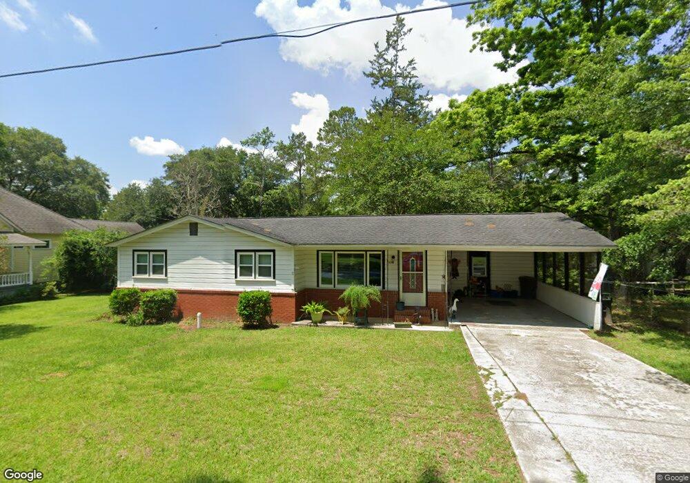
230 S Norton St Boston, GA 31626
Estimated Value: $146,102 - $216,000
--
Bed
1
Bath
1,020
Sq Ft
$172/Sq Ft
Est. Value
About This Home
This home is located at 230 S Norton St, Boston, GA 31626 and is currently estimated at $175,026, approximately $171 per square foot. 230 S Norton St is a home located in Thomas County with nearby schools including Hand in Hand Primary School, Garrison-Pilcher Elementary School, and Cross Creek Elementary School.
Ownership History
Date
Name
Owned For
Owner Type
Purchase Details
Closed on
Dec 6, 2021
Sold by
Carson Lucille S
Bought by
Dooley Robert C and Dooley Barbara A
Current Estimated Value
Purchase Details
Closed on
Apr 7, 1998
Bought by
Carson William E
Create a Home Valuation Report for This Property
The Home Valuation Report is an in-depth analysis detailing your home's value as well as a comparison with similar homes in the area
Home Values in the Area
Average Home Value in this Area
Purchase History
| Date | Buyer | Sale Price | Title Company |
|---|---|---|---|
| Dooley Robert C | $125,000 | -- | |
| Carson William E | $39,000 | -- |
Source: Public Records
Tax History Compared to Growth
Tax History
| Year | Tax Paid | Tax Assessment Tax Assessment Total Assessment is a certain percentage of the fair market value that is determined by local assessors to be the total taxable value of land and additions on the property. | Land | Improvement |
|---|---|---|---|---|
| 2024 | $1,021 | $32,834 | $3,518 | $29,316 |
| 2023 | $958 | $31,283 | $3,518 | $27,765 |
| 2022 | $560 | $25,025 | $2,639 | $22,386 |
| 2021 | $430 | $16,279 | $2,638 | $13,641 |
| 2020 | $434 | $16,074 | $2,639 | $13,435 |
| 2019 | $437 | $16,074 | $2,639 | $13,435 |
| 2018 | $441 | $16,117 | $2,639 | $13,478 |
| 2017 | $450 | $16,188 | $2,348 | $13,840 |
| 2016 | $448 | $16,083 | $2,348 | $13,735 |
| 2015 | $500 | $17,793 | $2,190 | $15,602 |
| 2014 | $493 | $17,418 | $2,190 | $15,228 |
| 2013 | -- | $17,418 | $2,190 | $15,228 |
Source: Public Records
Map
Nearby Homes
- 130 E Adams St
- 682 Salem Rd
- 146 Old Highway 84 W
- 185 Community Ln
- 2815 Parker Rd
- 9900 Ozell Rd
- 4311 Ozell Rd
- 431 Dry Lake Rd
- 00 Summer Hill Rd Unit 1
- 842 Crabapple Dr
- 2156 County Road 78
- 2818 Dry Lake Rd
- 00 Cone Road & Beulah Church Rd
- 454 Fox Meadow Ln
- 7402 Coffee Rd
- 233 Fox Meadow Ln
- 138
- 7500 U S 19
- 0 Spencer Rd
- 112 Henry's Rd
- 238 S Norton St
- 218 S Norton St
- 235 S Norton St
- 248 S Norton St
- 206 S Norton St
- 209 S Norton St
- 132 S Norton St
- 242 S Main St Unit BN
- 314 S Norton St
- 121 S Norton St
- 122 S Norton St
- 104 E Adams St
- 313 S Norton St
- 306 S Main St Unit BN
- 271 S Main St
- 314 S Main St Unit BN
- 321 S Norton St
- 113 S Norton St
- 283 S Main St
- 203 W Jefferson St